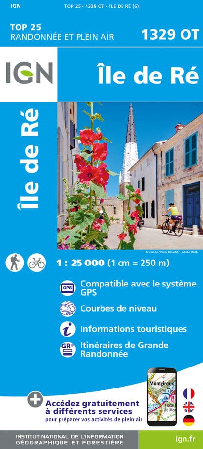
IGN TOP 25 hiking map No. 1329 OT - Ré Island

Price
Regular price 1430 €
Regular price Sale price 1430 €
/
  • Shipped within 24 to 48h from our warehouse in France
  • Free returns (*)
  • Real-time stock levels
  • Cartovia Guarantee – Delivery issue?
    We resend immediately upon receiving a simple photo.
  • In stock, ready to ship
  • Backordered, shipping soon
Tax included.

Frequently bought together:

The IGN TOP 25 hiking map No. 1329 OT covers the following area: Ré Island.

  • Contour lines at 10-metre intervals.
  • Detailed legend: vegetation, rocks, watercourses and more.
  • Hiking trails are shown.
  • Scale: 1:25,000 (1 cm = 250 m).

Municipalities covered: L'Houmeau, Sainte-Marie-de-Ré, La Flotte, Saint-Martin-de-Ré, Ars-en-Ré, Loix, Saint-Clément-des-Baleines, Le Bois-Plage-en-Ré, Rivedoux-Plage, La Couarde-sur-Mer, Les Portes-en-Ré.

Places to discover: Marais poitevin Regional Nature Park, Pertuis Breton, Pertuis d'Antioche, Aiguillon Bay, Bois de Trousse-Chemise, Pointe de l'Aiguillon, Pointe d'Arçay, Ré Island, Ensembles Littoraux et Marais de l'Île de Ré, Pointe des Baleines, Pointe de Chassiron, Remparts de La Rochelle, Fort de la Prée, Lileau des Niges Nature Reserve, Chanchardon Lighthouse, Ancienne Abbaye des Châteliers, Baleines Lighthouse.


ISBN/EAN : 9782758555339
Publication date: 2023
Scale: 1/25,000 (1cm=250m)
Printed sides: front
Folded dimensions: 23.6 x 11.2 x 0.5cm
Unfolded dimensions: 96 x 132cm
Language(s): French, English, German
Weight: 89 g