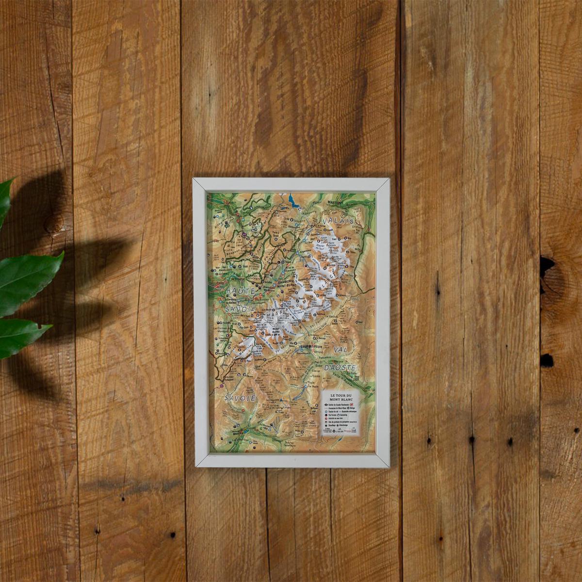
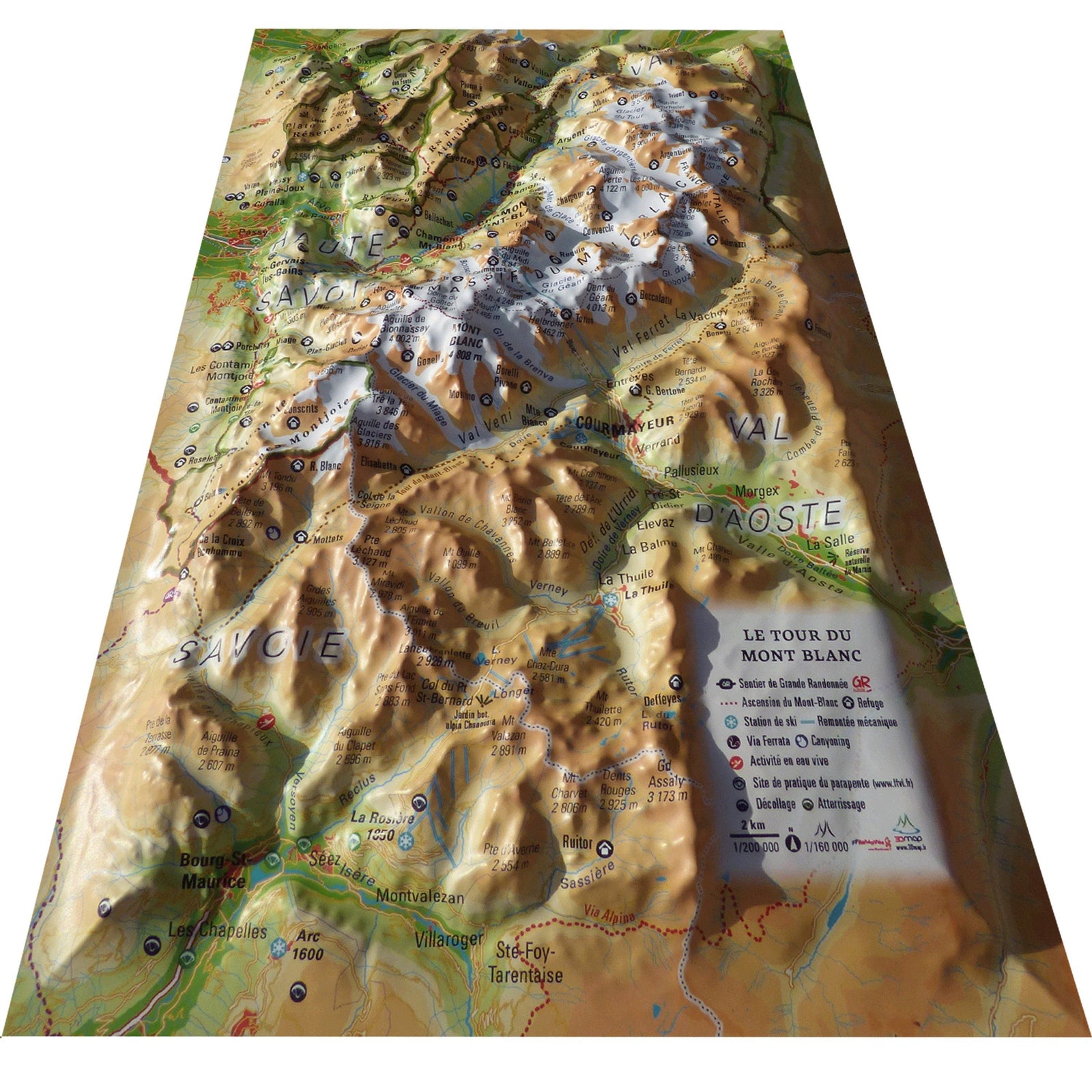
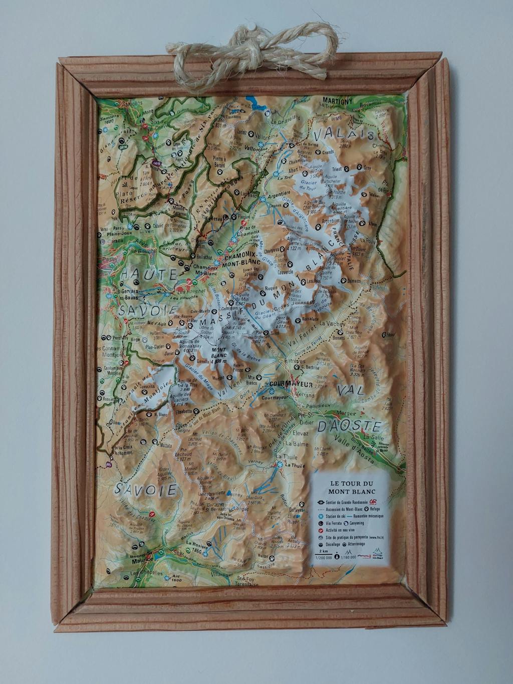
3D relief map - Tour du Mont Blanc (19.5 cm x 29.5 cm) | 3D Map (French)

Price
Regular price 1990 €
Regular price Sale price 1990 €
/
  • Ships within 24 business hours from our warehouse in France
  • Free returns (*)
  • Real-time stock levels
  • Cartovia Guarantee – Delivery issue?
    We resend immediately upon receiving a simple photo.
  • In stock, ready to ship
  • Backordered, shipping soon
Tax included.

Frequently bought together:

Discover the raised relief wall map of the Tour du Mont Blanc, offering a detailed and immersive view of Europe’s most iconic long-distance hiking route. This 3D map highlights glaciers, legendary peaks, deep valleys and the entire trail around the Mont Blanc massif.

A finishing frame is available as an optional accessory; we strongly recommend it for easier hanging and a refined display.

General data shown on the map:

  • Hydrological, natural, hypsometric and administrative information

  • Glaciers, major summits and rock formations

Outdoor activities and hiking sites:

  • Mont Blanc ascent route

  • Long-distance hiking trails

  • Mountain huts and guesthouses

  • Canyoning sites

  • Ski lifts

  • Viewpoints and orientation tables

  • Ski resorts

  • White-water activity areas

  • Paragliding sites (www.ffvl.fr)

    • Take-off and landing zones

  • Airports and aerodromes

Scale & dimensions:

  • Planimetric scale: 1:200,000

  • Altimetric scale: 1:120,000

  • Size: 19.5 × 29.5 cm

A perfect map for hikers, mountaineers, Tour du Mont Blanc enthusiasts, or anyone wishing to decorate their home with a beautiful and informative Alpine piece.


ISBN/EAN : 9791097206246
Publication date: 2020
Scale: 1/200,000 (1cm=2km)
Unfolded dimensions: 19.5cm x 29.5cm
Language(s): French
Weight: 32 g