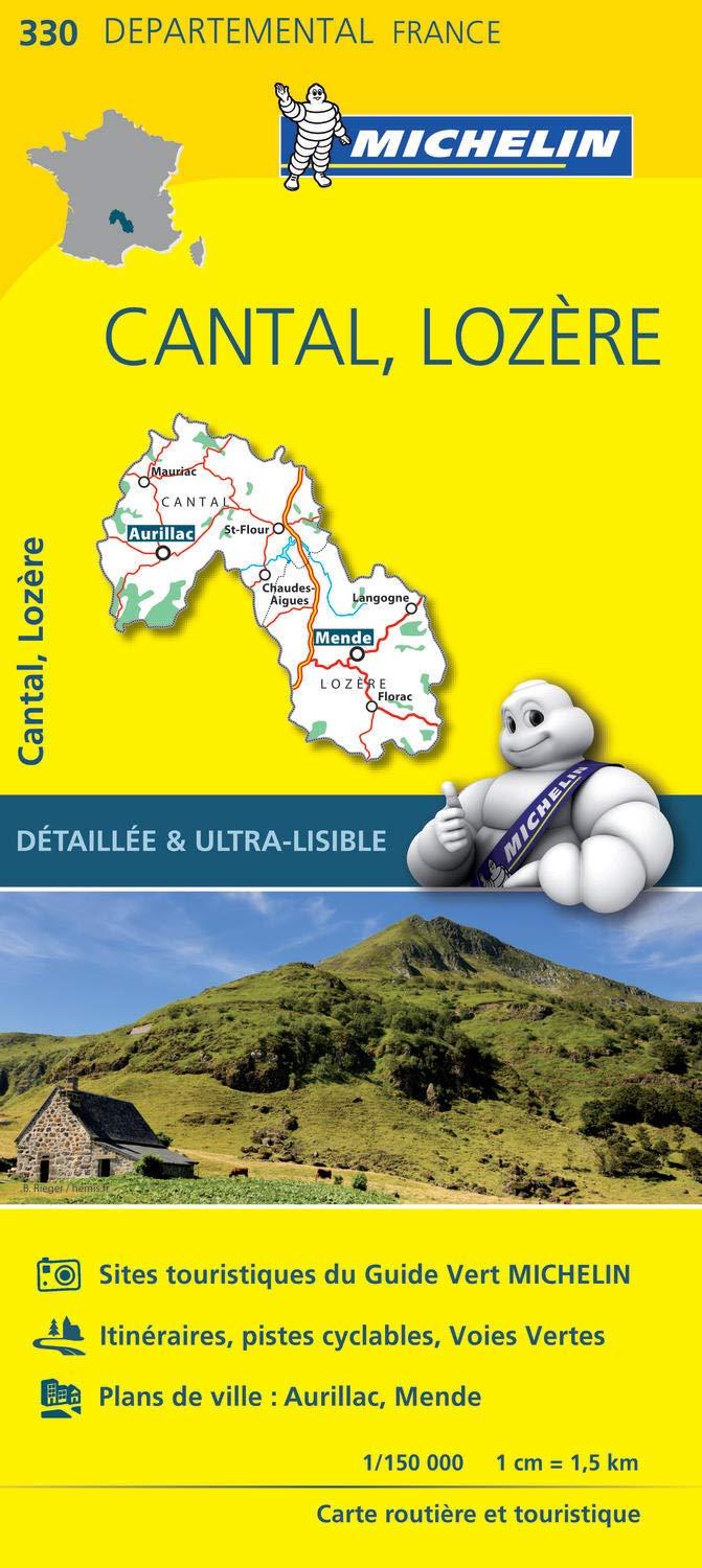
In the heart of the Cantal department and the Auvergne Volcanoes Regional Natural Park, between the towns of Aurillac and Saint-Flour, stand the remains of the largest stratovolcano in Europe: the Cantal volcaNo. Sculpted by a rich geological history, the massif, with a surface area of 2,500 km2 and a diameter of approximately 70 km, culminates at 1,855 m
(Cantal lead), and boasts unparalleled landscapes and a unique heritage.
This guide offers 49 hikes to explore the territory, through 5 geographical entities: the ridges, Saint-Flour and the eastern planèzes, Riom-ès-Montagnes and the northern plateaus, around Salers, the Carladès between Jordanne and Brezons.
Strong points:
• 49 circuits of varying lengths for family and sporting activities
• Practical format of 14 x 21 cm
• Maps on IGN background at 1:25,000
• General introduction, with presentation of the territory and several thematic double-pages
• For each circuit: detailed description of the hike, details of the centers of interest and heritage text
• Practical information and useful addresses
ISBN/EAN : 9782844666024
Publication date: 2022
Pagination: 136 pages
Folded dimensions: 21x14cm
Language(s): French
Weight:
330 g