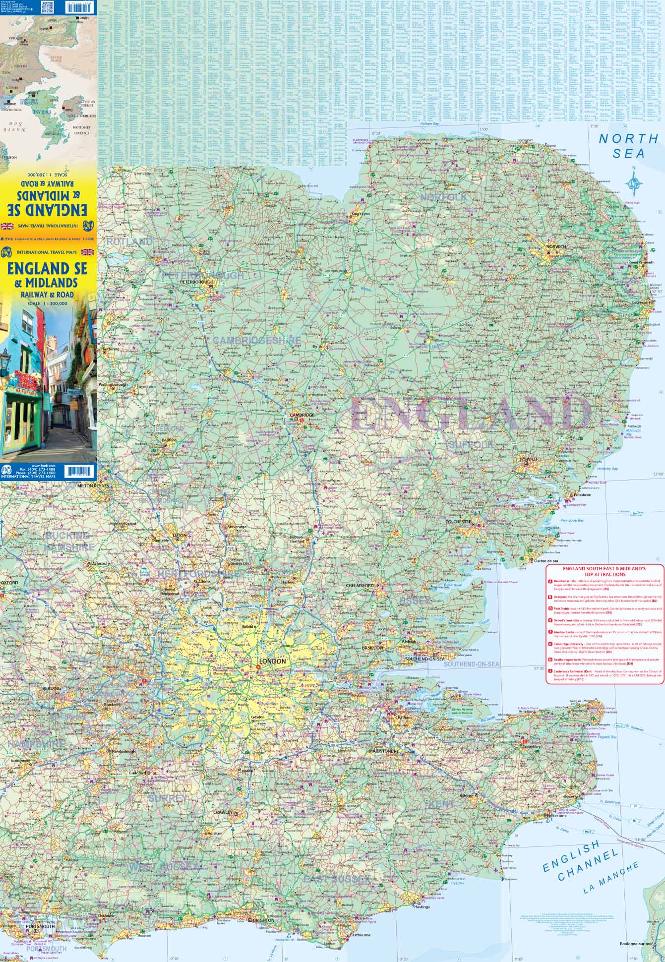
Travel Map - South England | ITM

Price
Regular price 1590 €
Regular price Sale price 1590 €
/
  • Free returns (*)
  • Real-time stock levels
  • Cartovia Guarantee – Delivery issue?
    We resend immediately upon receiving a simple photo.
  • In stock, ready to ship
  • Backordered, shipping soon
Tax included.

Frequently bought together:

The England South reference map (2026 edition) offers a detailed and legible view of Southern England, ideal for road trips, travel planning, and regional exploration. At a scale of 1:270,000, it provides an excellent balance between precision and coverage.

It highlights the entire road network as well as major cities and natural regions, facilitating navigation in urban areas and through the English countryside.

📌 Features

  • Scale: 1:270,000
  • Coverage: Southern England
  • Complete network: motorways, main roads (A-roads) and secondary roads
  • Main railway lines indicated
  • Major cities: London, Oxford, Cambridge, Brighton, Bristol, Bath, Canterbury, Southampton
  • Natural areas: Cotswolds, South Downs, New Forest, Dartmoor, Exmoor
  • Geographical information: county boundaries, rivers, coastline
  • Selected points of interest
  • Folded, lightweight, and easy-to-use map
  • Non-waterproof edition
  • Ideal for planning and field use


ISBN/EAN : 9781771292757
Publication date: 2026
Scale: 1/270,000 (1 cm = 2.7 km)
Printed sides: both sides
Folded dimensions: 24.6 x 10.3 x 0.5cm
Unfolded dimensions: 100 x 68cm
Language(s): English
Weight: 54 g