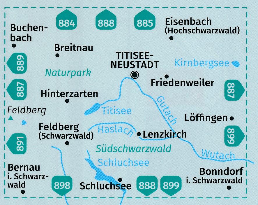
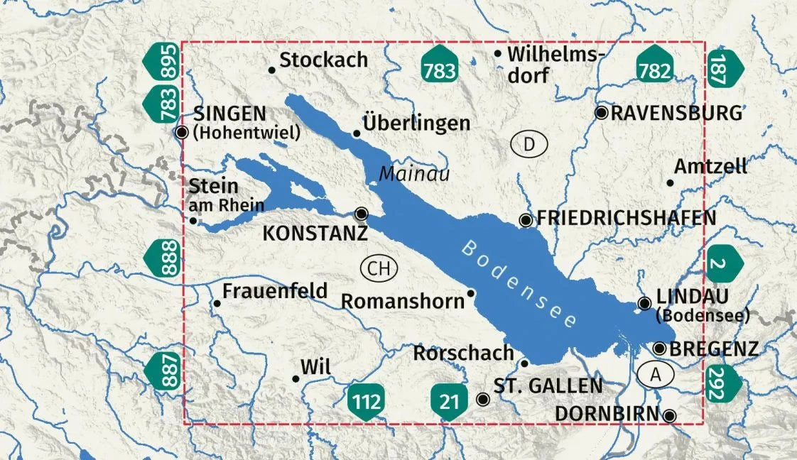
Cycling map No. F7008 - Rhine cycle path 1, from Stein am Rhein to Mannheim / Eurovélo 15 (Germany) | Kompass

Price
Regular price 1580 €
Regular price Sale price 1580 €
/
  • Shipping within 24 working hours from our warehouse in France
  • Choose your delivery method and cost at checkout, before confirming your order.
  • Free returns (*)
  • Real-time inventory
  • Low stock - 1 item left
  • Backordered, shipping soon
Tax included.

Often purchased together:

Kompass cycling maps show the entire route of a cycle path on one map. This works thanks to the so-called "leporello" format, which opens like an accordion. In addition to the route, it contains everything you need to know about the route and the surrounding area. There's also other information such as accommodation suggestions, an elevation profile, and highlights along the way. Rain, snow, and hail can't harm the map—the sturdy, tear- and weather-resistant material won't let you down.

The route:

- The Rhine runs for over 460 km between Stein am Rhein (Lake Constance) and Mannheim. It passes through the Black Forest, the Swiss Jura, the Vosges, and the Palatinate.

- And cyclists have plenty to see. The Rhine Falls, one of the most powerful in Europe, awaits them on the Upper Rhine. The sunniest region of Germany is crossed in the Upper Rhine, in the Markgräflerland and Kaiserstuhl. And in Alsace, one crosses the "Little Camargue", with its impressive landscape.


ISBN/EAN : 9783991542810
Publication date: 2025
Scale: 1/70,000 (1cm=700m)
Folded dimensions: 11 x 19cm
Language(s): German
Weight: 171 g