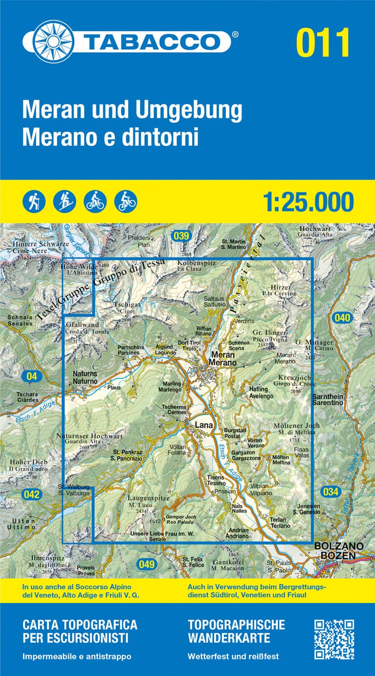
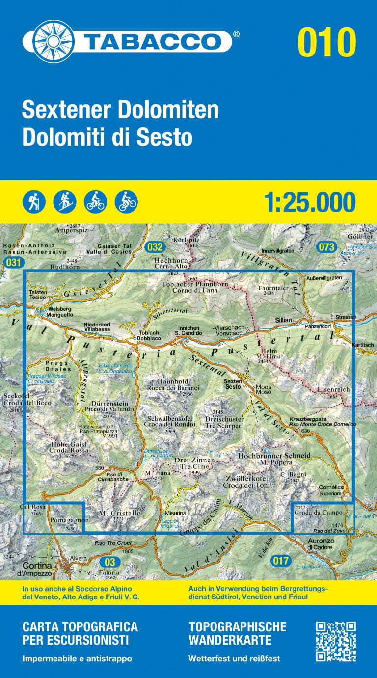
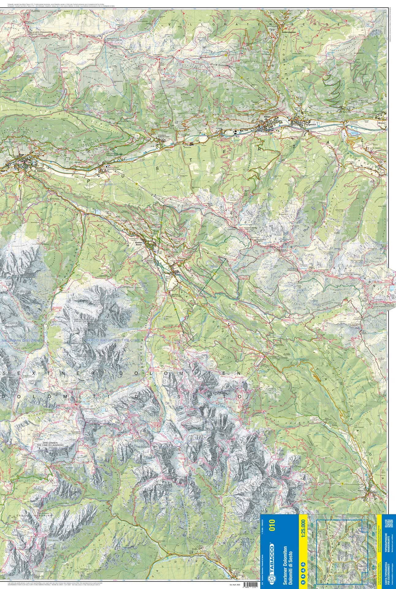
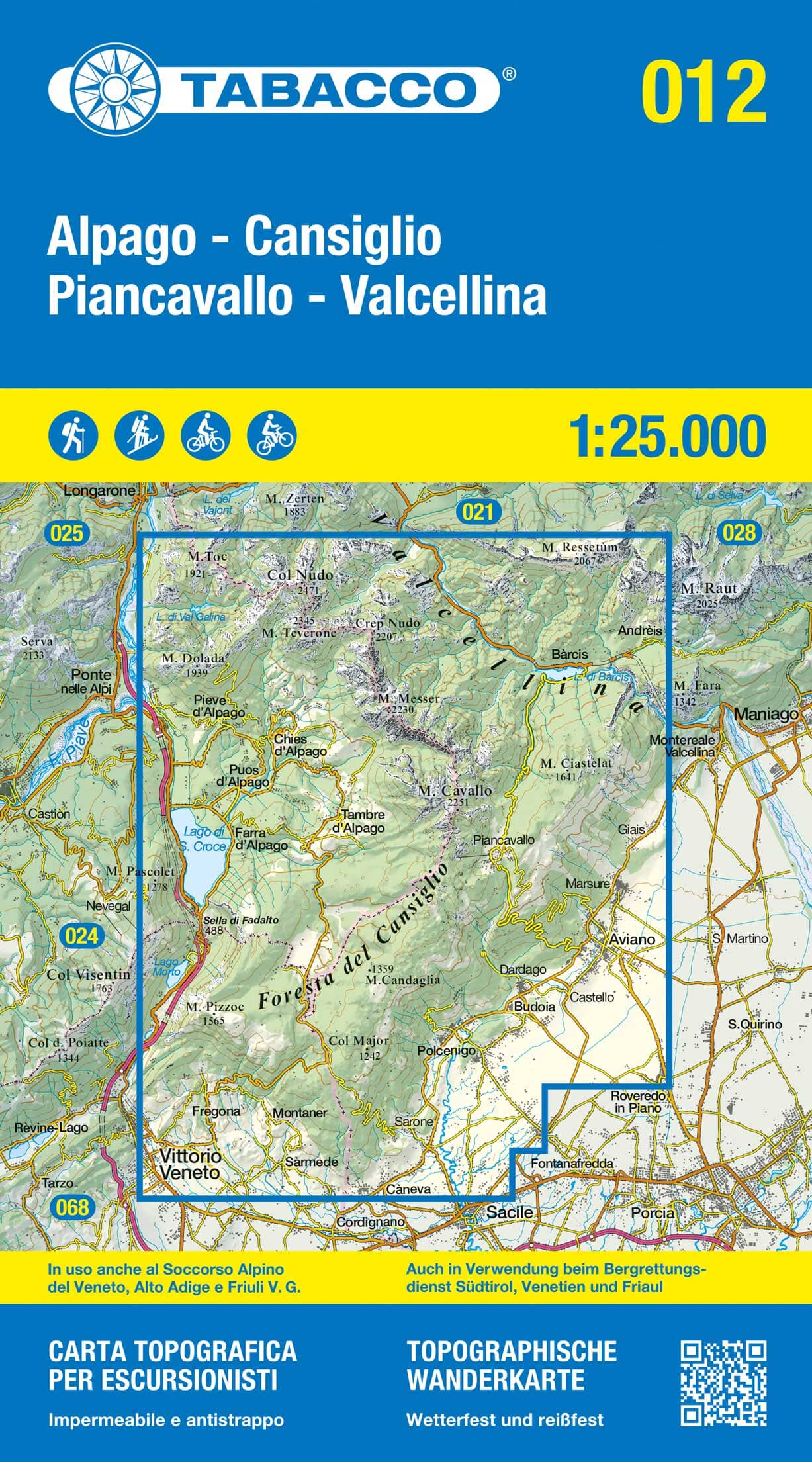
Explore the Braies Dolomites and the Fanes-Sennes-Prags Nature Park, in the heart of the Italian Alps, with this highly detailed and durable hiking map. A valuable ally for all your outdoor activities: hiking, cycling, cross-country skiing or simple nature excursions.
🏞️ A complete tool for all mountain enthusiasts:
-
Marked hiking trails with official names and numbers, including long-distance hiking trails
-
Cycle and mountain bike trails (including trails), via ferrata, cross-country skiing and ski touring circuits
-
Useful information: shelters, hostels, springs, parking lots, bus and train stops, swimming lakes, viewpoints
-
Realistic representation of the terrain : vegetation, contour lines, shading of reliefs, rock details
📐 Technical characteristics:
-
Scale 1:25,000 : 1 cm on the map = 250 meters on the ground
-
Waterproof and tear-proof paper, ideal for all weather conditions
-
Double-sided map largely covering the Braies Dolomites region
-
Digital download included via the Kompass Wanderkarten app (access to offline clipping and additional zoom levels)
📚 Included: Aktiv Guide booklet
A supplementary booklet offering hiking suggestions, practical advice and tourist information to enhance your stay.