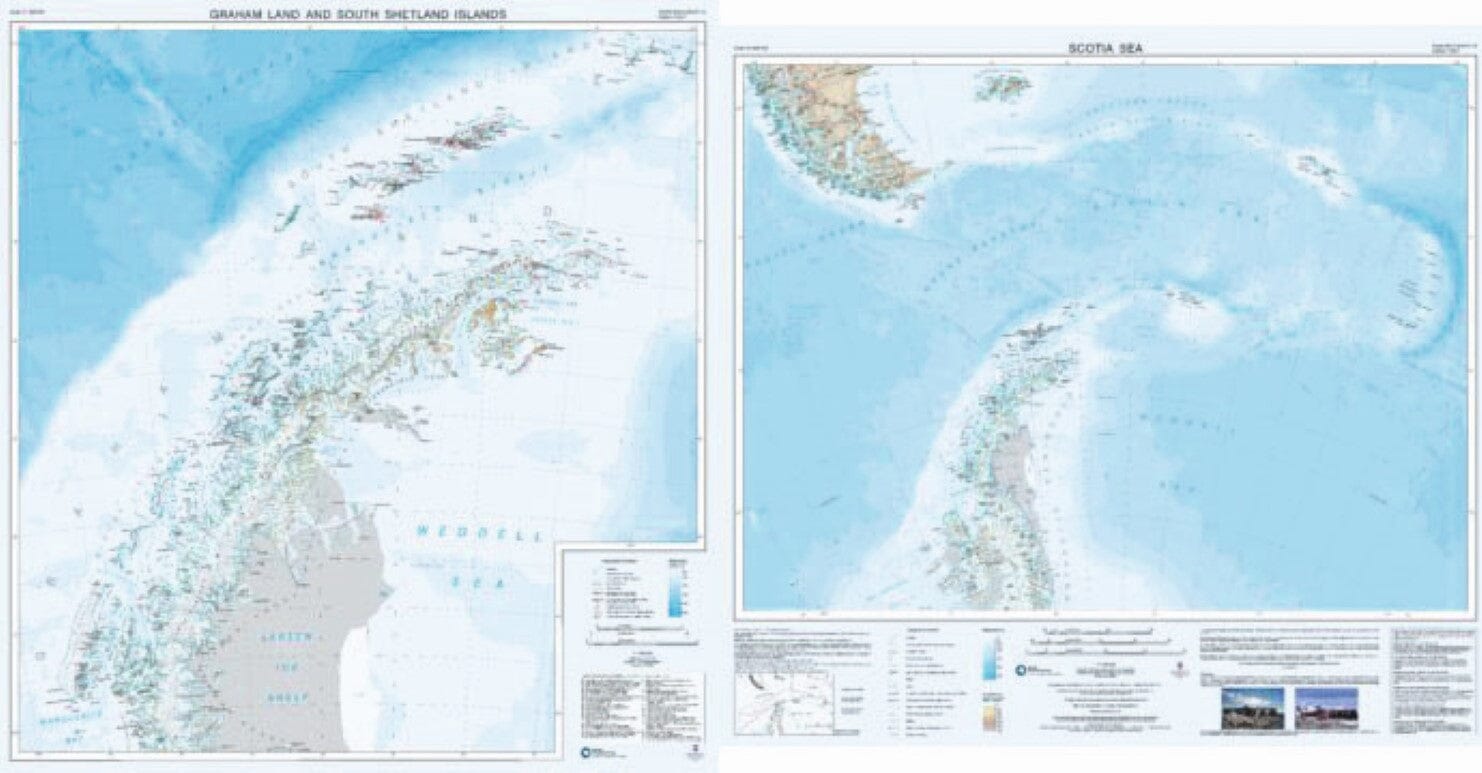
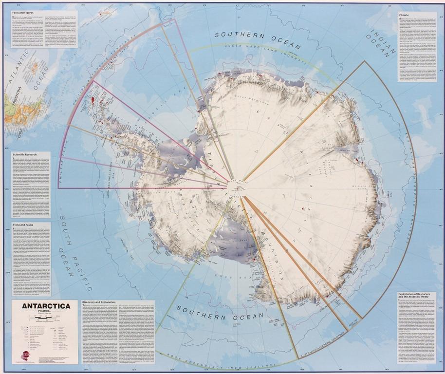
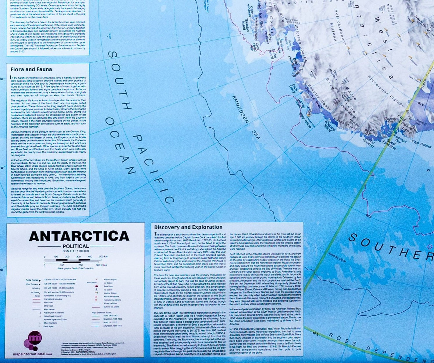
This double-sided map provides an overview of the northern Antarctic Peninsula on side A, with a regional scale map covering the Scotia Sea region on side B. It is an ideal companion for travel from South America or the Falkland Islands to South Georgia or the Antarctic Peninsula.
Side A: Scale 1:1,000,000. This map covers the South Shetland Islands and the Antarctic Peninsula as far south as Marguerite Bay at 68°30'S. It shows topographic features such as: coastline; ice shelves; rock exposure; contours; selected heights of mountain peaks; shaded terrain; bathymetry and major place names; permanent and summer-only scientific research stations and historic sites and monuments.
Side B: Scale 1:4,000,000. This map covers the Scotia Sea region including: Argentina and Chile south of 50°S (including Ushuaia and Punta Arenas); the Falkland Islands; South Georgia; the South Sandwich Islands; the South Orkney Islands and the northern Antarctic Peninsula.