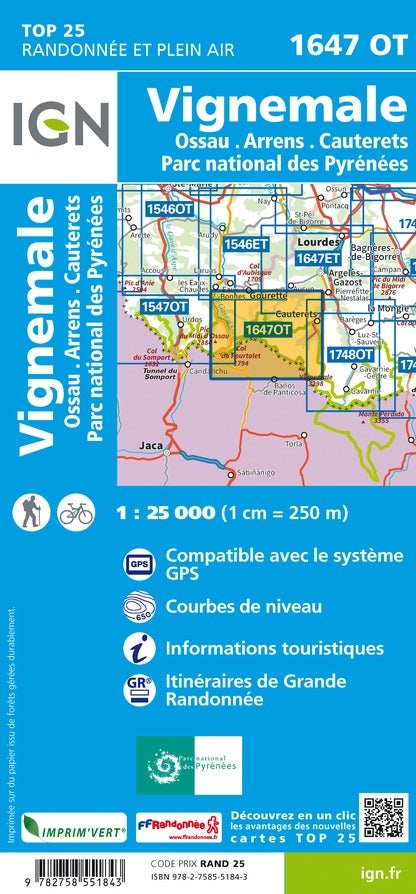
Map TOP 25 No. 1647 OT - Vignemale, Ossau, Arrens, Cauterets (PN of the Pyrenees) | IGN

Price
Regular price £1300
Regular price Sale price £1300
/
  • Shipping within 24 working hours from our warehouse in France
  • Choose your delivery method and cost at checkout, before confirming your order.
  • Free returns (*)
  • Real-time inventory
  • In stock, ready to ship
  • Backordered, shipping soon
Tax included.

Often purchased together:

Top 25 map of the Pic of Vignemale, the Ossau Valley, Arrons and Cauterets, published by IGN. This detailed map extends from goutette (included) to the neck of the (from north to south) and the Pic du Midi Ossau (inclusive) to Cauterets (from West East), and includes part of the National Park. Pyrenees.

Hiking map with space curves spaced 10 meters and detailed legend (vegetation, rocks, streams etc ...).

Indication of hiking trails. Scale 1/25 000 (1 cm = 250 m).


ISBN/EAN : 9782758551843
Publication date: 2022
Scale: 1/25,000 (1cm=250m)
Printed sides: front
Folded dimensions: 23.6 x 11.2 x 0.5cm
Unfolded dimensions: 96 x 132cm
Language(s): French, English, German
Weight: 89 g