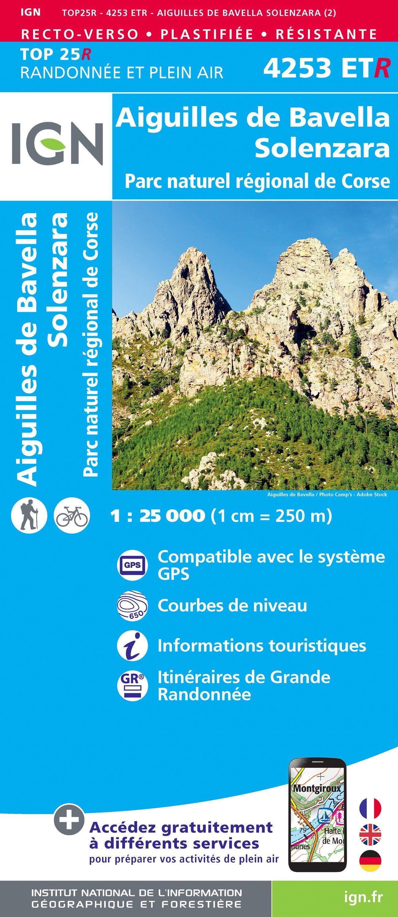
TOP 25 Map No. 4253 ETR (resistant) - Aiguilles de Bavella, Solenzara (PNR of Corsica) | IGN
Regular price
£1200
Regular price
£1600
Sale price
£1200
/
- Shipped within 24 to 48h from our warehouse in France
- Customs duties may apply on import to your country
- Free returns (*)
- Real-time stock levels
-
Cartovia Guarantee – Delivery issue?
We resend immediately upon receiving a simple photo.
- Low stock - 1 item left