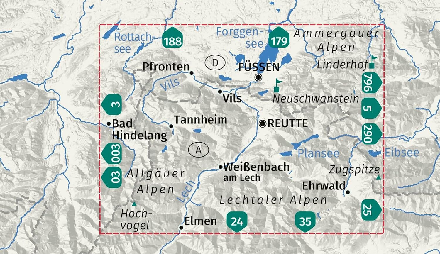
Hiking maps - Sölk Valleys, Rottenmann Tauern & Seckau Alps | Kompass 223 - 1:55,000

Price
Regular price £1900
Regular price Sale price £1900
/
  • Shipped within 24 to 48h from our warehouse in France
  • All-inclusive price: customs duties are already paid by Cartovia
  • Free returns (*)
  • Real-time stock levels
  • Cartovia Guarantee – Delivery issue?
    We resend immediately upon receiving a simple photo.
  • Low stock - 2 items left
  • Backordered, shipping soon
Tax included.

Frequently bought together:

This set of 2 Kompass hiking maps covers the Sölk Valleys, the Rottenmann Tauern, and the Seckau Alps. Designed for hiking, cycling, and outdoor activities, these maps offer extensive coverage of the region while maintaining an excellent level of detail.

📌 Features

  • Set of 2 maps
  • Scale: 1:55,000 (1 cm = 550 m)
  • Official hiking trails with names and numbers
  • Cycling routes
  • Via ferratas
  • Inns and huts
  • Parking lots
  • Public transport (bus and train)
  • Ski touring and cross-country ski routes
  • Springs and swimming areas
  • Offline map extract usable in the Kompass-Wanderkarten app

🌍 Covered Region

  • Sölk Valleys
  • Rottenmann Tauern
  • Seckau Alps

⭐ Highlights

  • Extensive coverage thanks to the 2 included maps
  • Detailed mapping for hiking and cycling
  • Relief represented by contour lines and shading
  • Numerous tourist and practical information
  • Compatible with the Kompass app for offline use

🏔️ About the Region

The Sölk Valleys, the Rottenmann Tauern, and the Seckau Alps are distinguished by their alpine landscapes, mountain lakes, and peaks. The towns of Schladming and Murau are important cultural centers in the region, while the Greim and the Zirbitzkogel are among the most popular hiking destinations.


ISBN/EAN : 9783991545293
Publication date: 2026
Scale: 1/55000 (1cm=550m)
Folded dimensions: 11 x 19cm
Language(s): German
Weight: 174 g