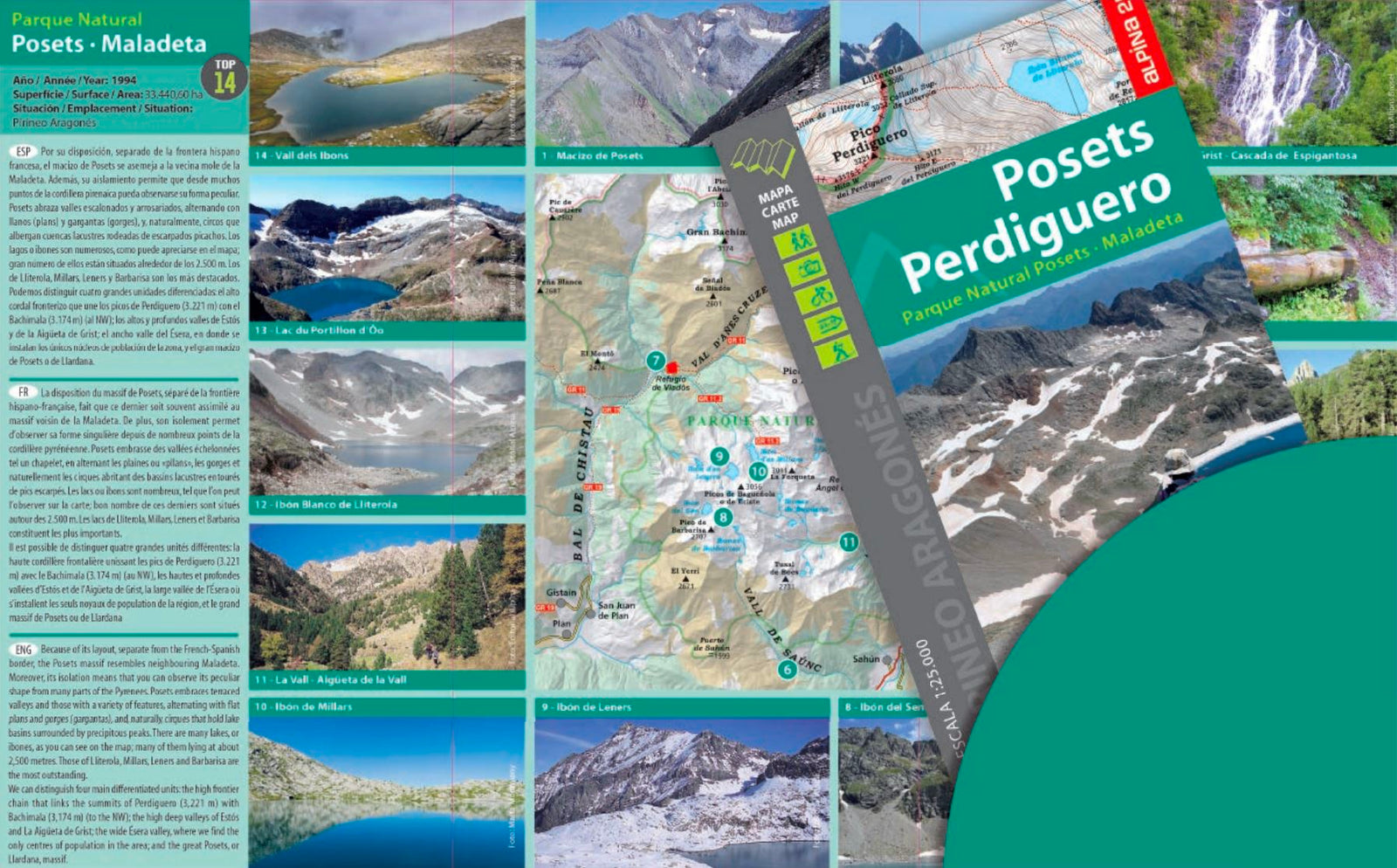
Hiking map - Posets, Perdiguero (Aragonese Pyrenees) | Alpina

Price
Regular price £1400
Regular price Sale price £1400
/
  • Shipping within 24 working hours from our warehouse in France
  • Choose your delivery method and cost at checkout, before confirming your order.
  • Free returns (*)
  • Real-time inventory
  • In stock, ready to ship
  • Backordered, shipping soon
Tax included.

Often purchased together:

Detailed hiking map of the POSET and PERDIGUERO.

Map sector: Aragonese Pyrenees. Massif of the posets and valley of Benasque. Natural park posets - sickta.

The detailed map, published by Alpina, is in color with the curves of level, and indicates the marked trails (GR, PR), trails, shelters, waterfalls, etc. The map comes with a folder including: • Refuges
• Hiking
• Information on the National Park
• Top14: Points of interest


ISBN/EAN : 9788480908818
Publication date: 2021
Scale: 1/25,000 (1cm=250m)
Printed sides: front
Folded dimensions: 21 x 11.5 x 1cm
Unfolded dimensions: 98 x 68cm
Language(s): French, English, Castilian
Weight: 130 g