IGN TOP 25 hiking map No. 1936 ET - Les Eyzies, Dordogne & Vézère Valleys

Price
Regular price £1580
Regular price Sale price £1580
/
  • In stock in France and in the UK
    Shipped within 24 to 48h from the warehouse closest to you
  • Free returns (*)
  • Real-time stock levels
  • Cartovia Guarantee – Delivery issue?
    We resend immediately upon receiving a simple photo.
  • In stock, ready to ship
  • Backordered, shipping soon
Tax included.

Frequently bought together:

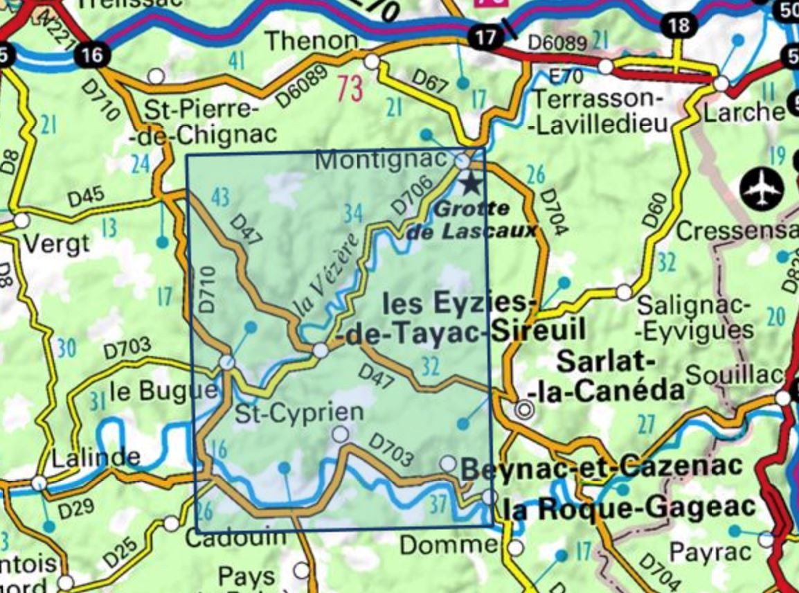
The IGN TOP 25 hiking map No. 1936 ET covers the following area: Les Eyzies, Dordogne & Vézère Valleys.

This highly accurate topographic mapping shows every detail on the ground:

  • Transport routes down to the smallest paths.
  • Buildings, including individual sheds.
  • Woodland, isolated trees, rivers and springs.

Contour lines show the terrain.

  • Waymarked trails and tourist information are also shown.

Municipalities covered: Tamniès, Valojoulx, Saint-André-d'Allas, Vézac, Saint-Vincent-de-Cosse, Peyzac-le-Moustier, Allas-les-Mines, Siorac-en-Périgord, Saint-Chamassy, Saint-Germain-de-Belvès, Berbiguières, Cladech, Marnac, Mauzens-et-Miremont, Savignac-de-Miremont, Les Eyzies, Sergeac, Saint-Léon-sur-Vézère, Marquay, Beynac-et-Cazenac, Limeuil, Campagne, Saint-Cyprien, Tursac, Rouffignac-Saint-Cernin-de-Reilhac, Montignac.

Places to discover: Abri, Abris, Roque St-Christophe et Pas du Miroir, Font de Gaume, Belcayre Castle, Laussel Castle, Caverne de Bara-Bahau, Commarque Castle, Aquarium, Cap Blanc, Tour, Gfre du Proumeyssac, Cro-Magnon, Grte de Bernifal, Puymartin Castle.


ISBN/EAN : 9782758555865
Publication date: 2024
Scale: 1/25,000 (1cm=250m)
Printed sides: front
Folded dimensions: 24 x 11cm
Unfolded dimensions: 96 x 132cm
Language(s): French, English, German
Weight: 88 g