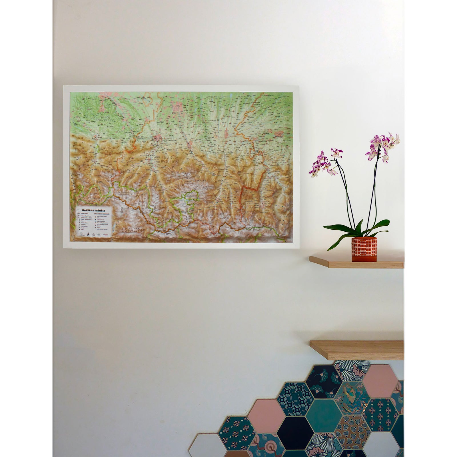
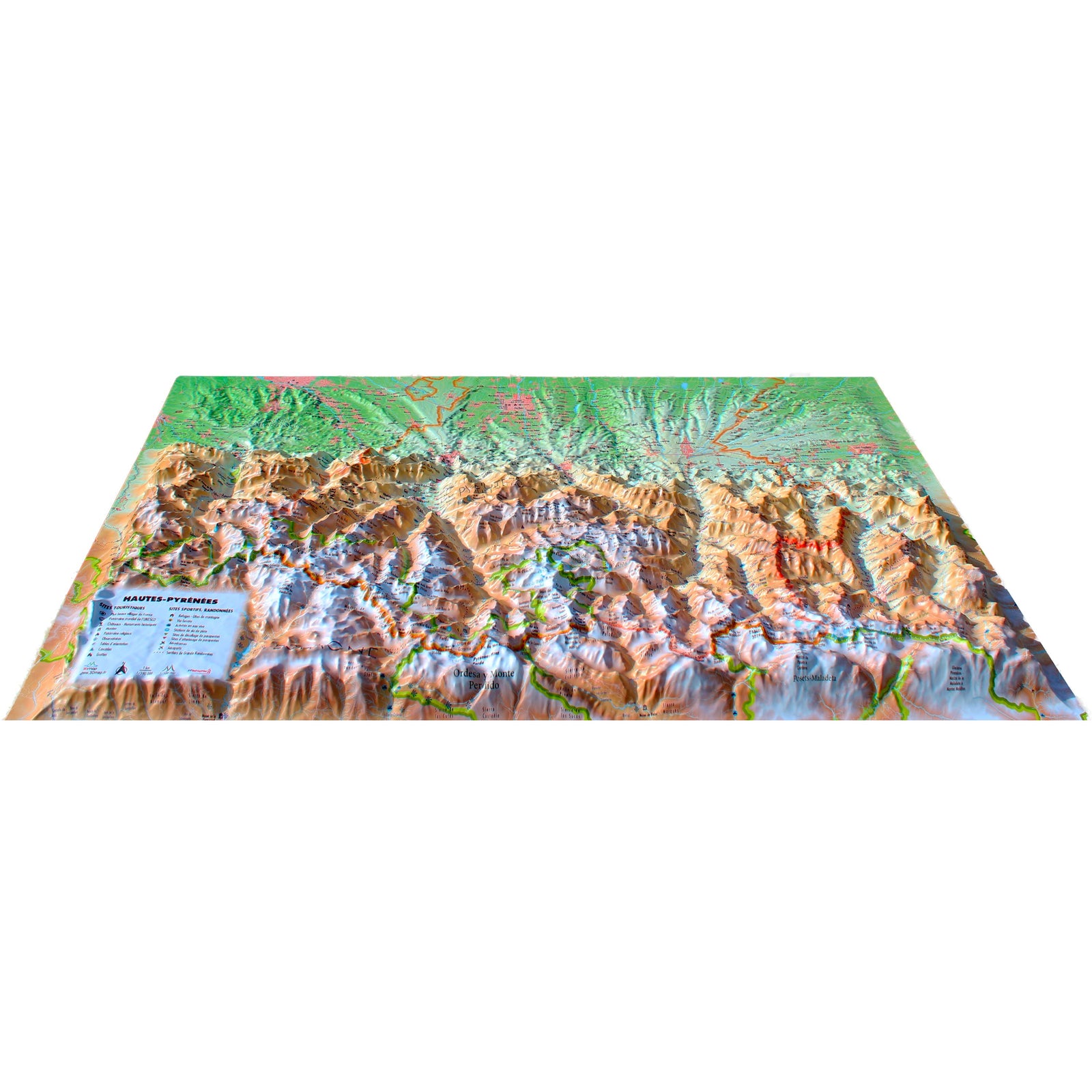
Relief wall map of the Hautes-Pyrénées published by 3D Map.
A finishing frame is also available as an option : We recommend it to make hanging easier and to highlight your map.
🌍 GENERAL INFORMATION:
Rivers, reliefs, forests: nature in all its diversity
Boundaries and territories: essential administrative landmarks
🏰 TOURIST ESSENTIALS
Most Coffee table Villages of France: authenticity, charm and heritage
🖼️ Museums: treasures of history and culture
⛪ Religious heritage: remarkable buildings and places of meditation
🌳 Natural sites: immersion in exceptional landscapes
💦 Waterfalls: refreshing shows in the heart of nature
🕳️ Caves: Fascinating underground adventures
🔭 Lookouts & Orientation Tables: breathtaking views to the horizon
⛰️ OUTDOOR SPORTS & ADVENTURE
🥾 Long-distance Hiking Trails (GR): for walkers of all levels
🏡 Shelters & Gîtes: welcoming stops on your journey
🎿 Alpine ski resorts: thrills guaranteed
🧗 Via Ferrata: safe climbing with a view!
🌊 Whitewater activities: rafting, kayaking, canyoning... thrills guaranteed
🪂 Paragliding sites (ffvl.fr): fly over the most Coffee table landscapes
Clearly identified take-off and landing areas
✈️ Airports & Airfields: easily access adventure
📏 SCALES & DIMENSIONS
Planar scale: 1:190,000
Altimetric scale: 1:100,000
map size: 41 cm x 61 cm