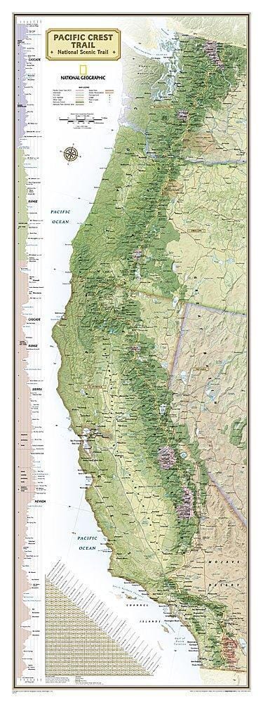
General Map - Pacific Crest Trail | National Geographic
- Free returns (*)
- Real-time stock levels
-
Cartovia Guarantee – Delivery issue?
We resend immediately upon receiving a simple photo.
📦 Hard-to-find maps - worldwide shipping
📦 Hard-to-find maps & travel guides - worldwide shipping, 30-day returns
🌞 Summer travel: 20,000+ maps in stock
🌞 Plan your summer: 20,000+ maps and travel guides in stock Details →
✅ Latest editions guaranteed — since 2010
✅ Latest editions guaranteed - 180,000+ travellers equipped since 2010
Prepare for your Pacific Crest Trail (PCT) adventure with this National Geographic overview and planning map. Approximately 2,650 miles (4,265 km) long, the PCT connects the Canadian border to the Mexican border, traversing Washington, Oregon, and California.
The map shows the entire route and gathers essential information for organizing a multi-day hike, a section of the trail, or a complete thru-hike through the Cascades, the Sierra Nevada, and the great deserts of the American West.
ISBN/EAN
: 9781566959568
Publication date: 2026
Scale: 1:160,000 (1 cm = 1.6 km)
Printed sides: double-sided
Folded dimensions: 7.48 x 3.94 inches / 19 x 10 cm
Unfolded dimensions: 24.8 x 32.28 inches / 63 x 82 cm
Language(s): English
Weight:
3.2 oz
The exclusive newsletter for travel and discovery enthusiasts!