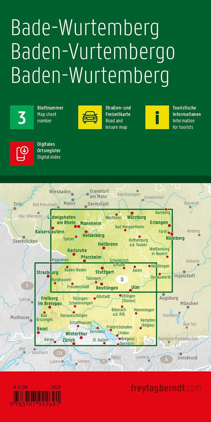
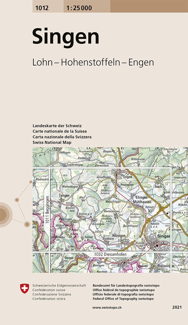
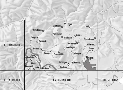
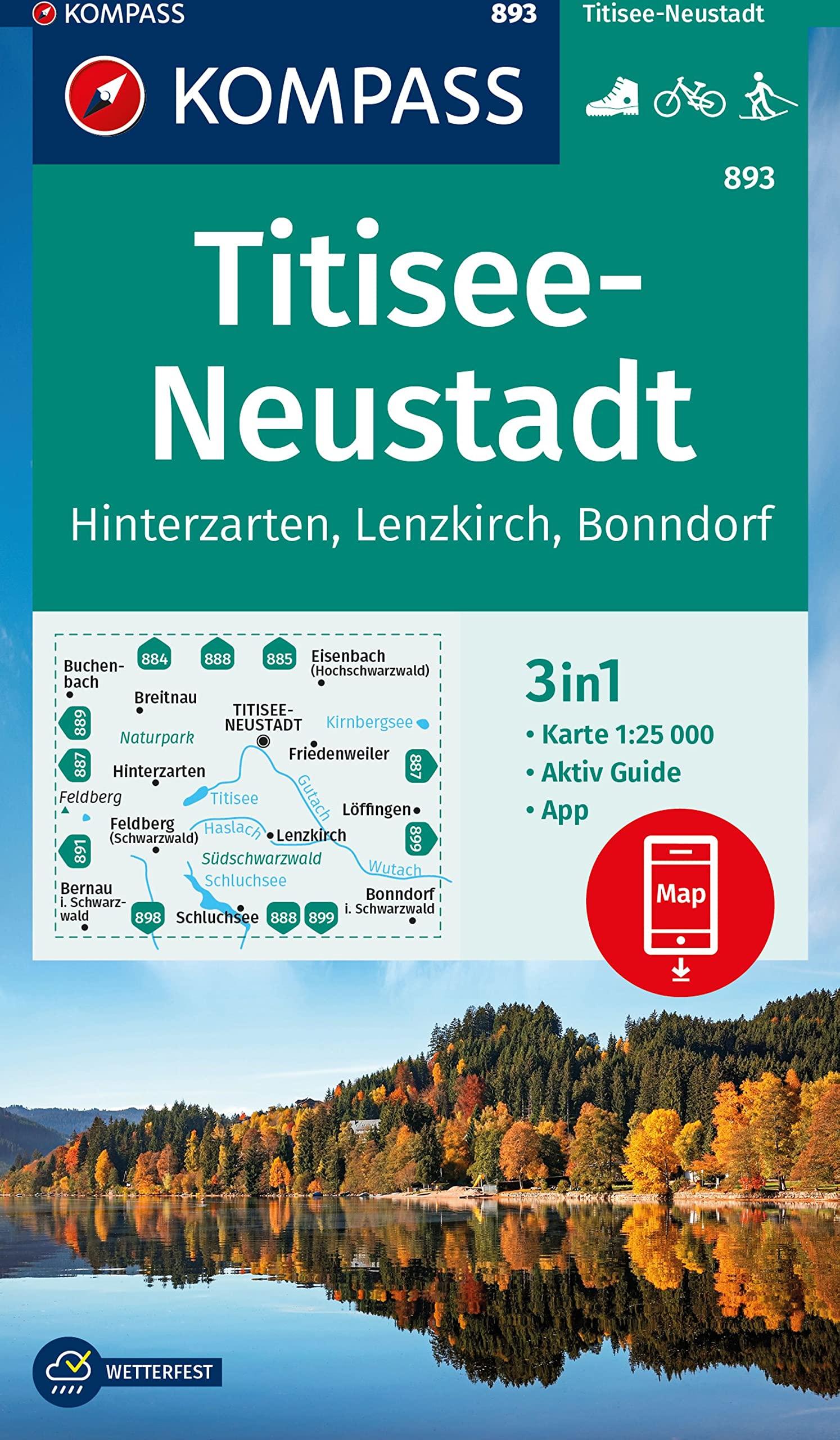
Hiking and cycling map – Remstal, Stuttgart with RemstalWeg – Kompass No. 785
1:50,000 scale – Durable paper – Ideal for hiking and cycling
Explore the Remstal , a charming wine-growing valley near Stuttgart , with this Kompass map, ideal for hiking and cycling . It includes the RemstalWeg , an iconic route in the region.
Kompass mapping is accurate and constantly updated by GPS , with trails marked according to their level of difficulty , contour lines , vegetation zones , as well as comprehensive tourist information . It is also available offline in the Kompass app .
🏞️ About the region:
The Remstal , east of Stuttgart, is a green and peaceful river valley surrounded by terraced vineyards , orchards and wooded hills . The RemstalWeg runs through the entire valley and offers spectacular panoramas from viewpoints such as the Kleinheppacher Kopf or the Korber Kopf .
Historic towns like Schorndorf and Waiblingen add a cultural dimension to your excursions. It is an ideal region for combining nature , local wines and regional discoveries .
🗺️ Technical characteristics:
-
Scale 1:50,000 : 1 cm = 500 m
-
Ultra-precise GPS mapping with trails classified by difficulty
-
Weather and tear resistant paper
-
Usable offline with the Kompass app
-
Detailed tourist information included