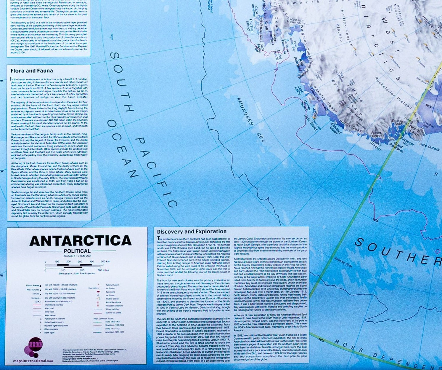
Map of South Georgia and Shackleton Crossing | British Antarctic Survey
- Free returns (*)
- Real-time stock levels
-
Cartovia Guarantee – Delivery issue?
We resend immediately upon receiving a simple photo.
🧭 Latest editions only - best publishers
🧭 Always the latest editions - curated from the world’s best publishers
20,000+ maps 🗺️ hiking, travel, posters in stock
Over 20,000 maps 🗺️ and travel guides, hiking maps, posters, globes, and décor items in stock!
Rated Excellent 4.8 ⭐️ - 9,100+ reviews on Trustpilot
Rated Excellent 4.8 ⭐️ on Trustpilot - 9,100+ reviews from explorers and map lovers worldwide.
This double-sided map shows South Georgia on one side and the Shackleton Crossing route on the other. It includes the location of abandoned whaling stations, information notes about South Georgia and its history, and a brief summary of Shackleton's crossing.
Side A: Displays topographic information including: coastline and offshore rocks; bathymetry; rock outcrop and moraine; elevation information such as contours and selected heights of mountain peaks; place names; scientific research stations and abandoned whaling stations.
Side B: Covers the route taken by Sir Ernest Shackleton on the first crossing of South Georgia in 1916 and which is followed today by many intrepid explorers. This 1:40,000 scale map contains detailed topographic data created from VHR satellite imagery, with 1:25,000 scale insets of key areas. A cross-section of the route is also shown.
ISBN/EAN
: 9780856652295
Publication date: 2021
Language(s): English
Weight:
99 g
The exclusive newsletter for travel and discovery enthusiasts!