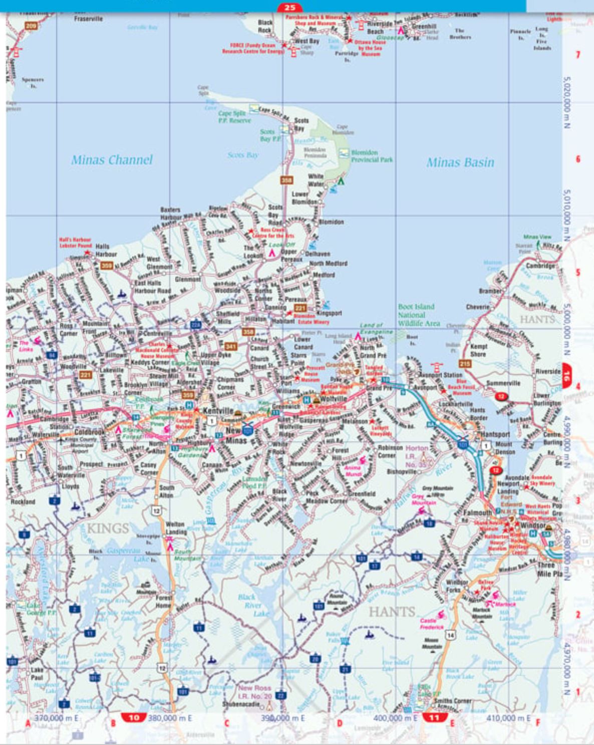
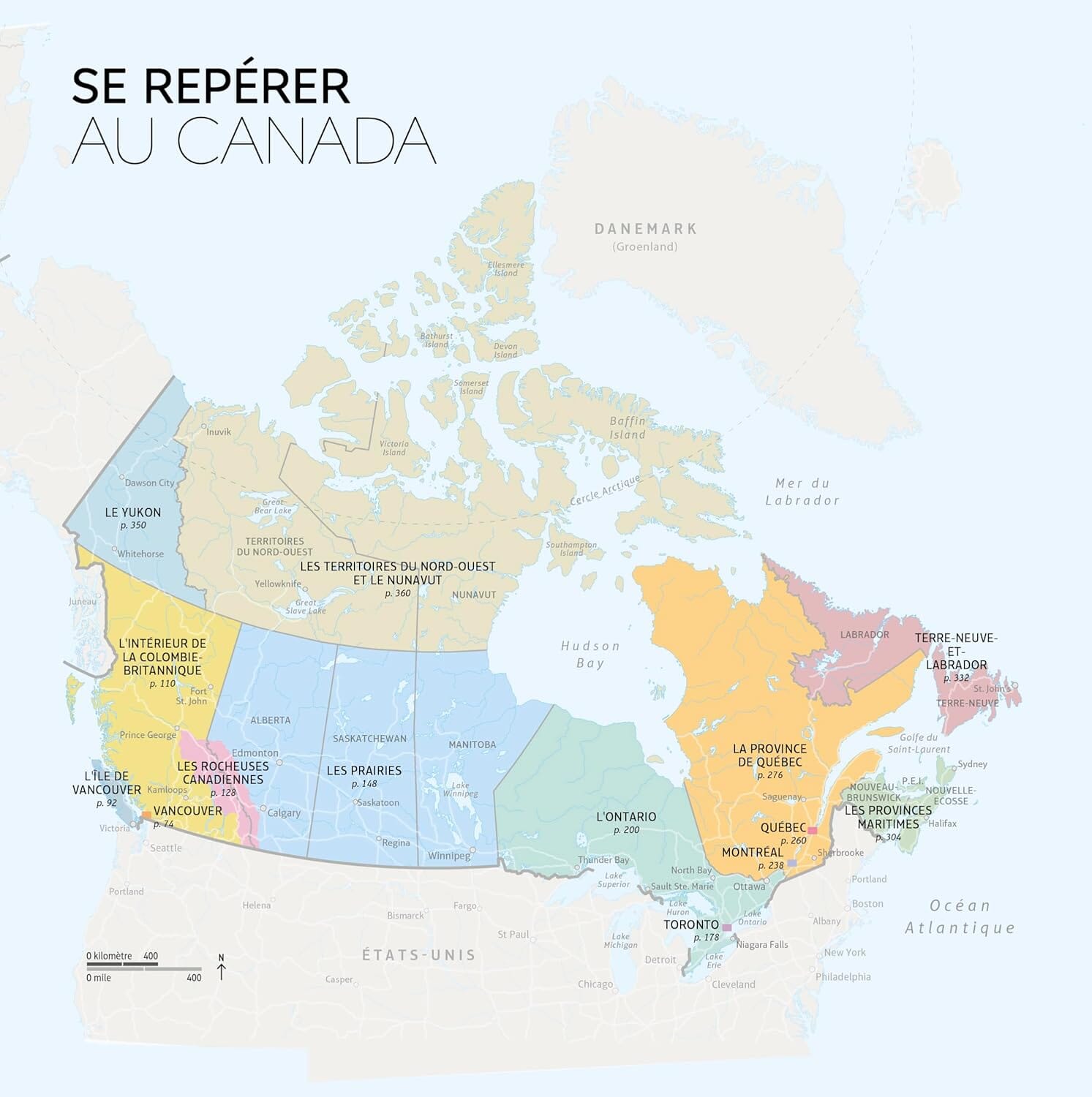
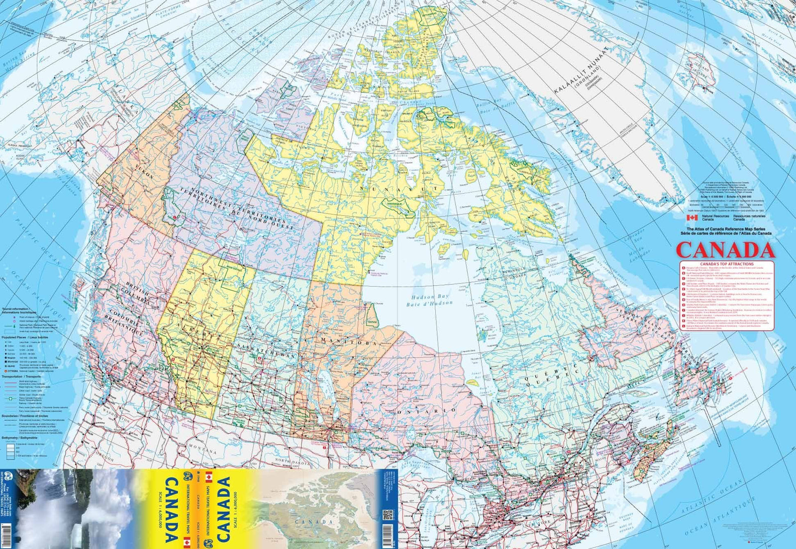
This 120-page atlas contains road maps (1:250,000) of New Brunswick, Nova Scotia, and Prince Edward Island, locator maps, a UTM zone map, route maps, a distance table, Atlantic Canada ferry information, Confederation Bridge information, scenic drives, a community index, and a road index.
Regional maps include expressways, interchanges, exit numbers, primary divided highways, primary highways, secondary divided highways, secondary highways, primary unpaved highways, secondary unpaved highways, county/regional/municipal roads, paved and unpaved roads, unimproved roads, seasonal roads, the Trans-Canada Highway, interstate highways, airports, VIA Rail stations, railways, ferries, RCMP, Quebec police, police stations, hospitals, customs, tourist information centers, toll bridges, borders, time zones, rest areas, skiing, mountain biking, golf courses, docks, boat launches, marinas, points of interest, landmarks, scenic drives, snowmobile trails, Trans Canada Trail, campgrounds, UNESCO World Heritage Sites, national historic sites, bird watching, viewpoints/lookouts, lighthouses, whale watching, sugar shacks, rapids, waterfalls, beaches, peaks, national and provincial parks, bird sanctuaries, National Defense, Indian reserves, populations, and much more.
ISBN/EAN
: 9781554862191
Publication date: 2025
Scale: 1/250,000 (1 cm = 2.5 km)
Unfolded dimensions: 11.02 inches x 8.27 inches (28 x 21 cm)
Language(s): English
Weight:
350 g