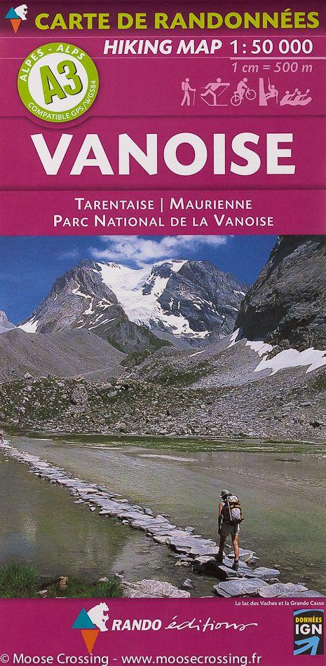
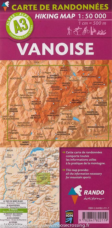
TOP 25 Map No. 3534 OTR (resistant) - The Three Valleys & Modane (Vanoise National Park, Alps) | IGN

Price
Regular price $2900
Regular price Sale price $2900
/
  • Shipping within 24 working hours from our warehouse in France
  • Choisissez votre mode et vos frais de livraison à l’étape de paiement, avant de valider.
  • Retours gratuits (*)
  • Stocks en temps réel
  • In stock, ready to ship
  • Backordered, shipping soon
Tax included.

Souvent achetés ensemble :

Top 25 topographic map around the region around the menuires, Méribel and Courchevel with particular part of the Vanoise National Park. This map published by IGN ranges from Bose to Modane (from north to south), and menuires to Pralognan - la - Vanoise (from West East). Hiking map with space curves spaced 10 meters and detailed legend (vegetation, rocks, streams etc ...). Indication of hiking trails.

Scale 1 / 25,000 (1 cm = 250 m). GPS compatible map.

- This map is printed on a laminatedized support and tearing resistant , ideal for the practice of outdoor activities.
- double - sided map: a reduced footprint that facilitates handling.


ISBN/EAN : 9782758545651
Publication date: 2018
Scale: 1/25,000 (1cm=250m)
Printed sides: both sides
Folded dimensions: 23.6 x 11.2 x 0.5cm
Unfolded dimensions: 50 x 132cm
Language(s): French, English, German
Weight: 84 g