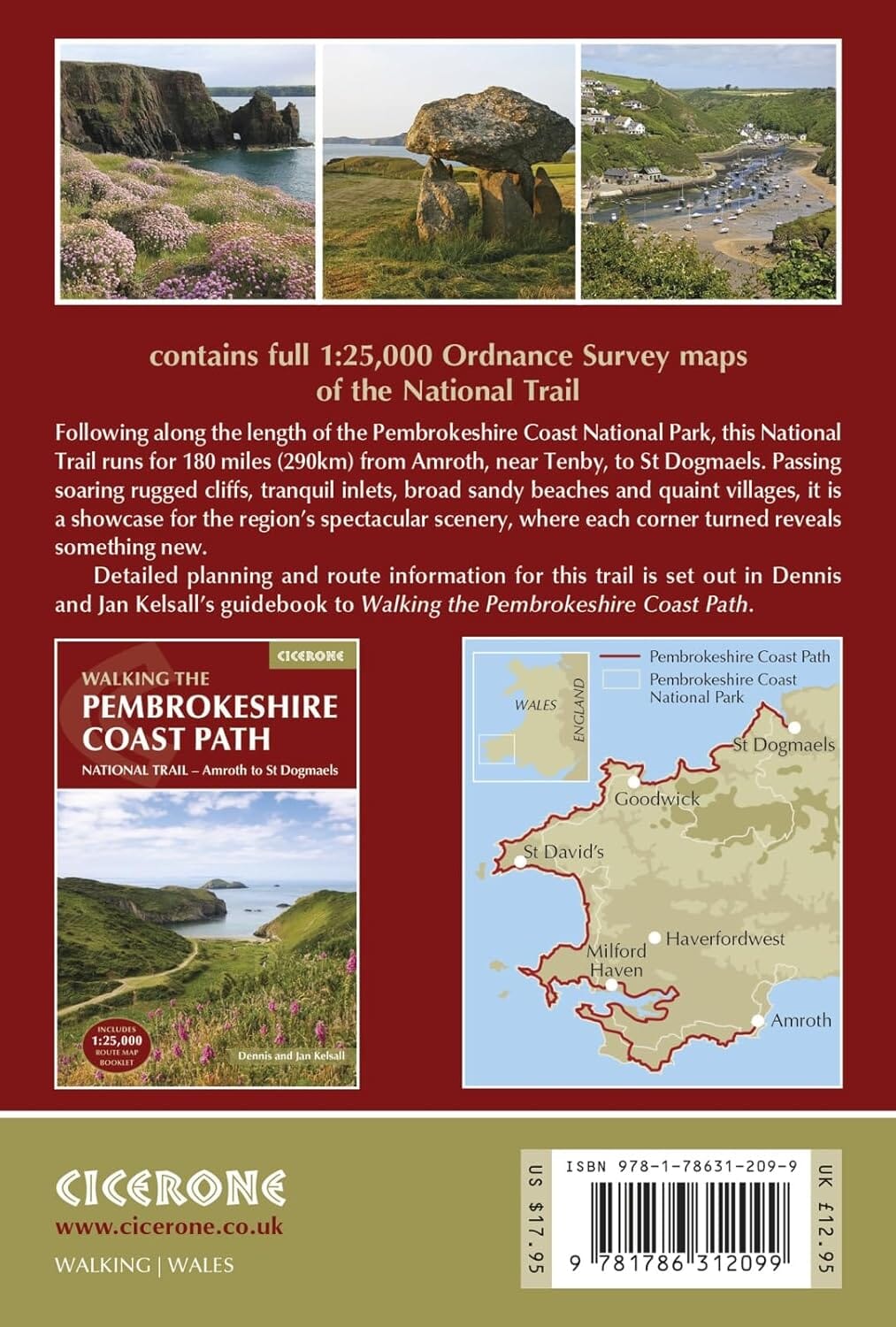
Carnet de cartes de randonnées - Hadrian's Wall Path | Rucksack Readers

Prix
Prix régulier 1399 €
Prix régulier Prix réduit 1399 €
/
  • Expédition sous 24 h ouvrées depuis notre entrepôt en France
  • Retours gratuits (*)
  • Stocks en temps réel
  • Garantie Cartovia - Problème de livraison ?
    On renvoie tout de suite, sur simple photo.
  • En stock
  • En rupture de stock, expédition prochainement
Taxes incluses.

Souvent achetés ensemble :

Carnet de cartes de randonnées (en anglais) du sentier du sentier du mur d'Hadrien édité par Rucksack Readers.

Description fournie par l'éditeur :

Hadrian’s Wall Path is a superb National Trail that runs for 85 miles beside the Roman wall between Bowness-on-Solway and Wallsend, near Newcastle. Experts can't agree whether it's better to walk it from west to east or vice versa, so this booklet uniquely maps it in both directions, scale 1:50,000, with miles correctly numbered each way:

  • route rewalked and mapping updated in late 2025
  • route line more accurate than OS mapping and the official website
  • wo booklets in one, west-to-east and east-to-west
  • custom, clear mapping at 1:50,000: no irrelevant clutter
  • forts, milecastles and visitor centres shown
  • includes city centre plans for Carlisle and Newcastle upon Tyne
  • lightweight (50 grams) and small enough to slip in your pocket
  • robust, opens flat and printed on rainproof paper.


ISBN/EAN : 9781913817350
Date de publication : 2025
Echelle : 1/50 000 (1 cm = 500 m)
Dimensions plié(e) : 15 X 22 cm
Langue(s) : anglais
Poids : 50 g