Hiking map no. 1007 - Pacific Crest Trail - Shasta and Lassen : Castle Crags to Sierra Buttes | National Geographic

Price
Regular price $1495
Regular price Sale price $1495
/
  • Shipped within 24 to 48h from our warehouse in the USA
  • Free returns (*)
  • Real-time stock levels
  • Cartovia Guarantee – Delivery issue?
    We resend immediately upon receiving a simple photo.
  • In stock, ready to ship
  • Backordered, shipping soon
Tax included.

Frequently bought together:

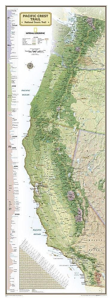
This hiking map no. 1007 covers Pacific Crest Trail - Shasta and Lassen : Castle Crags to Sierra Buttes.

Waterproof and tear-resistant topographic map of the Pacific Crest Trail through the Shasta and Lassen area.

The PCT crosses lush forests on volcanic soils as it leaves the Cascades and enters the Sierra Nevada. Northern California's hiking season runs from May to early November, with high-elevation snow lingering into June. Summer can bring extreme heat and scarce water, particularly on the dry Hat Creek Rim section.

Highlights include Bucks Lake and Crags Wilderness Areas, McArthur-Burney Falls Memorial and Castle Crags State Parks, and Lassen Volcanic National Park.

The PCT extends 4,265 km from Canada to Mexico, crossing six national parks, 25 national forests and 48 wilderness areas, from the volcanic Cascades and snowy Sierra Nevada to the Mojave and Sonoran Deserts.

Each guide provides detailed maps at approximately 1 inch = 1 mile, elevation profiles with distances between campsites and points of interest, and information on resupply, safety and GPS navigation. Its compact, durable, waterproof format is easier to use than folded maps.

Suitable for everyone from occasional walkers to thru-hikers completing the entire trail.


ISBN/EAN : 9781566957892
Publication date: 2019
Scale: 1/75,000 (1cm=750m)
Language(s): English
Weight: 0 g