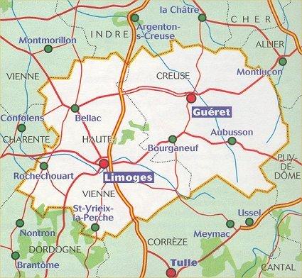
The IGN Blue Series No. 2130 hiking map covers the Bourganeuf, Saint-Sulpice-Laurière area.
This highly accurate topographic mapping shows every detail on the ground:
- Transport routes down to the smallest paths.
- Buildings, including individual sheds.
- Woodland, isolated trees, rivers and springs.
Contour lines show the terrain.
Municipalities covered: Bourganeuf, Saint-Sulpice-Laurière, Saint-Dizier-Masbaraud, Saint-Léger-la-Montagne, Azat-Châtenet, Châtelus-le-Marcheix, Augères, Saint-Martin-Terressus, Le Châtenet-en-Dognon, Sauviat-sur-Vige, Ceyroux, Saint-Priest-Palus, Saint-Amand-Jartoudeix, Jabreilles.
Places to discover: Millevaches en Limousin, Bois des Échelle :s, Roches de Mazuras, Puy de Jouër, Puy de Sauvagnac, Puy de Jabreilles, Monts d'Ambazac, Notre-Dame des Rochers Chapel, Lanterne des Morts, Arborétum, Barage de St-Marc, Pont du Dognon.