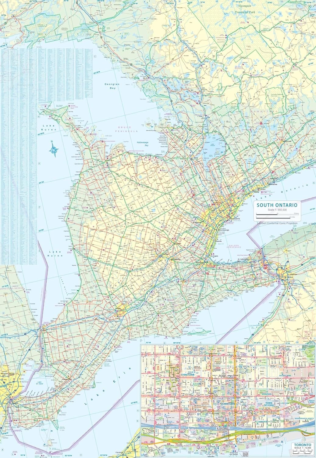
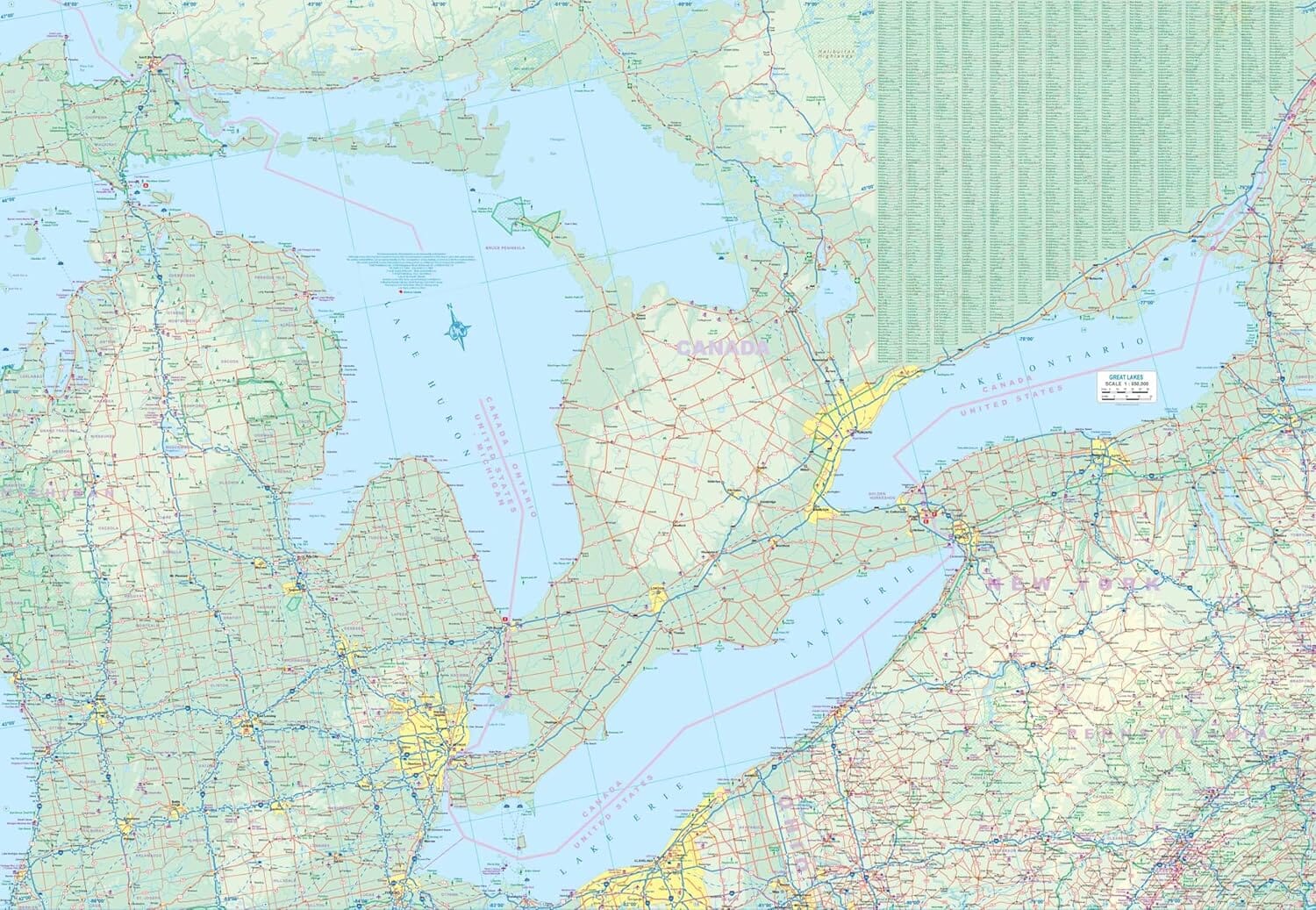
It's the perfect car companion for traveling in this region, whether you're a resident or a short-term visitor. It has all the features needed to facilitate navigation, even in unfamiliar areas.
In this 256-page atlas, you will find city maps (1:20,000/1:62,000), return road maps (1:250,000), location maps, lists of features (points of interest, hospitals, golf clubs, universities and colleges, shopping malls), a map of downtown Ottawa, an index of road maps and regional road maps, and a community index.
The city maps include Alexandria, Almonte, Amherstview, Arnprior, Brockville, Cantley, Cardinal, Carleton Place, Casselman, Chelsea, Cornwall, Embrun, Gananoque, Gatineau (Angers, Aylmer, Buckingham, Hull, Masson), Hawkesbury, Ingleside, Iroquois, Kemptville, Kingston, Long Sault, Montebello, Morrisburg, and Ottawa. (Barrhaven, Blackburn Hamlet, Carp, Constance Bay, Cumberland, Fitzroy Harbour, Greely, Kanata, Kars, Kenmore, Manotick, Metcalfe, Munster, Navan, Nepean, North Gow