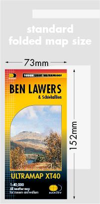
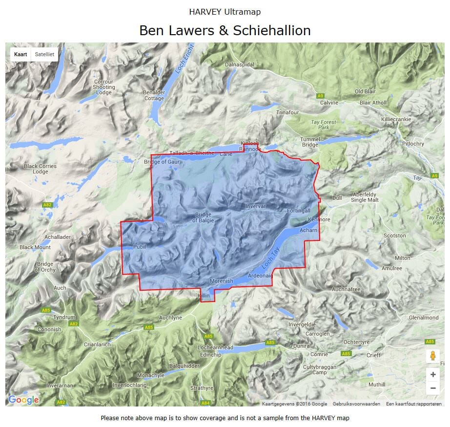
Hiking map - Ben Lawers XT40 | Harvey Maps - Ultramap

Price
Regular price 202 kr
Regular price Sale price 202 kr
/
  • Shipping within 24 working hours from our warehouse in France
  • Shipping method and fees are shown at checkout
  • Free returns (*)
  • Real-time stock levels
  • In stock, ready to ship
  • Backordered, shipping soon
Tax included.

Frequently bought together:

Ultra light and compact waterproof hiking map published by Harvey Maps, ideal for discovering the most beautiful regions of England, Wales or Scotland.
Original description of the publisher:

Covers at Large Area Yet Is Handily Compact. Pocket Perfect!

Detailed Map for Runners and Walkers of the Hills Between Loch Tay and Loch Rannoch.
Includes Ben Lawers, Schiehallion and the Tarmachan Ridge.
Includes 16 Munros and 6 Corbetts.

Has The Advantages of ITS Bigger Brothers:
USE WITHOUT A MAP CASE: TOUGH AND 100% WATERPROOF
Open Directly to Either Side of the Sheet


ISBN/EAN : 9781851375783
Publication date: 2016
Scale: 1/40,000 (1cm=400m)
Printed sides: both sides
Folded dimensions: 7.3 x 15.2cm
Unfolded dimensions: 30.4 x 87.5cm
Language(s): English
Weight: 70 g