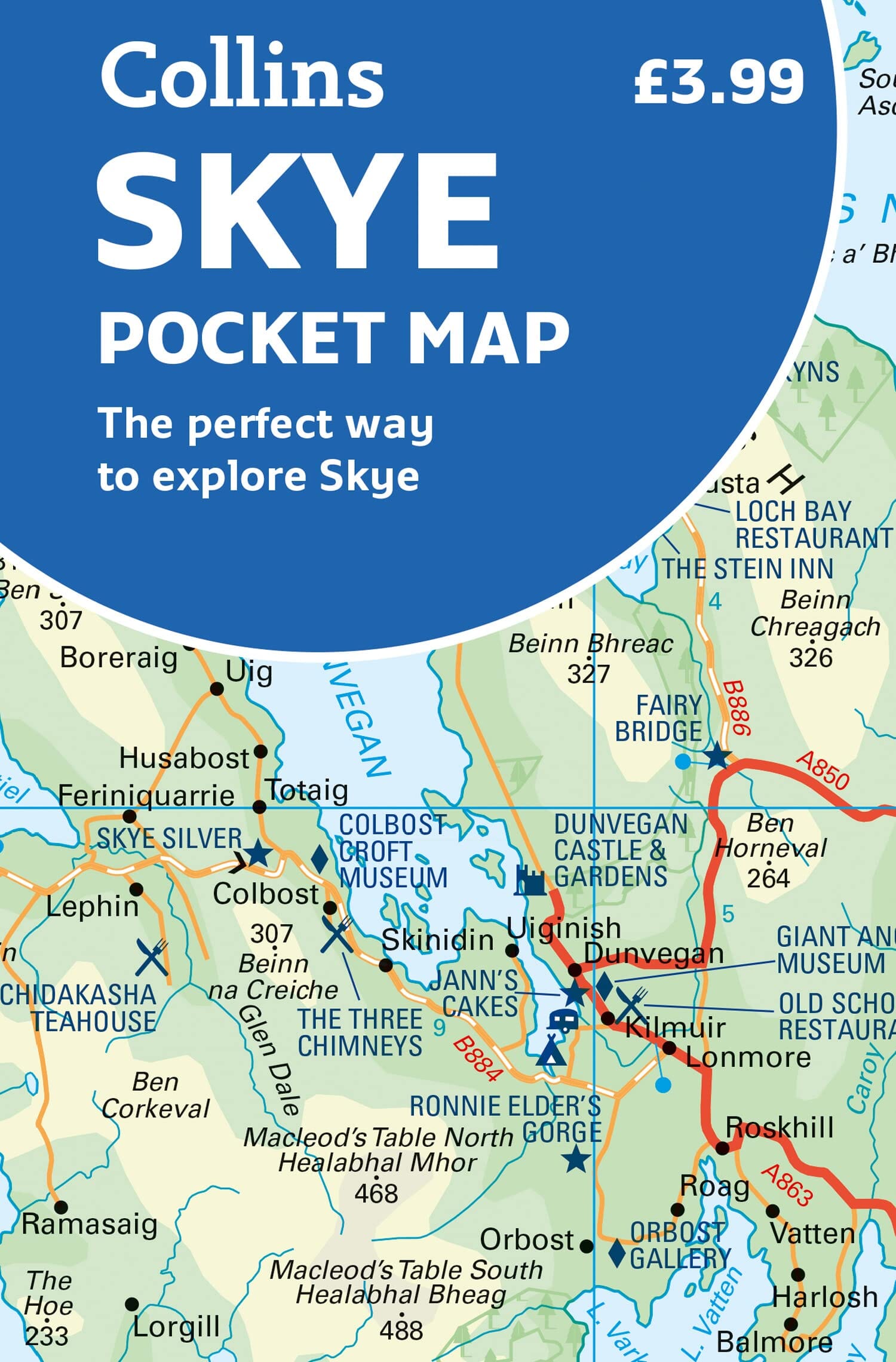
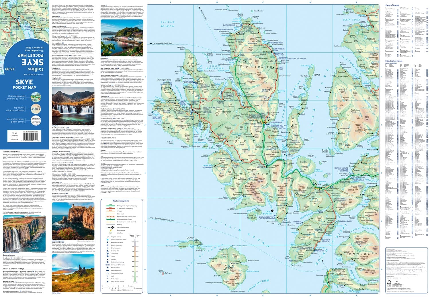
Pocket Map - Isle of Skye | Collins
- Shipping within 24 working hours from our warehouse in France
- Shipping method and fees are shown at checkout
- Free returns (*)
- Real-time stock levels
- Low stock - 1 item left
Plus de 19 500 cartes 🗺️ et guides de voyage, cartes de randonnée, posters, globes, déco en stock !
La Compagnie des Cartes devient Cartovia ✨ Notée Excellent ⭐️ sur Trustpilot (9 000+ avis).
Livraison gratuite pour toute commande > 50 € (cartes pliées et guides, France métropolitaine)
Small, color map of the Isle of Skye with a high level of detail. Clear mapping of the Isle of Skye showing the road network, ferries, and places of interest. Map at a scale of 1:175,000.
The Collins Road Map is clear, detailed, and in color. It is presented in a handy format ideal for your pocket or handbag.
This map includes:
• Road map of the island
• Caravan and camping sites
• Tourist attractions
• Ferry connections
• List of main places to visit, with additional details on Dunvegan Castle, the Old Man of Storr, and Loch Coruisk
• Detailed index of place names
ISBN/EAN : 9780008492595
Publication date: 2022
Scale: 1 / 175 000 (1 cm = 1,75 km)
Printed sides: both sides
Folded dimensions: 9 x 14 cm
Language(s): English
Weight:
40 g
L'infolettre exclusive des passionnés de voyage et de découverte !