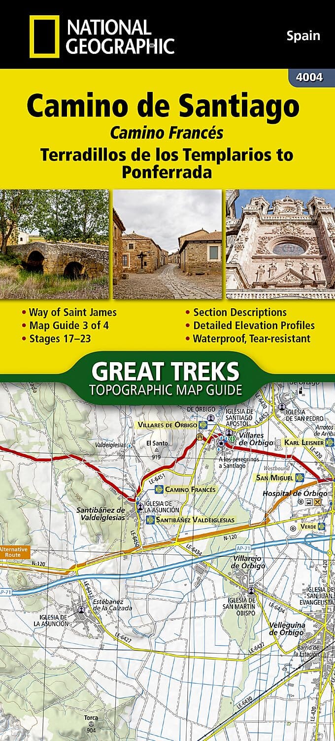
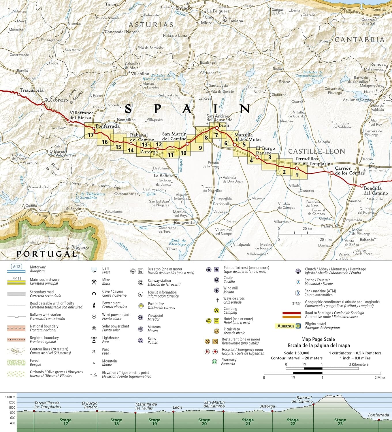
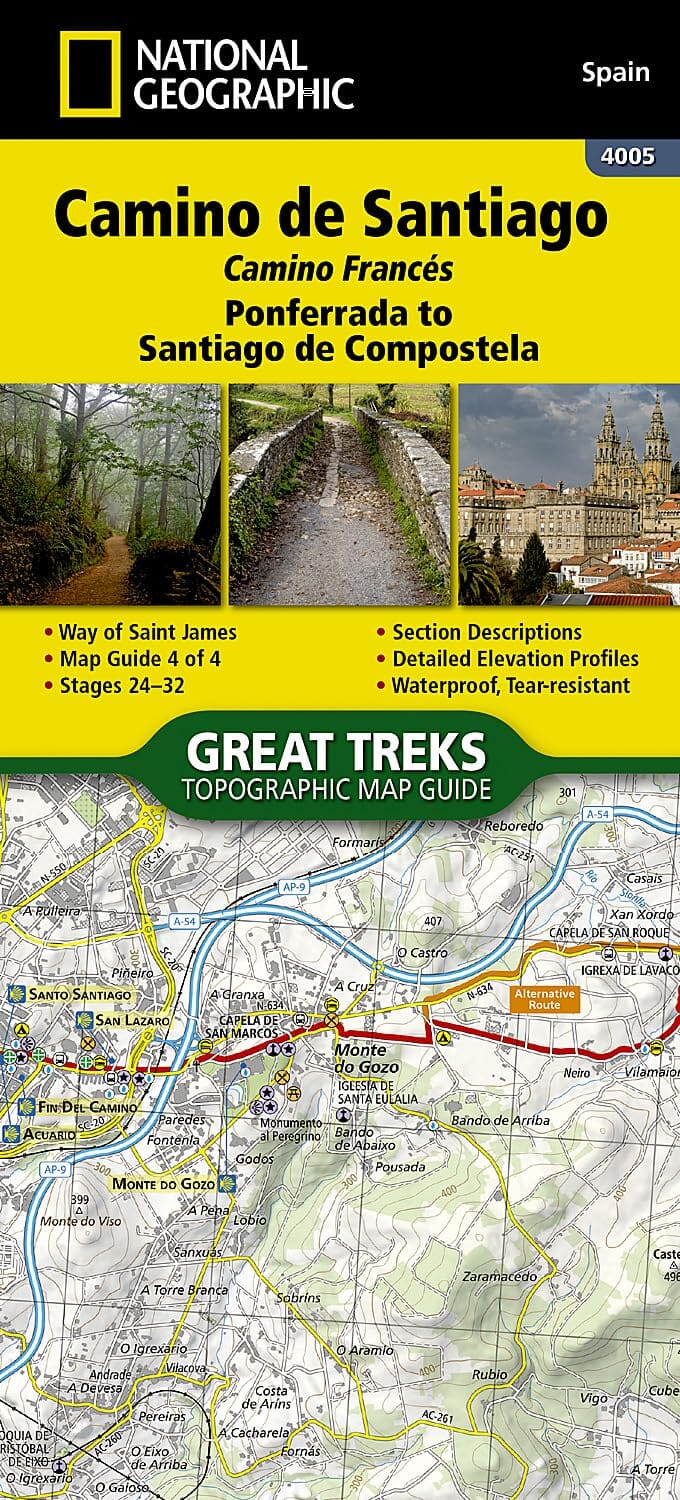
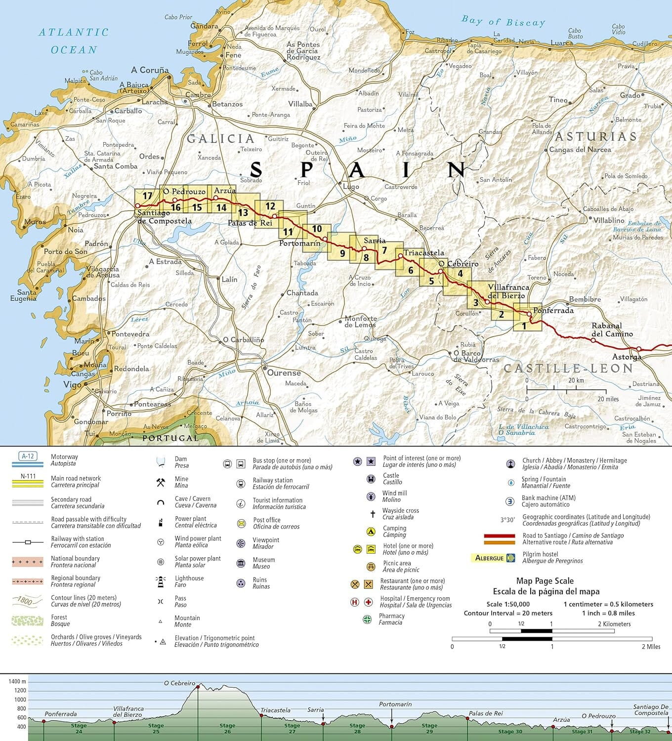
Hiking map No.4002 - Camino de Santiago 1: Saint-Jean-Pied-de-Port to Santo Domingo de la Calzad | National Geographic

Price
Regular price 179 kr
Regular price Sale price 179 kr
/
  • Shipping within 24 working hours from our warehouse in France
  • Choisissez votre mode et vos frais de livraison à l’étape de paiement, avant de valider.
  • Retours gratuits (*)
  • Stocks en temps réel
  • In stock, ready to ship
  • Backordered, shipping soon
Tax included.

Souvent achetés ensemble :

The topographic map from Saint-Jean-Pied-de-Port to Santo Domingo de la Calzada is the perfect travel companion for exploring the easternmost section of the Camino Francés (French Way). This section of the path passes through the Pyrenees, from France to Spain, then through Pamplona (Iruña) and includes sections 1 to 9. A detailed description of each section of the path is included and points travelers to the many landmarks encountered on the way.

Each Camino de Santiago map guide includes detailed 2 cm = 1 km topographic maps. Each page is centered on the path and overlaps adjacent pages, so there is little chance of getting lost. At the bottom of each page, a trail profile shows the distance between towns, rest areas and trail access points. The trail map and profile provide a step-by-step visual guide to the hike.

This map is waterproof and tear-resistant.


ISBN/EAN : 9781566959193
Publication date: 2024
Pagination: 48 pages
Scale: 1/50,000 (1cm=500m)
Printed sides: both sides
Folded dimensions: 23.5 x 10.9cm
Language(s): English
Weight: 91 g