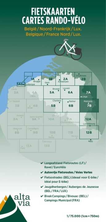
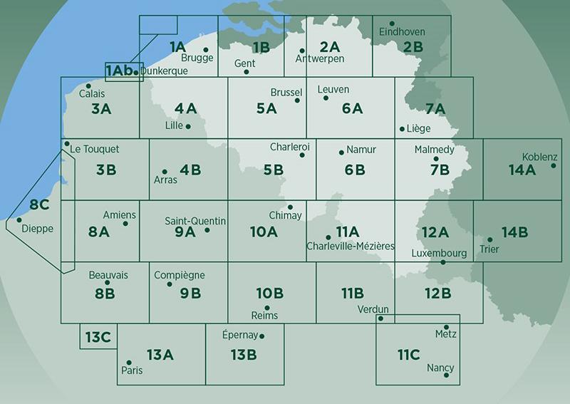
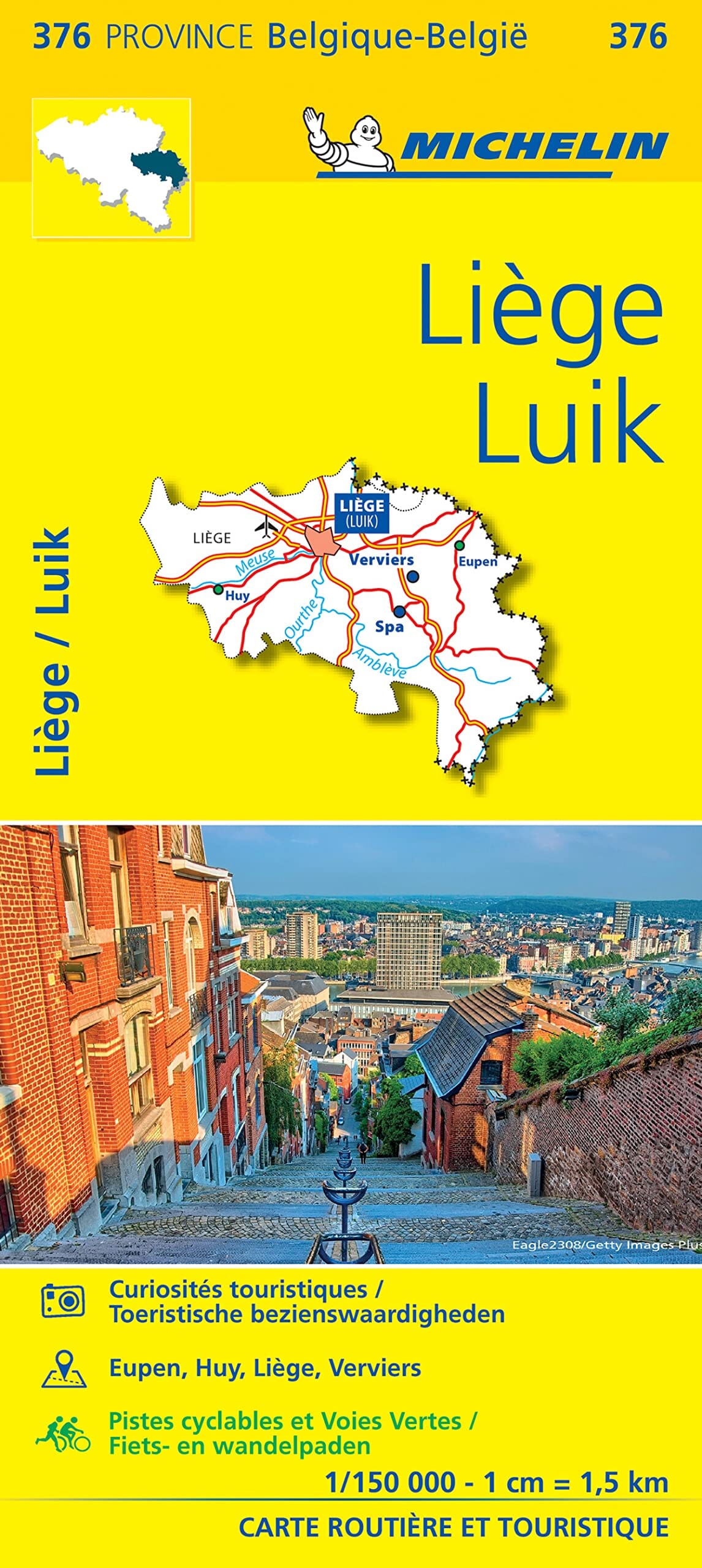
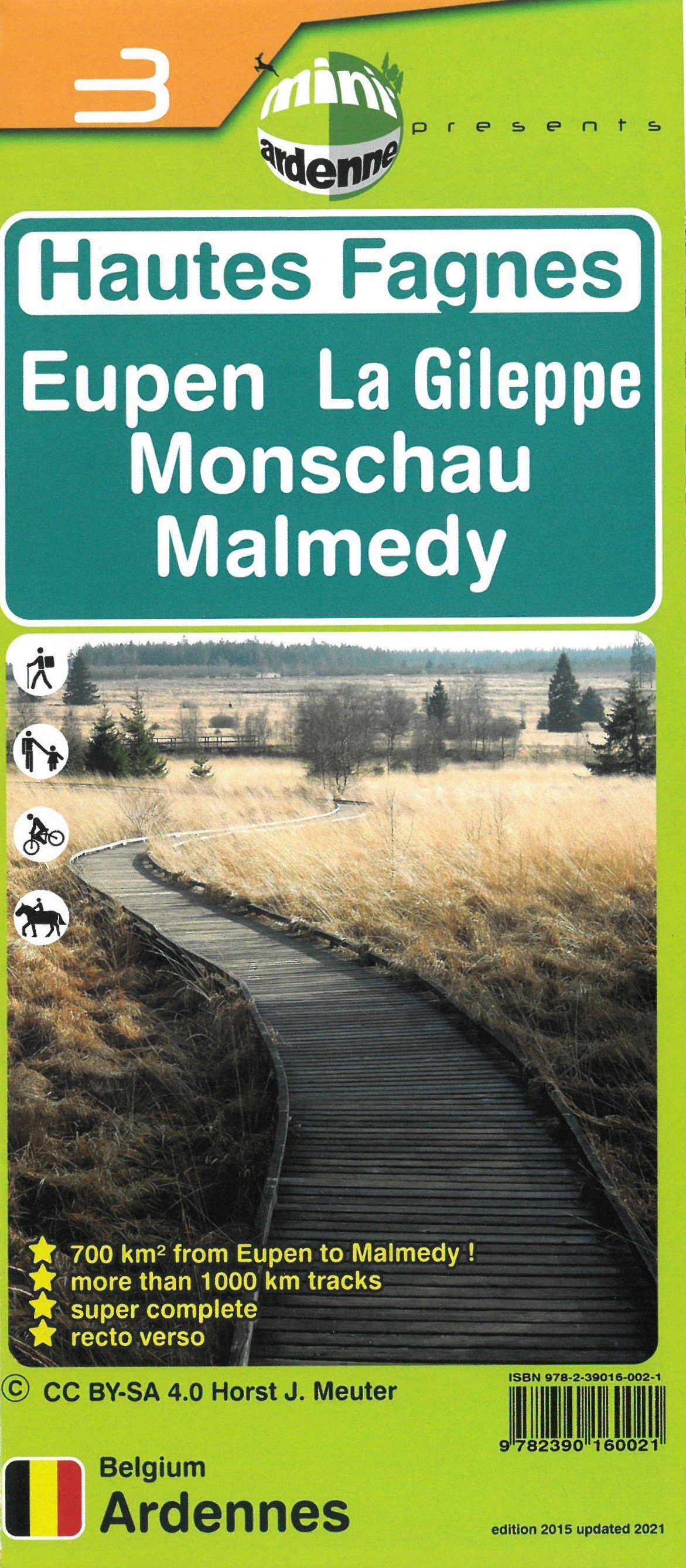
Cycle tourism map No. 7 - Luik & Oostkantons | Alta Via

Price
Regular price 6500 zł
Regular price Sale price 6500 zł
/
  • Shipping within 24 working hours from our warehouse in France
  • Shipping method and fees are shown at checkout
  • Free returns (*)
  • Real-time stock levels
  • In stock, ready to ship
  • Backordered, shipping soon
Tax included.

Frequently bought together:

Topographic and cycle tourism map from the publisher Alta Via which focuses on the Voies Vertes, a cycle tourism network covering Belgium, Luxembourg and the North of France.
All LF and Ravel routes are included, supplemented by old railway lines and towpaths transformed into cycle paths.
The maps show all youth hostels, campsites and shelters, etc.
The scale is 1/75,000 (1 cm = 750 m).
The maps are printed on "stone paper".

Click this link to view the complete series from publisher Alta Via.


ISBN/EAN : 9789082714449
Publication date: 2024
Scale: 1/75,000 (1cm=750m)
Language(s): French, English, Flemish
Weight: 80 g