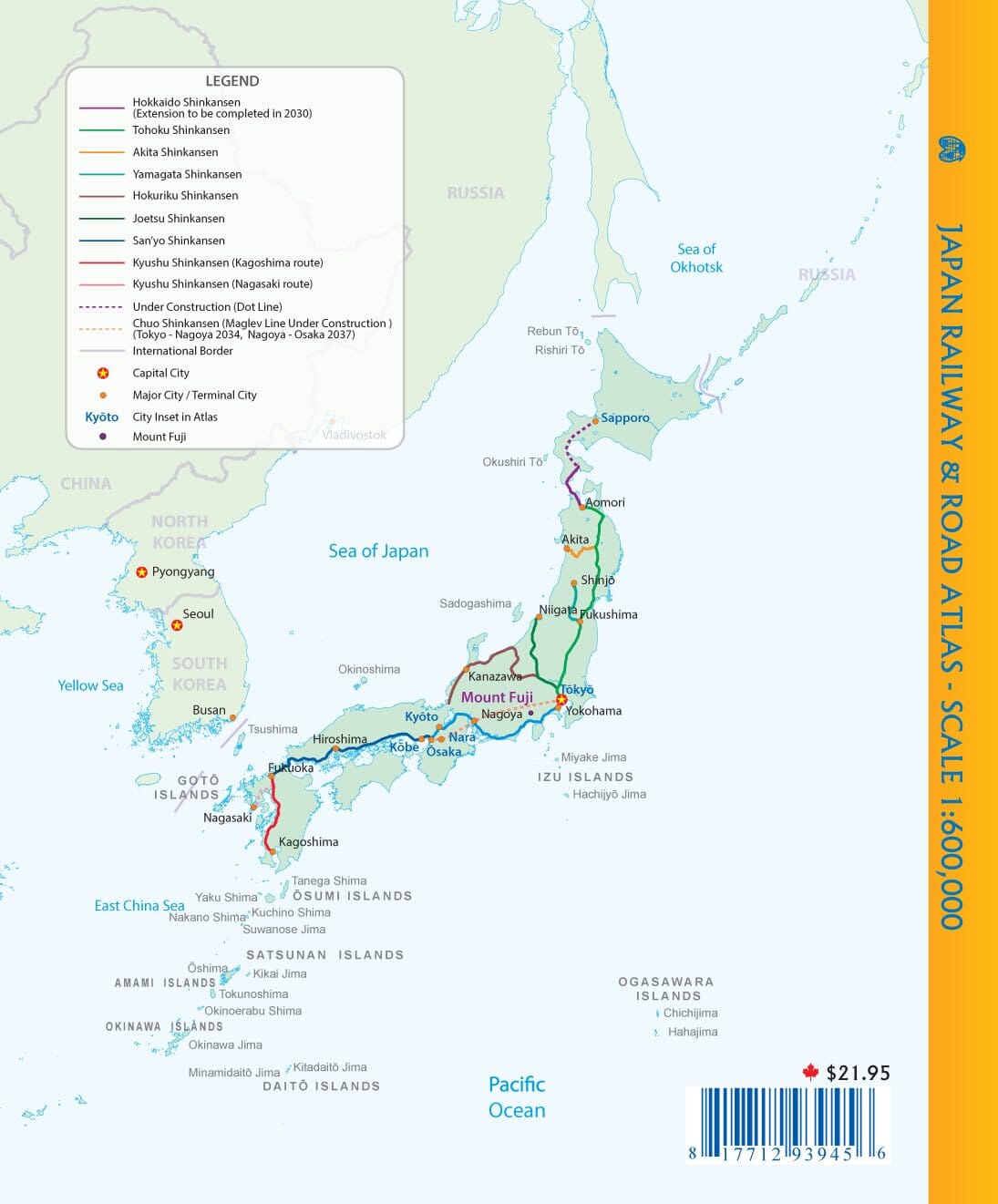
Pocket Atlas - Japan (Roads and Railways) | ITM
- Shipping within 24 working hours from our warehouse in France
- Shipping method and fees are shown at checkout
- Free returns (*)
- Real-time stock levels
- In stock, ready to ship
Over 19,500 maps 🗺️ and travel guides, hiking maps, posters, globes, and décor items in stock!
Rated Excellent ⭐️ on Trustpilot — 9,000+ reviews from explorers and map lovers worldwide.
Explore the world, one map at a time 🗺️
Pocket atlas of all of Japan published by ITM. Roads, points of interest, and national parks are indicated. Terrain mapping and city index are included.
Travel to Japan is booming, but one of the major challenges in creating a map of the country is the exceptional density of its urban areas, which makes it difficult to read on a conventional format.
Thanks to the book format , we were able to enlarge the scale to offer a much clearer and more comfortable reading. This choice also allowed us to add detailed double-page maps of the main cities: Tokyo, Kyoto, Nara, Osaka and Kobe . An ideal solution for travelers wishing to easily orient themselves in such a dense and structured country.
ISBN/EAN : 9781771293945
Publication date: 2025
Pagination: 107 pages
Scale: 1/600,000 (1 cm = 6 km)
Folded dimensions: 21 x 14 x 0.8 cm
Language(s): English
Weight:
167 g
The exclusive newsletter for travel and discovery enthusiasts!