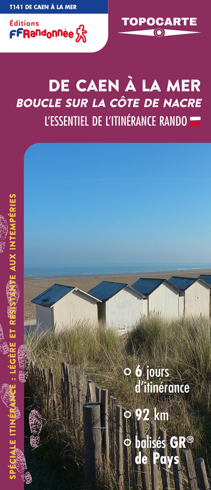
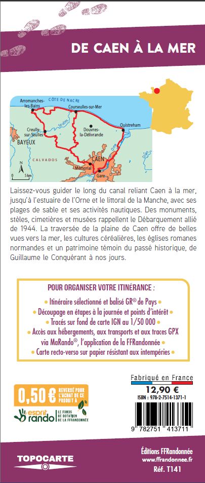
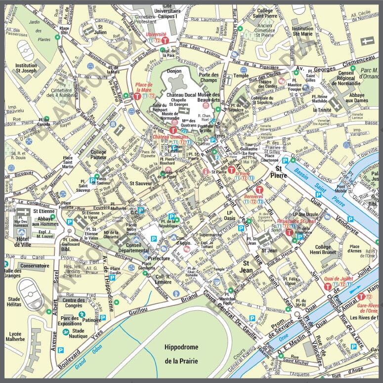
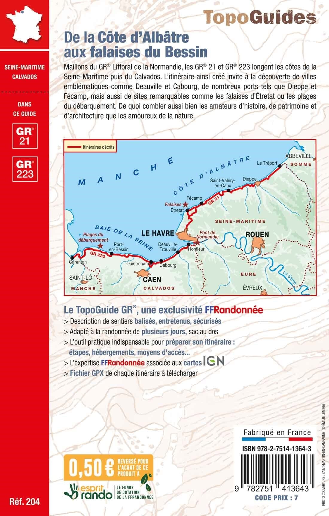
Topocarte - From Caen to the sea, loop on the Côte de Nacre | FFRandonnée
- Shipping within 24 working hours from our warehouse in France
- Shipping method and fees are shown at checkout
- Free returns (*)
- Real-time stock levels
- Low stock - 2 items left
Over 19,500 maps 🗺️ and travel guides, hiking maps, posters, globes, and décor items in stock!
Rated Excellent ⭐️ on Trustpilot — 9,000+ reviews from explorers and map lovers worldwide.
Explore the world, one map at a time 🗺️
This map is based on the new GR® from Pays de Caen to the sea and offers hikers a 91 km loop (5 days) starting from Caen, exploring the Orne estuary, the Channel coastline, the landing beaches and the Caen plain. The route can be split into two loops of 3 and 4 days for long weekends.
In 2025, the map will evolve: a softened four-color process and reinforced paper (still rainproof!). The GPX track and a selection of accommodation and useful addresses remain accessible via MaRando, the FFRandonnée application.
The topocarte is the essential and practical tool to simplify roaming.
ISBN/EAN : 9782751413711
Publication date: 2025
Scale: 1/50,000 (1cm=500m)
Printed sides: both sides
Folded dimensions: 25 x 10.7 x 0.3 cm
Language(s): French
Weight:
80 g
The exclusive newsletter for travel and discovery enthusiasts!