Overview Map (in English) - The World (sold folded) | ITM
- Shipping within 24 working hours from our warehouse in France
- Shipping method and fees are shown at checkout
- Free returns (*)
- Real-time stock levels
- In stock, ready to ship
Over 19,500 maps 🗺️ and travel guides, hiking maps, posters, globes, and décor items in stock!
Over 19,500 maps 🗺️ and travel guides, hiking maps, posters, globes, and décor items in stock!
Rated Excellent ⭐️ on Trustpilot — 9,000+ reviews from explorers and map lovers worldwide.
Rated Excellent ⭐️ on Trustpilot — 9,000+ reviews from explorers and map lovers worldwide.
Explore the world, one map at a time 🗺️
Explore the world, one map at a time 🗺️
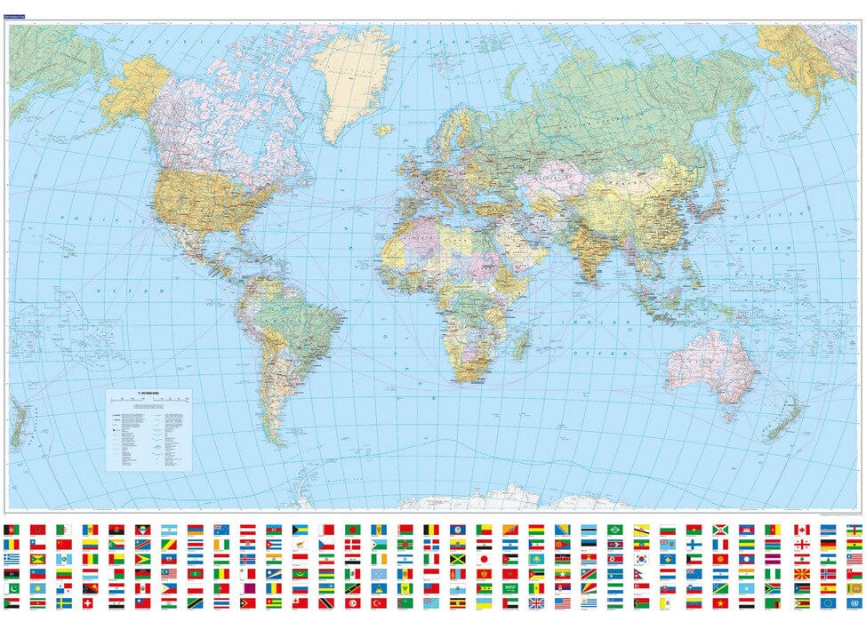
This map represents the world from a political point of view:
The major countries are listed with their administrative divisions (provinces or states).
A relevant selection of cities is also included.
Politically sensitive areas are carefully depicted:
Ukraine is shown with its internationally recognized borders,
Palestine is named, even though Gaza is too small to be visible,
Taiwan is visually differentiated from mainland China,
Western Sahara is colorful but unnamed,
The Gulf of Mexico is commonly named after him.
Clocks indicating time zones are placed in the margins, and Svalbard is named by its Norwegian designation.
The second side of the map shows:
The flags of all internationally recognized countries , listed in alphabetical order .
For each country: location on the map , area , capital , population (latest data available).
ISBN/EAN : 9781771299053
Publication date: 2025
Scale: 1/43,400,000 (1 cm = 434 km)
Printed sides: both sides
Folded dimensions: 24.6 x 10.3 x 0.5cm
Unfolded dimensions: 68x100cm
Language(s): English
Weight:
109 g
The exclusive newsletter for travel and discovery enthusiasts!


