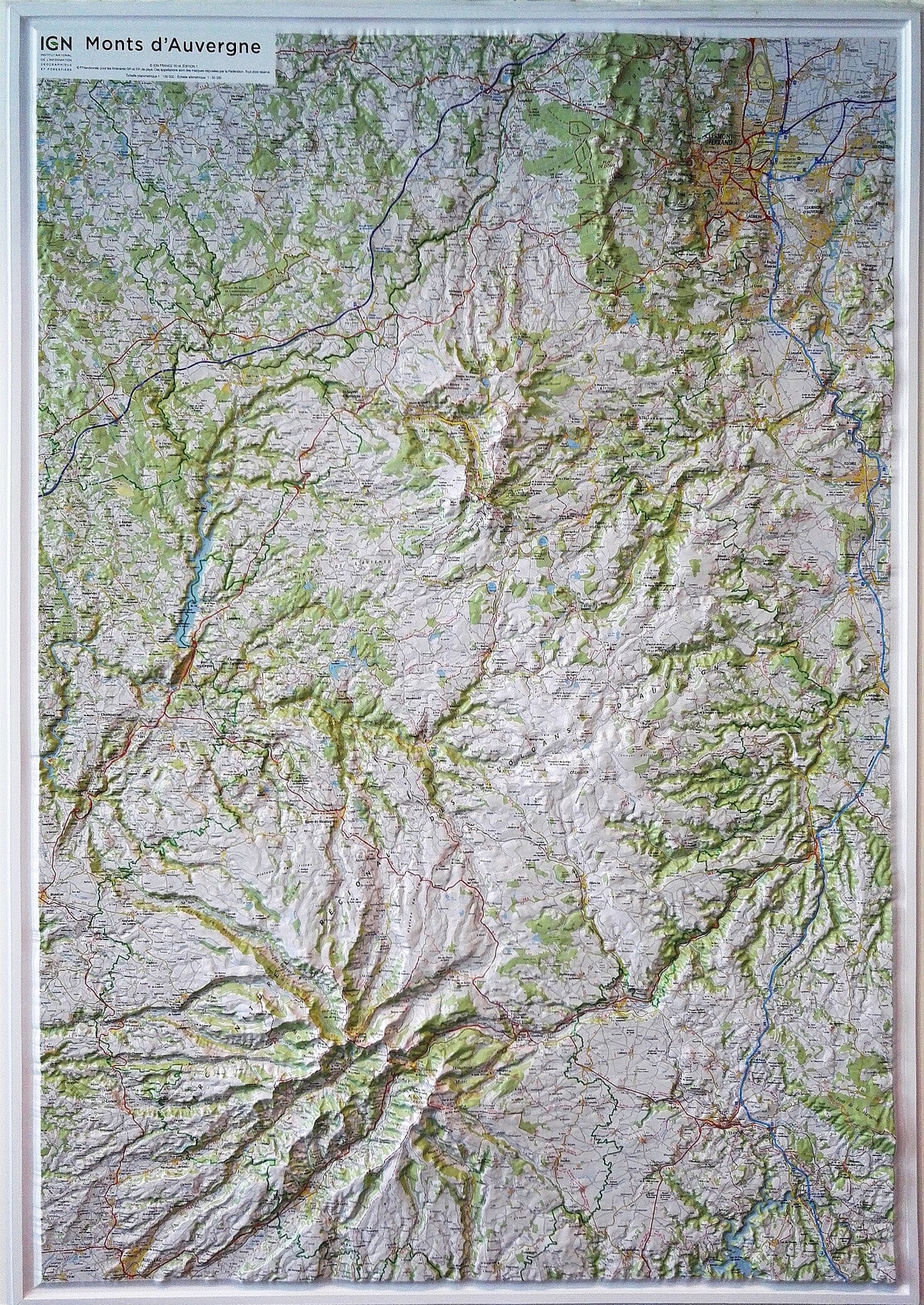
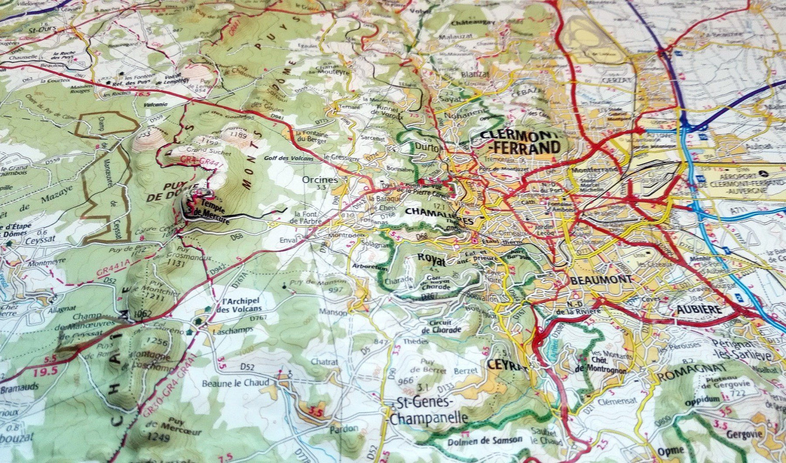
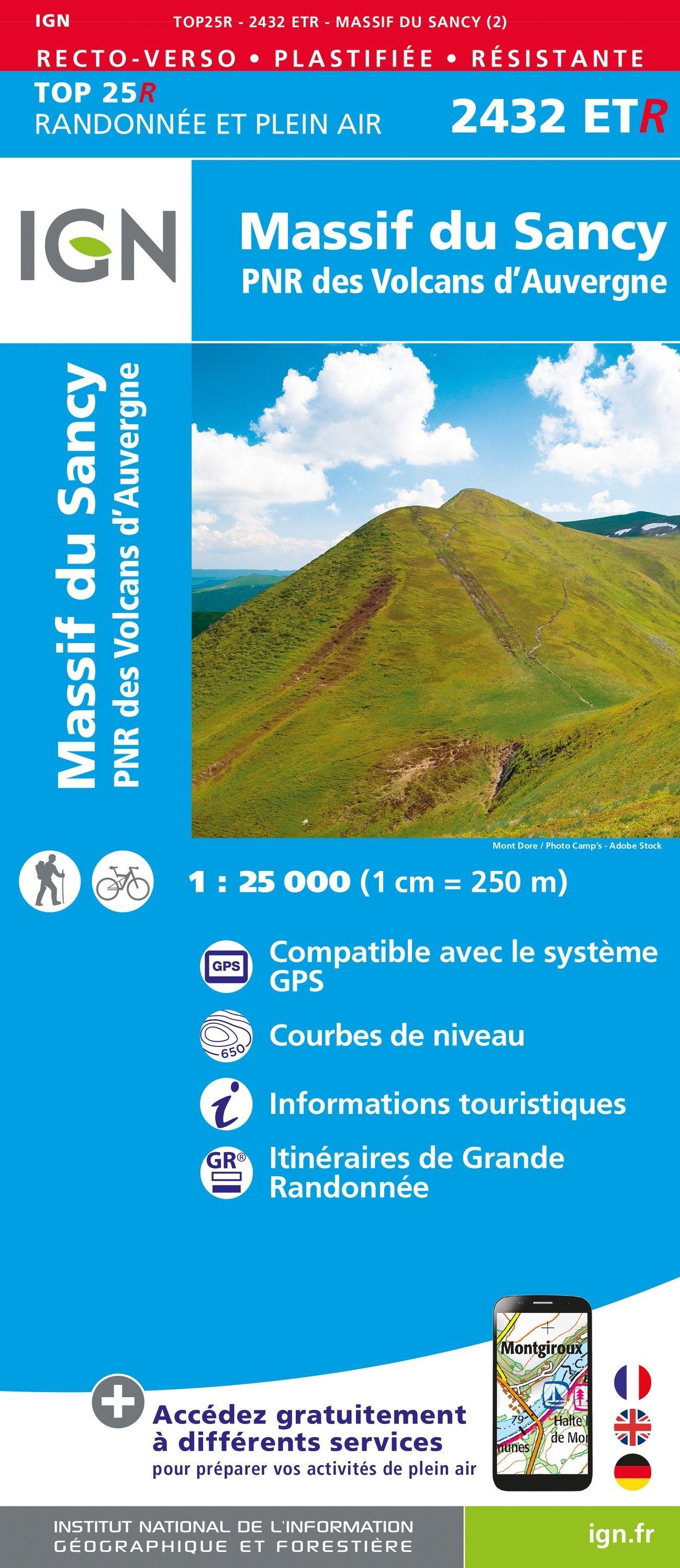
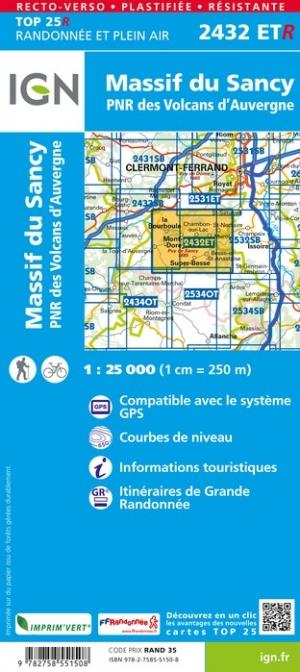
TOP 25 map n° 2537 OT - Nasbinals, Monts d'Aubrac | IGN
- Shipping within 24 working hours from our warehouse in France
- Shipping method and fees are shown at checkout
- Free returns (*)
- Real-time stock levels
- In stock, ready to ship
Over 19,500 maps 🗺️ and travel guides, hiking maps, posters, globes, and décor items in stock!
Rated Excellent ⭐️ on Trustpilot — 9,000+ reviews from explorers and map lovers worldwide.
Explore the world, one map at a time 🗺️
TOP 25 topographic map n° 2537OT of Nasbinals and Monts d'Aubrac published by IGN. Hiking map with contour lines spaced 10 meters apart and detailed legend (vegetation, rocks, waterways, etc.). Indication of hiking trails.
Scale 1/25,000 (1 cm = 250 m).
Municipalities covered : Nasbinals, Saint-Urcize, La Trinitat, Jabrun, Les Bessons, Fournels, Saint-Laurent-de-Veyrès, Grandvals, Deux-Verges, Saint-Rémy-de-Chaudes-Aigues, Brion, Chauchailles, Prinsuéjols-Malbouzon, La Fage-Saint-Julien, Noalhac, Recoules-d'Massif de l'Aubrac, La Fage-Montivernoux
Places to discover : Aubrac Massif, Salhiens Lake, Laguiole Woods, Roquette-Bonneval State Forest, Rigambal Woods, Puech du Roussillon, Aubrac Massif Mountains, the Truques of the Aubrac Massif, Cap Combattut Mountain, Aubrac Massif Mountains, Ste-Marie, Aubrac Massif House, La Baume, Déroc Cave, Déroc Waterfall
ISBN/EAN : 9782758557340
Publication date: 2025
Scale: 1/25,000 (1cm=250m)
Printed sides: front
Folded dimensions: 23.6 x 11.2 x 0.5cm
Unfolded dimensions: 96 x 132cm
Language(s): French, English, German
Weight:
89 g
The exclusive newsletter for travel and discovery enthusiasts!