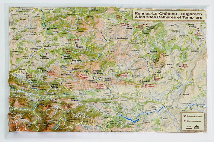
Small relief map - Rennes-Le-Chateau Bugarach - 21 x 31 cm
- Made to order - Shipping within 5 to 8 working days
- Shipping method and fees are shown at checkout
Over 19,500 maps 🗺️ and travel guides, hiking maps, posters, globes, and décor items in stock!
Rated Excellent ⭐️ on Trustpilot — 9,000+ reviews from explorers and map lovers worldwide.
Explore the world, one map at a time 🗺️
The relief map of Rennes-le-Château - Bugarach and its Cathar and Templar sites includes castles and citadels, remarkable sites, and all the towns in the region. It covers the region from Quillan to Tautavel, including Rennes-le-Château, the Pic de Bugarach, the Galamus Gorges, the castles of Peyrepertuse, Quéribus, Padern, Aguilar, and many others.
This completely new vision helps showcase the natural and cultural heritage of this region, which can be explored with both your eyes and your fingers!
ISBN / EAN : 9782361681210
Impression: front
Dimensions déplié(e) : 21x31cm
Langue : French
Poids :
50 g
produits plaisant qui complète bien à la maison les cartes IGN
The exclusive newsletter for travel and discovery enthusiasts!