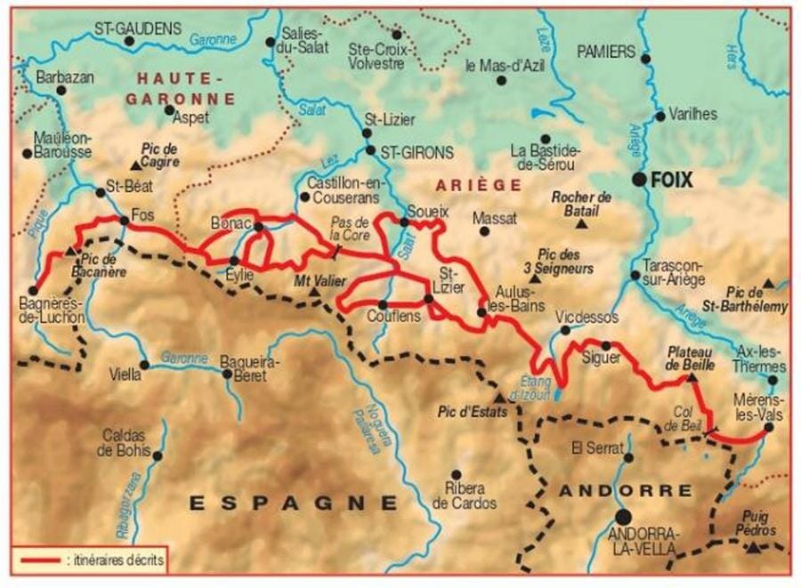
TOP 75 Map No. 20 - Ariège Pyrenees, Mont Valier & Pique d'Estats | IGN
- Shipping within 24 working hours from our warehouse in France
- Shipping method and fees are shown at checkout
- Free returns (*)
- Real-time stock levels
- In stock, ready to ship
Over 19,500 maps 🗺️ and travel guides, hiking maps, posters, globes, and décor items in stock!
Rated Excellent ⭐️ on Trustpilot — 9,000+ reviews from explorers and map lovers worldwide.
Explore the world, one map at a time 🗺️
Top 75 Topographic map of the Ariege Pyrenees, Mount Valier, and the pic of Estates published by IGN. This detailed map covers the Ariège Pyrenees, its national park, as well as Mount Valier and the pic of estates. Level curves, detailed legend and indication of hiking trails. Cities index. P>
This map includes 5 zooms at 1/25,000 scale to discover exceptional hikes. P>
ISBN/EAN : 9782758544715
Publication date: 2018
Scale: 1/75,000 (1cm=750m) & 1/25,000 (1cm=250m)
Printed sides: front
Folded dimensions: 24.6 x 11.2 x 0.7cm
Unfolded dimensions: 130 x 100cm
Language(s): French, English, German
Weight:
89 g
Qualité prix
The exclusive newsletter for travel and discovery enthusiasts!