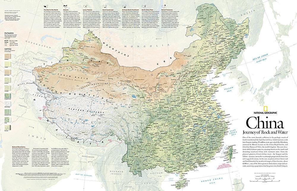
One of the most spectacular collisions in Earth's geological history transformed the land that is now China. The tectonic crash of India into Eurasia beginning 35 million years ago uplifted the Himalayas and lifted the Tibetan Plateau. The new elevations altered climate patterns, created deserts in the north, and flooded southeastern China with monsoon rains. This detailed physical map of China illustrates the country's wide range of land cover, including forests, grasslands, row crops, bare soil, deserts, and more. Published in May 2008, this map was one half of a two-map set with "The Forbidden City."
.
