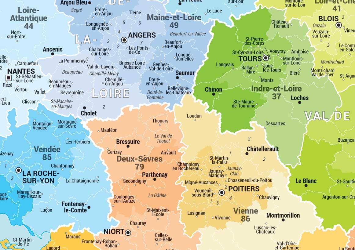
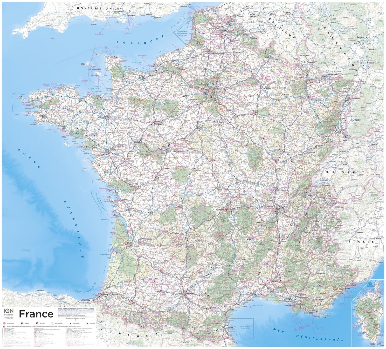
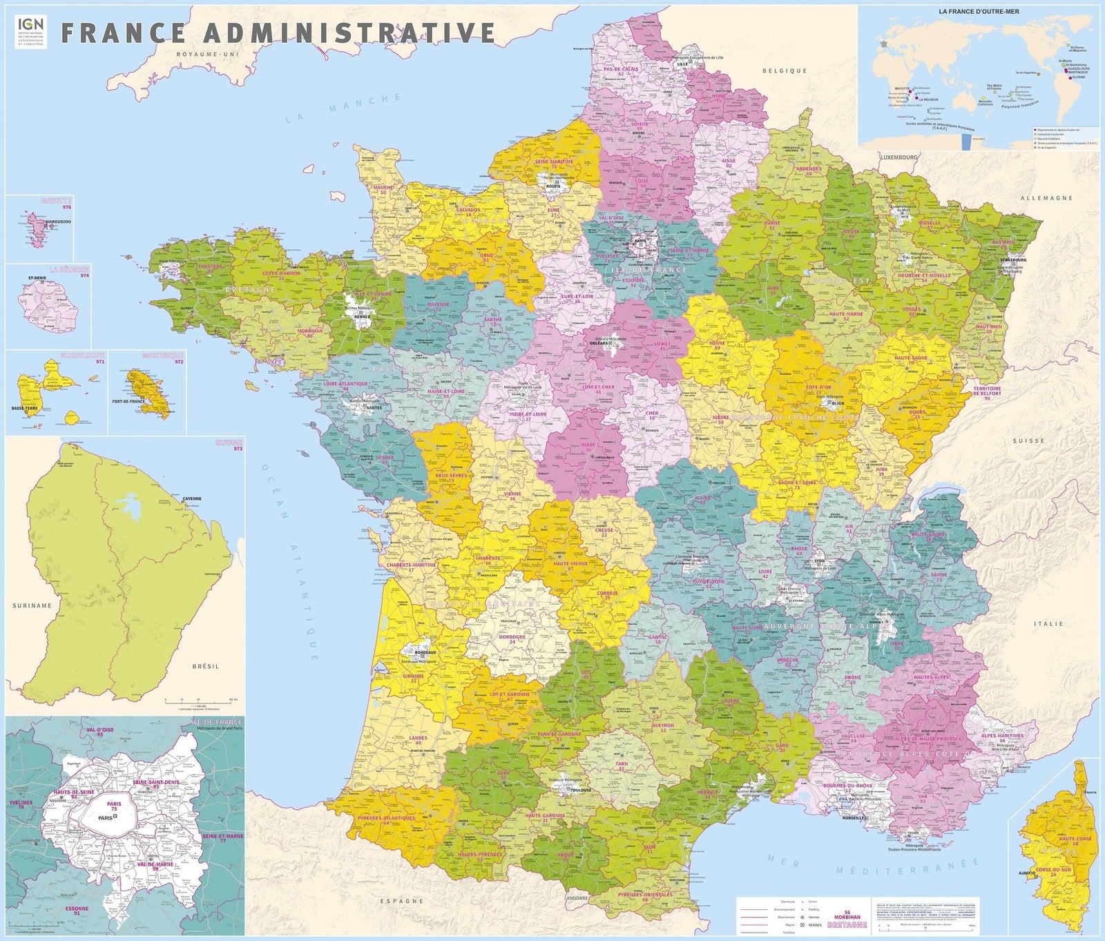
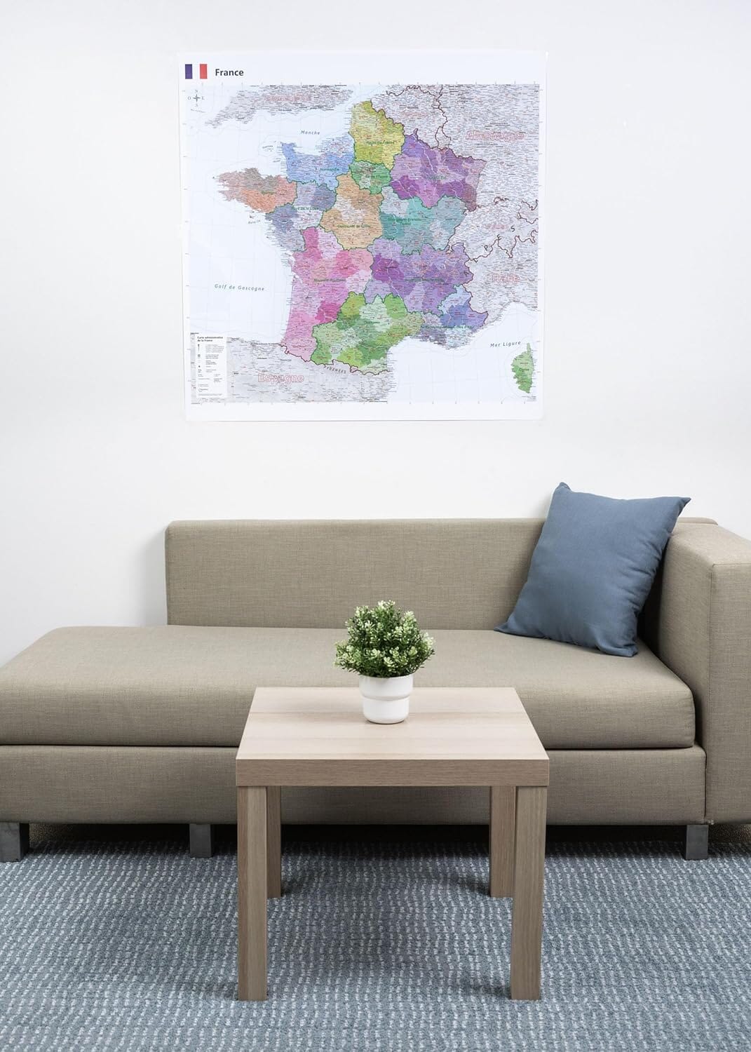
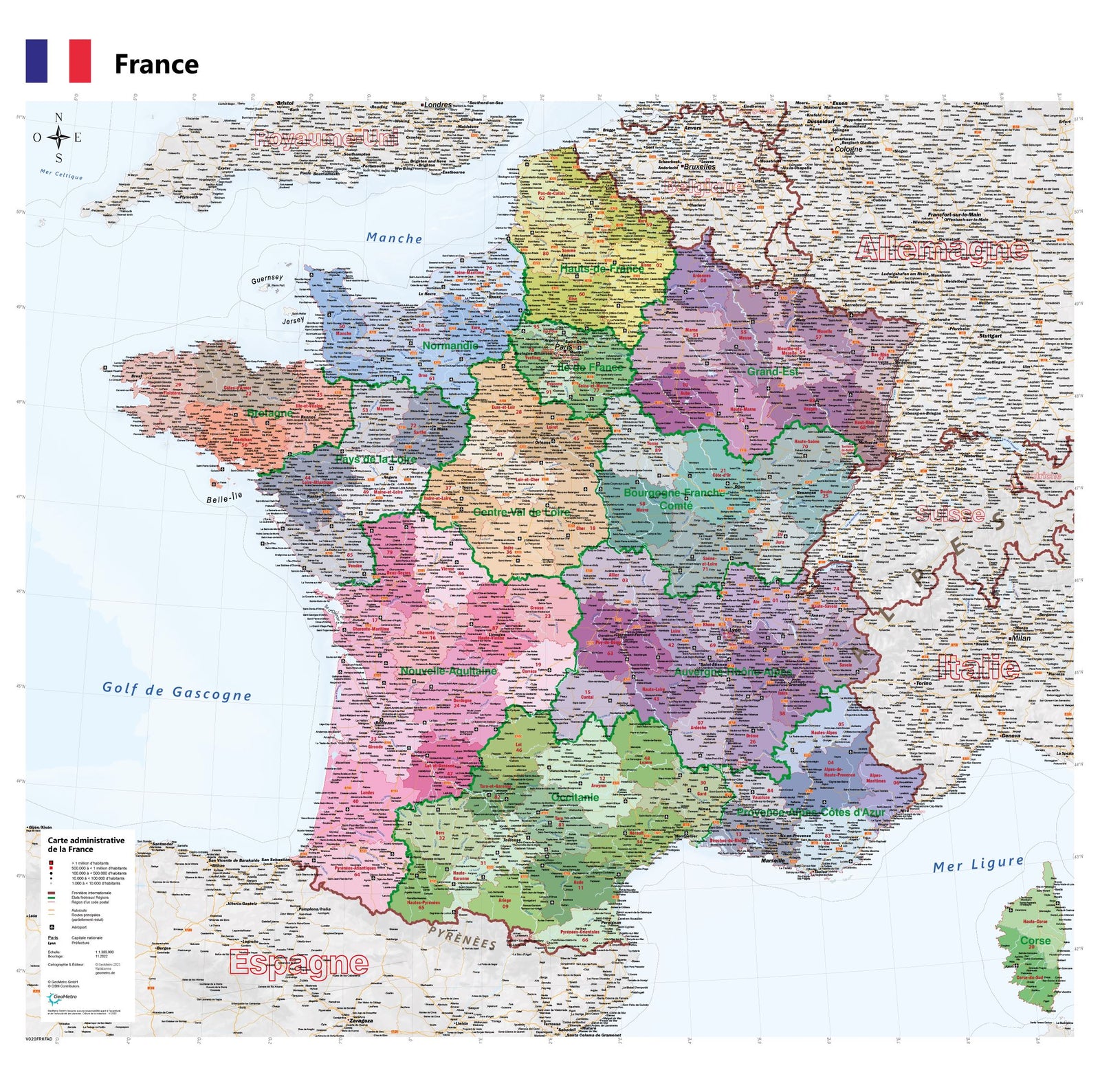
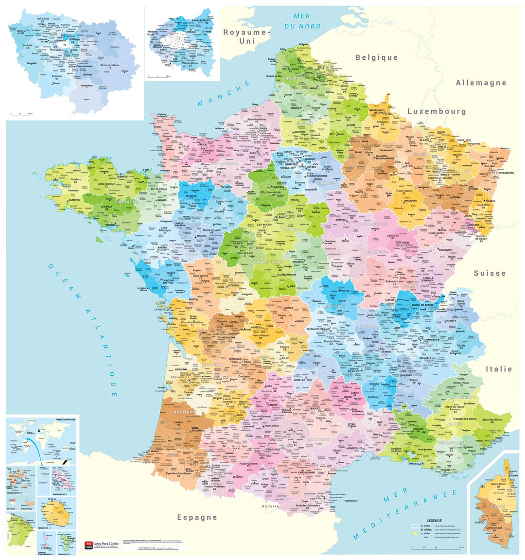
Laminated wall map - Administrative France (90 x 96 cm) | Blay Foldex
- Printed on demand - Shipping within France only
- Shipping method and fees are shown at checkout
Over 19,500 maps 🗺️ and travel guides, hiking maps, posters, globes, and décor items in stock!
Rated Excellent ⭐️ on Trustpilot — 9,000+ reviews from explorers and map lovers worldwide.
Explore the world, one map at a time 🗺️
This matte-laminated administrative map offers a clear and detailed view of France. Thanks to a carefully selected range of colors, regions, departments, and cantonal cities are easily distinguished for better visual understanding. The map is designed to be both aesthetically pleasing and functional, making it ideal for professional or personal use.
Regional boundaries and capitals
Department boundaries and prefectures
District boundaries and capitals
Limits and capitals of canton-city
Name of the canton-city, when it differs from its central office
Date de publication : 2021
Impression: front
Dimensions déplié(e) : 90 x 96 cm
Langue : French
The exclusive newsletter for travel and discovery enthusiasts!