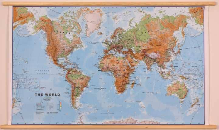
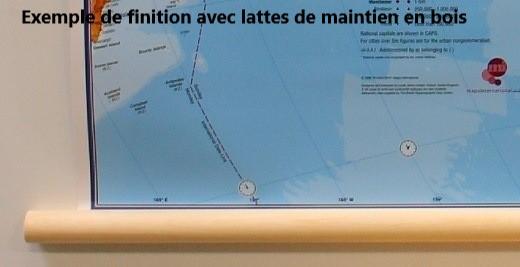
Laminated Wall Map with Wooden Slats - Physical World (in English) - 1/30M (136 x 84 cm) | Maps International

Price
Regular price 16495 €
Regular price Sale price 16495 €
/
  • Custom-made product - Shipping within mainland France, Belgium, Germany, Luxembourg, and the Netherlands within 7 to 10 business days from our workshop. Other countries: please contact us for a quote
  • Shipping method and fees are shown at checkout
Tax included.

Often purchased together:

Laminated wall map of the physical world (in English). It is equipped with wooden support slats for easy hanging on a wall (in a classroom, for example).

The dimensions of the wall map are: 136 x 84 cm.

Please note:Additional manufacturing time is to be expected (approximately one week).

As this product is custom-made at the request of our customers, it cannot be returned.

The physical relief is successfully combined with rivers and country names. Borders are clearly displayed.
A blurring effect shows the mountain in an almost 3D effect. A symbol identifies the highest mountain on continents and in different countries.
Country names and boundaries are clearly indicated. Symbols indicate capital cities as well as state or provincial capitals (where possible). Within the United States, Canada, Brazil, and Australia, internal state or provincial boundaries are indicated.
The variation in ocean depth is indicated by several shades of color. The mid-Pacific, from Alaska/Siberia to New Zealand, is shown on both ends of the map for a better representation of this region.
The projection used is the Van der Grinten projection.


    ISBN / EAN : 9781910378090B
    Date de publication : 2023
    Echelle : 1/30,000,000 (1cm=300km)
    Impression: front
    Dimensions déplié(e) : 136 x 84cm
    Langue : English
    Poids : 400 g