Tourist map - Cinque Terre (Liguria, Italy) | Touring Club Italiano
- Shipping within 24 working hours from our warehouse in France
- Shipping method and fees are shown at checkout
- Free returns (*)
- Real-time stock levels
- In stock, ready to ship
Plus de 19 500 cartes 🗺️ et guides de voyage, cartes de randonnée, posters, globes, déco en stock !
La Compagnie des Cartes devient Cartovia ✨ Notée Excellent ⭐️ sur Trustpilot (9 000+ avis).
Livraison gratuite pour toute commande > 50 € (cartes pliées et guides, France métropolitaine)
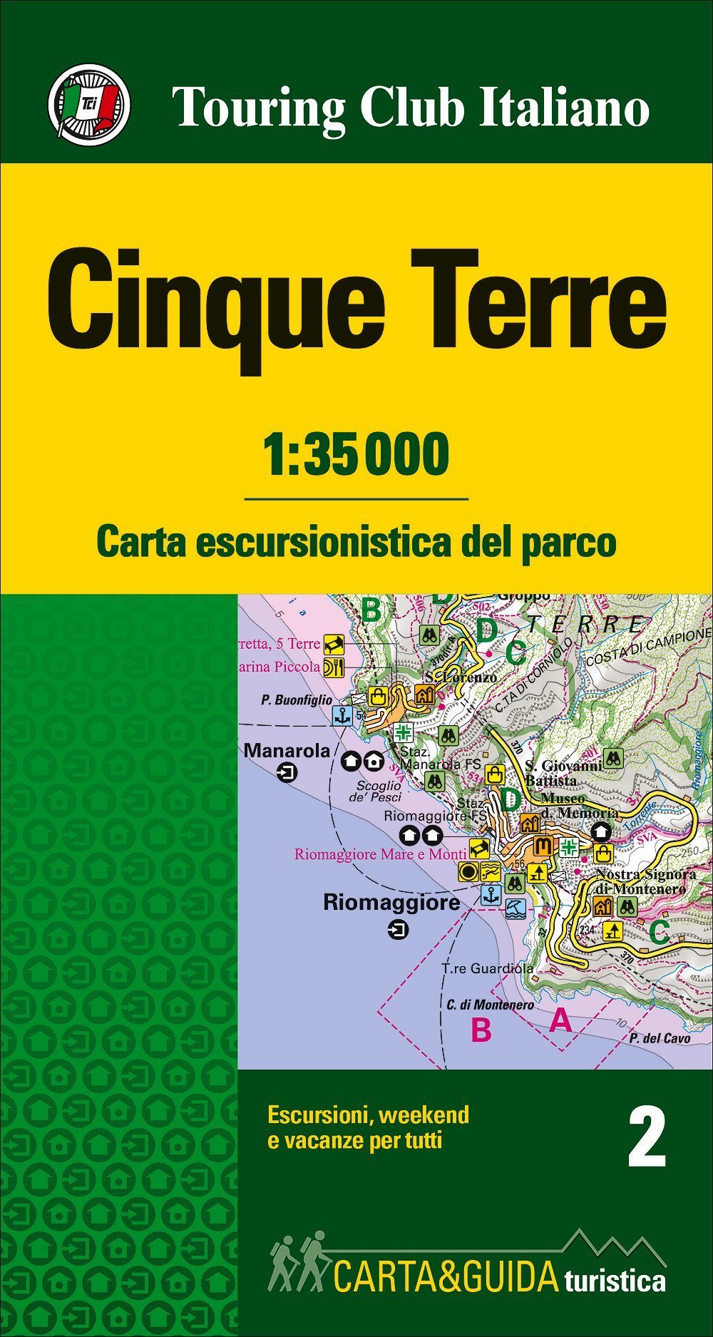
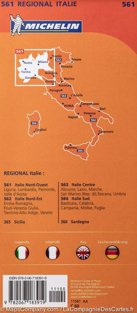
1: 35,000 scale hiking map (1 cm = 350 m) and guide of the Cinque Terre Park. p>
The map contains:
- Road networks, motorway, railway and navigation, useful for accessing park entries
- Hiking trails numbered
- 4 Routes chosen by Touring > - The panoramic points, animal observation points, forests, nature reserves and marinas, botanical gardens
- Points of cultural interest such as museums, churches, castles, Monuments, ruins, UNESCO sites
- Directions for sportsmen: Golf courses, equestrian centers, rafting, adventure parks, cross - country ski trails, rocky walls
- For those who like the Sea: Beach type (sand, rock), most important beaches, marina
- service information: infoPoint, pharmacies, car parks, campsites, where to sleep and where to eat, tourist airports, equipment rental .
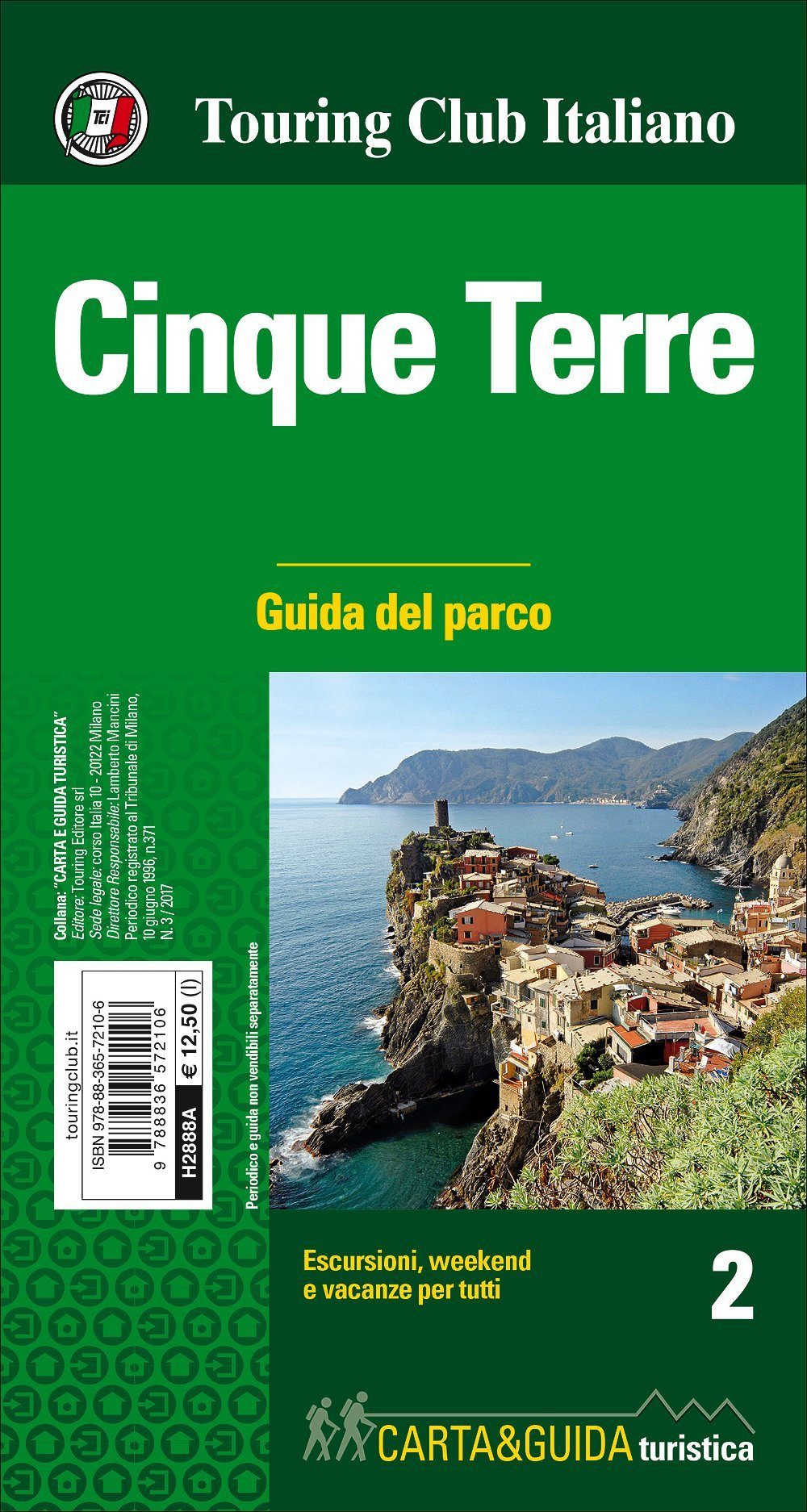
The guide contains:
- an introduction to the park with information on flora, fauna, geolog IE, geography and local products
- The Park ID map with the reporting of useful numbers and visits centers
- a detailed description of the 4 routes shown on the map with the plan. p>
ISBN/EAN : 9788836572106
Publication date: 2017
Scale: 1/35,000 (1cm=350m)
Printed sides: front
Folded dimensions: 23 x 12cm
Unfolded dimensions: 84 x 90cm
Language(s): Italian
Weight:
47 g
La carte très complète couvre tout le littoral de Levanto à la Spezia. Elle est utile pour avoir une vision globale des itinéraires de randonnées possibles. Cependant, son échelle au 1/35 000 ne fournit pas suffisamment de détails pour l'exploiter en randonnée.
Conforme à mon attente.
Bonjour,
Est-ce que Corniglia est sur la carte ?
les textes sont ils écrits en français svp ?
Merci
Les textes sur la carte elle-même sont en italien.
parfait
L'infolettre exclusive des passionnés de voyage et de découverte !