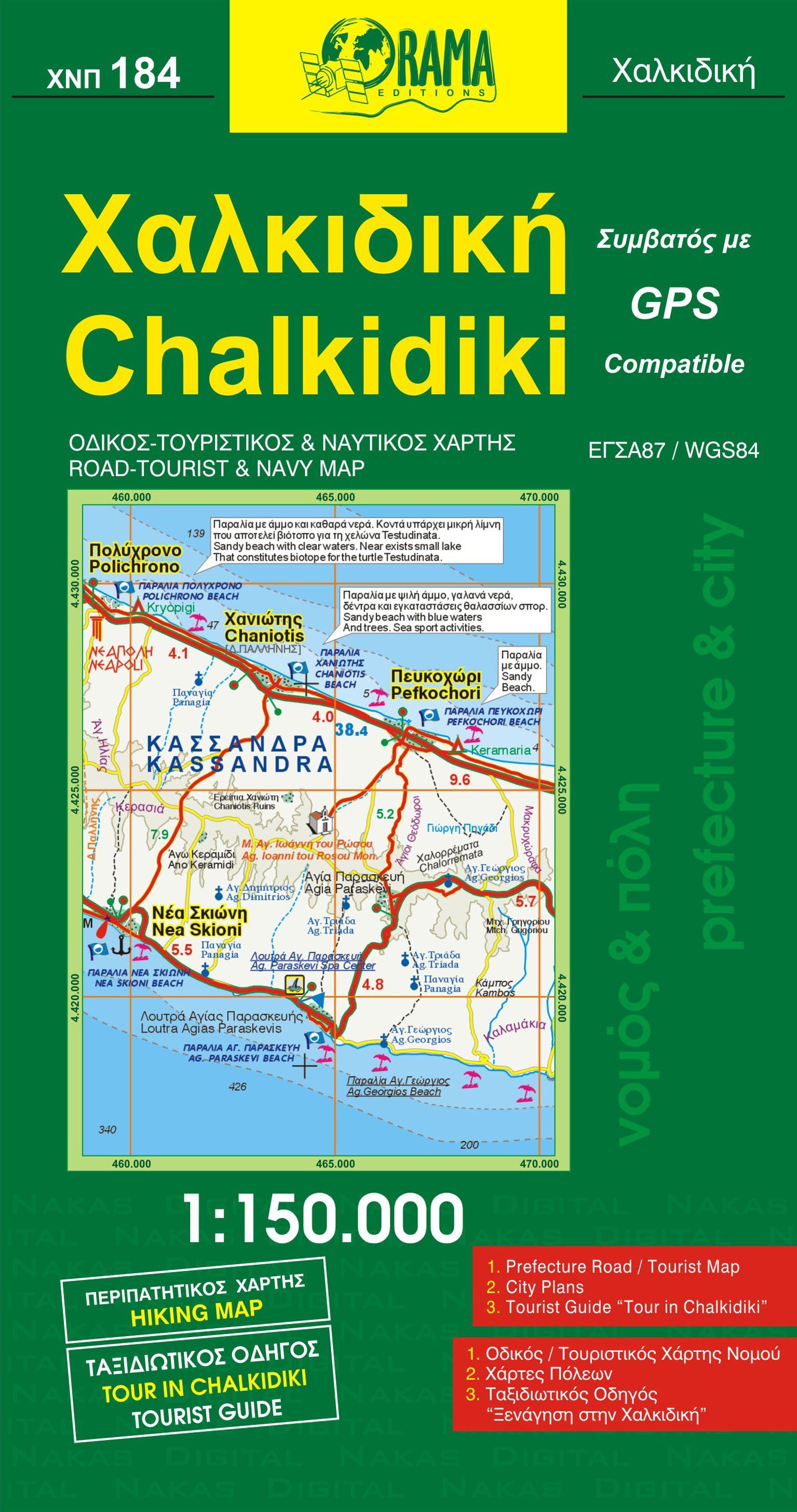
Road Map - Halkidiki, Thassos & Mount Olympus (Greece) | Freytag & Berndt
Regular price
1290 €
Regular price
Sale price
1290 €
/
- Shipping within 24 working hours from our warehouse in France
- Choose your delivery method and cost at checkout, before confirming your order.
- Free returns (*)
- Real-time inventory
- In stock, ready to ship