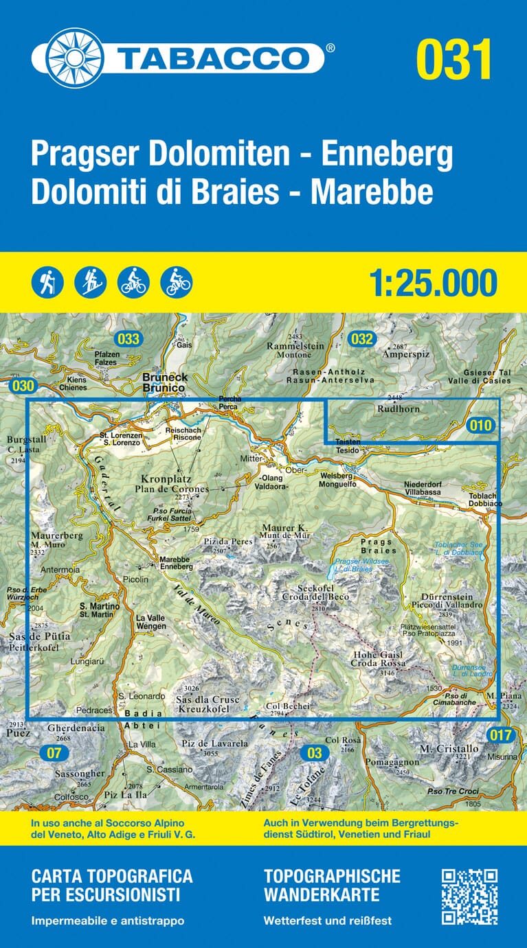
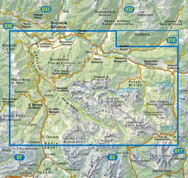
Hiking map No. 627 - Villnösstal / Val di Funes (South Tyrol) | Kompass
- Shipping within 24 working hours from our warehouse in France
- Shipping method and fees are shown at checkout
- Free returns (*)
- Real-time stock levels
- In stock, ready to ship
Plus de 19 500 cartes 🗺️ et guides de voyage, cartes de randonnée, posters, globes, déco en stock !
La Compagnie des Cartes devient Cartovia ✨ Notée Excellent ⭐️ sur Trustpilot (9 000+ avis).
Livraison gratuite pour toute commande > 50 € (cartes pliées et guides, France métropolitaine)
Waterproof hiking map No. 627 of the Villnösstal / Val di Funes region (Italy) published by Kompass.
Kompass maps contain everything outdoor enthusiasts need to know.
These highly detailed maps show the topography of the terrain, indicate hiking trails with marks according to difficulty level, contour lines and corresponding vegetation types as well as comprehensive tourist information.
Symbols indicate campsites, youth hostels, mountain huts, selected hotels and remote inns, sports and recreational facilities, and a wide range of other places of interest.
The legend is multilingual.
ISBN/EAN : 9783991541950
Publication date: 2025
Scale: 1/25,000 (1cm=250m)
Folded dimensions: 11 x 19cm
Language(s): multilingual
Weight:
114 g
L'infolettre exclusive des passionnés de voyage et de découverte !