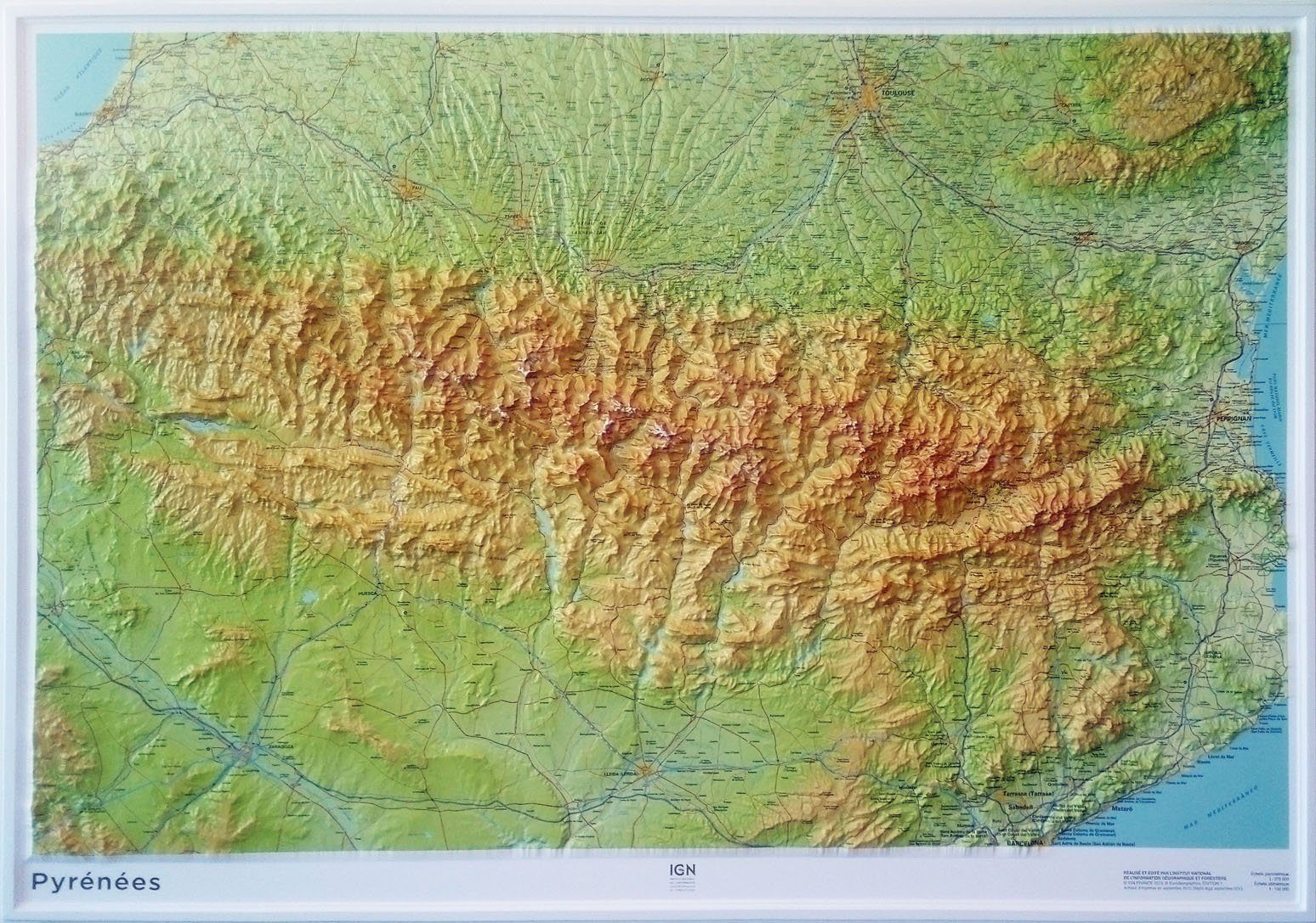
Hiking map No. 9 - Cathar Trail (Eastern Pyrenees) | Rando Editions (French)
- Shipping within 24 working hours from our warehouse in France
- Shipping method and fees are shown at checkout
- Free returns (*)
- Real-time stock levels
- In stock, ready to ship
Over 19,500 maps 🗺️ and travel guides, hiking maps, posters, globes, and décor items in stock!
Rated Excellent ⭐️ on Trustpilot — 9,000+ reviews from explorers and map lovers worldwide.
Explore the world, one map at a time 🗺️
Detailed topographic map of the Cathar trail. Pyrenees Hiking map No. 9, published by Rando Editions, which covers the entire Cathar Castles, the Mediterranean Sea to Foix. P>
Indication of the Cathar trail (Quéribus, Peyrepertuse, Montségur, Puylaurens), campsites and other points of tourist interest. p>
Hiking map with level curves and useful information to mountain practice. p>
1/50 000 scale (1 cm = 500 m). p>
ISBN/EAN : 9782344013397
Publication date: 2016
Scale: 1/50,000 (1cm=500m)
Printed sides: front
Folded dimensions: 22.5 x 11 x 0.5cm
Unfolded dimensions: 133 x 100cm
Language(s): French English
Weight:
90 g
love the fact that I can see a broader picture, rather than just a snippet like on the GPS
découpage adapté au trajet
Très bien
The exclusive newsletter for travel and discovery enthusiasts!