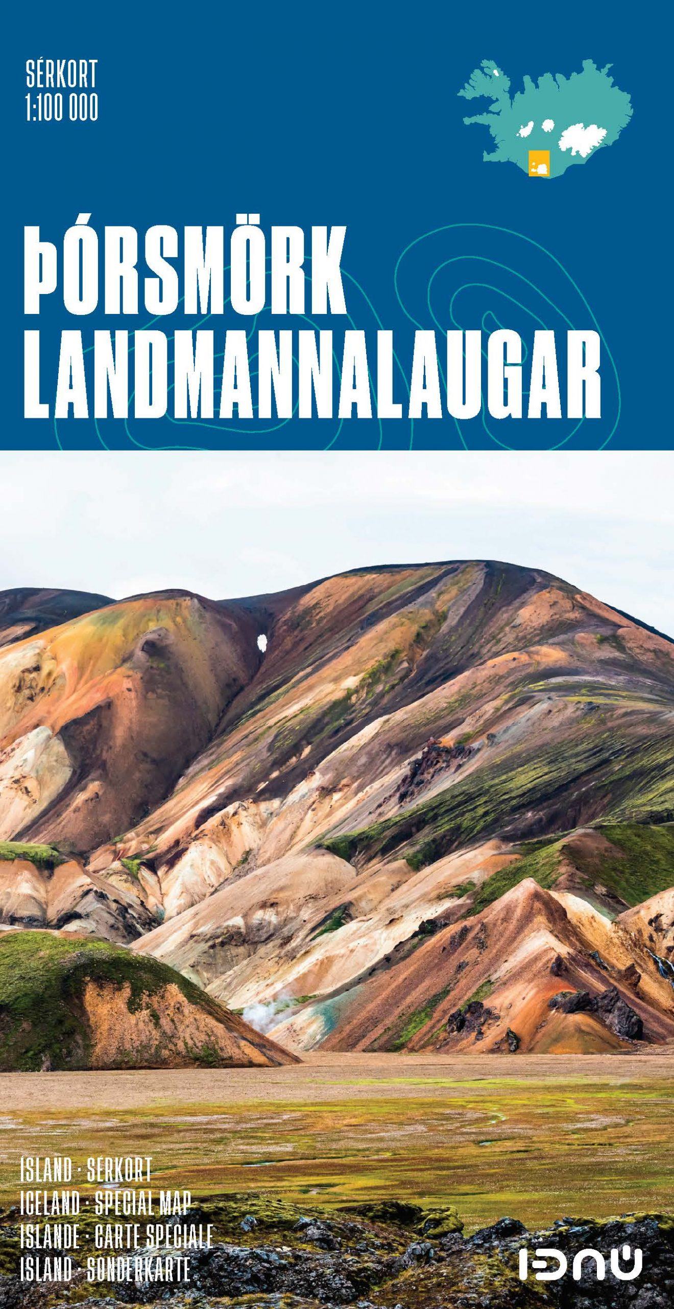
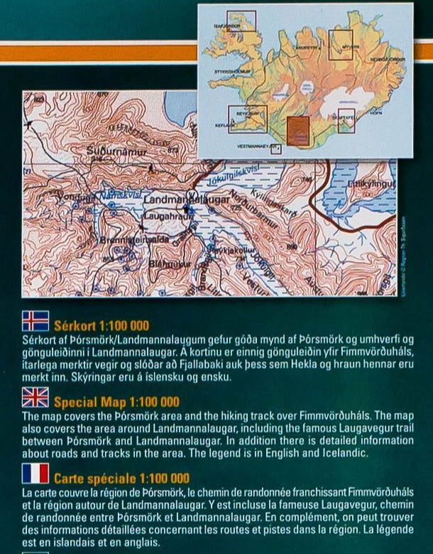
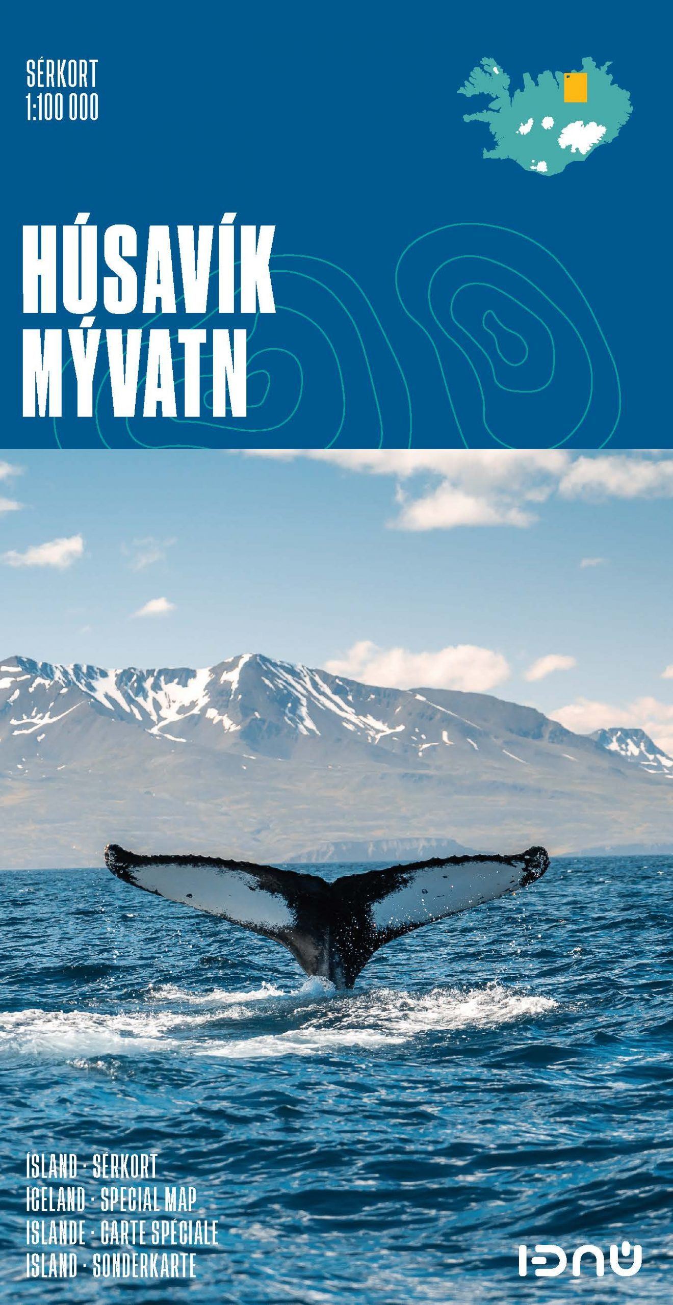
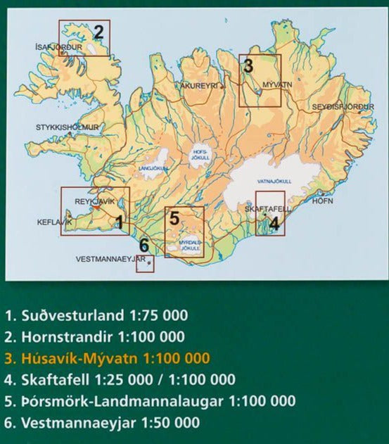
Detailed map - Thorsmork & Landmannaugar (Iceland) | Ferdakort
- Free returns (*)
- Real-time stock levels
-
Cartovia Guarantee – Delivery issue?
We resend immediately upon receiving a simple photo.
📦 Hard-to-find maps - worldwide shipping
📦 Hard-to-find maps & travel guides - worldwide shipping, 30-day returns
🌞 Summer travel: 20,000+ maps in stock
🌞 Plan your summer: 20,000+ maps and travel guides in stock Details →
✅ Latest editions guaranteed — since 2010
✅ Latest editions guaranteed - 180,000+ travellers equipped since 2010
Topographic map of Thorsmork span> and Landmannaugar published by Ferdakort (Serkort series). This map covers the area around Porsmörk and Landmannaugar and includes the famous Laugavegur, a hiking trail between these two cities. Also information on the roads and tracks of the region. P>
This detailed map of Iceland is protected by a laminated case. p>
ISBN/EAN
: 9789979675112
Publication date: 2021
Scale: 1/100,000 (1cm=1km)
Printed sides: front
Folded dimensions: 23.2 x 12.8cm
Unfolded dimensions: 84 x 62cm
Language(s): French, English, German, Icelandic
Weight:
73 g
Belle carte plastifiée précise
échelle 1/50000 à conseiller pour le trek Landmannalaugar/Skogar
The exclusive newsletter for travel and discovery enthusiasts!