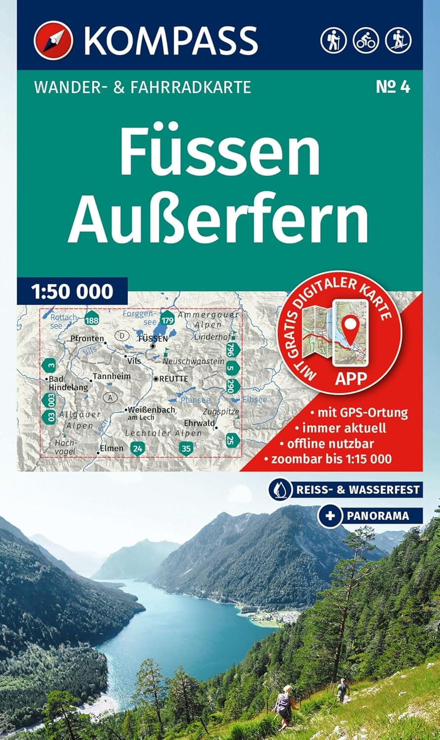
Hiking map no. WK231 - Mittelkärnten - Gurlktaler Alpen - Friesach - Feldkirchen (Austrian Alps)| Freytag & Berndt

Price
Regular price CHF 1300
Regular price Sale price CHF 1300
/
  • Ships within 48 business hours from our US warehouse. Customs charges may apply for deliveries outside the United States
  • Free returns (*)
  • Real-time inventory
  • Cartovia Guarantee – Delivery issue?
    We resend immediately upon receiving a simple photo.
  • Low stock - 2 items left
  • Backordered, shipping soon
Tax included.

Often purchased together:

The Mittelkärnten (Central Carinthia) hiking, cycling and leisure map is the perfect companion for exploring this diverse region of Austria. Ideal for hikers, cyclists, mountain bikers and outdoor enthusiasts, it helps you plan your routes and discover key sights and viewpoints along the way.

With a detailed 1:50,000 scale, the map clearly shows hiking trails, long-distance routes, cycle paths, mountain bike tours, and horse-riding trails. It also includes essential tourist information and offers full GPS compatibility, making it a reliable and practical tool for any adventure.

Its large 82 × 96.3 cm double-sided format provides a comprehensive overview of the region while remaining foldable and easy to carry.


Features:

  • Scale 1:50,000

  • Hiking and long-distance trails

  • Cycling routes & MTB tours

  • Horse-riding trails

  • Tourist information

  • GPS compatible

  • Double-sided map, approx. 82 × 96.3 cm


ISBN/EAN : 9783707920826
Publication date: 2025
Scale: 1/50,000 (1 cm = 500 m)
Folded dimensions: 20.5 x 12.5cm
Unfolded dimensions: 82 x 96 cm
Language(s): German English
Weight: 100 g