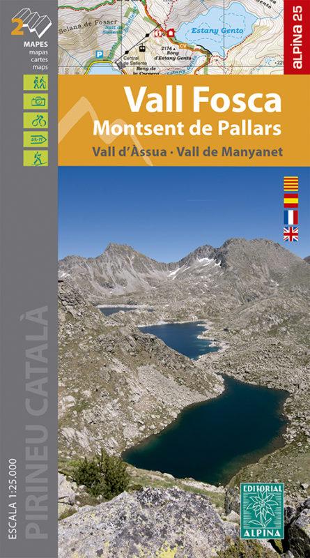
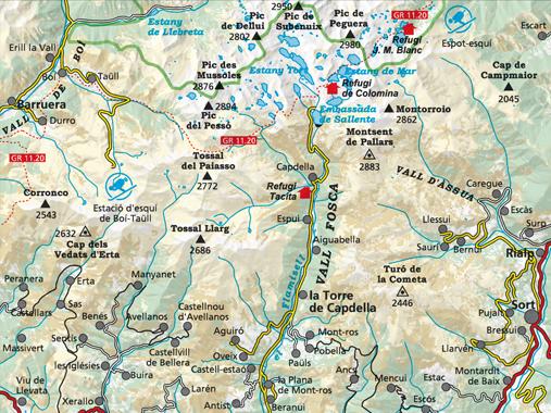
Set of 2 hiking maps - Vall Fosca, Monstent de Pallars, Vall Assua (Catalan Pyrenees) | Alpina

Price
Regular price CHF 1600
Regular price Sale price CHF 1600
/
  • Ships within 24 business hours from our warehouse in France
  • Free returns (*)
  • Real-time stock levels
  • Cartovia Guarantee – Delivery issue?
    We resend immediately upon receiving a simple photo.
  • Low stock - 2 items left
  • Backordered, shipping soon
Tax included.

Frequently bought together:

Topographic maps with information of interest for hikers: shelters, marked trails (GR, PR, local trails), mountain trails, etc.

Map sector: Catalan Pyrenees. Vall Fosca, Vall de Manyanet and Vall Assua. Southern sector of Aigüestorte National Park.

  • Refuges information kept, campsites, tourist offices
  • space curves spaced 10 m
  • Curves of main levels of 50 m
  • Shaded Relief
  • GPS compatible
  • Trail indication.


ISBN/EAN : 9788480908344
Publication date: 2021
Scale: 1/25,000 (1cm=250m)
Printed sides: front
Folded dimensions: 21 x 12.5cm
Unfolded dimensions: 98 x 68cm
Language(s): French, English, Castilian, Catalan
Weight: 170 g