Hiking map No. 14 - Sierra de Guara: Sierra and Canyons of Guara Natural Park | Rando Editions

Price
Regular price CHF 1400
Regular price Sale price CHF 1400
/
  • Shipped within 24 to 48h from our warehouse in France
  • Customs duties may apply on import to your country
  • Free returns (*)
  • Real-time stock levels
  • Cartovia Guarantee – Delivery issue?
    We resend immediately upon receiving a simple photo.
  • In stock, ready to ship
  • Backordered, shipping soon
Tax included.

Frequently bought together:

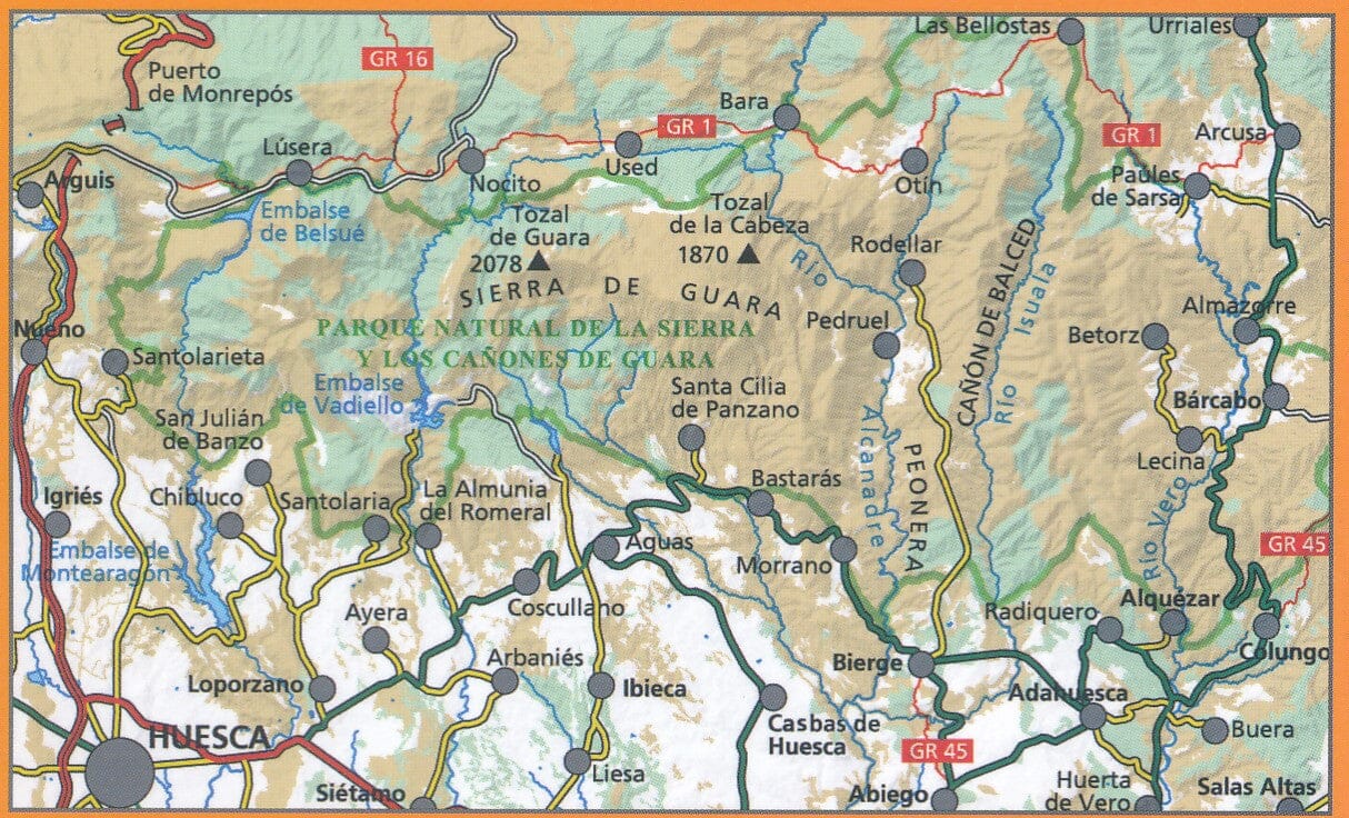
The detailed Sierra de Guara topographic map, No. 14 by Rando Editions, covers the entire massif: Sobrarbe, Somontano and Hoya de Huesca. It includes a detailed legend.

The coverage makes road access easier from Sabinanigo and Monrepos Pass, as well as Ainsa, in the north, and from Huesca and Abiego in the south. The A23 to the west and the A138 to the east are shown.

The map provides information on outdoor activity routes:

  • Canyoning: main parking areas, access points and exits for the Guatizalema, Formiga, Alcanadre, Mascun, Balces-Isuala and Vero rivers, among others.
  • Mountain biking: waymarked routes in Zona Zero around Ainsa (Sobrarbe) to the north and Hoya de Huesca to the south.
  • Hiking: waymarked routes and/or routes of particular interest, for day walks or multi-day hikes, including the GR-1 and GR-45.

The new multi-stage routes are also marked:

  • Camino Natural de la Hoya de Huesca: Arguis - Nocito - Vadiello - Bierge.
  • Camino Natural del Somontano: Bierge - Rodellar - Alquézar.
  • Camino de San Urbes: a newly waymarked GR route linking Huesca to the San Urbes hermitage in the Ordesa - Monte Perdido massif.


ISBN/EAN : 9782344041222
Publication date: 2020
Scale: 1/50,000 (1cm=500m)
Printed sides: front
Folded dimensions: 22.5 x 11 x 0.5cm
Unfolded dimensions: 131 x 90cm
Language(s): French English
Weight: 80 g