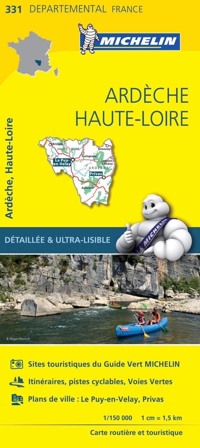
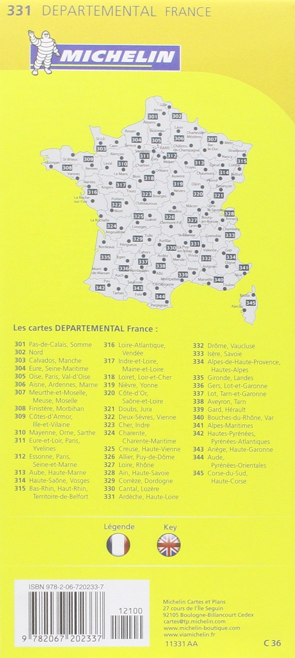
IGN TOP 25 hiking map no. 2939 OTR (resistant) - Ardèche Gorges, Bourg-Saint-Andéol, Vallon-Pont-d'Arc

Price
Regular price CHF 1700
Regular price Sale price CHF 1700
/
  • Ships within 24 business hours from our warehouse in France
  • Free returns (*)
  • Real-time stock levels
  • Cartovia Guarantee – Delivery issue?
    We resend immediately upon receiving a simple photo.
  • In stock, ready to ship
  • Backordered, shipping soon
Tax included.

Frequently bought together:

TOP 25 hiking map no. 2843OTR of the Ardèche Gorges, Bourg-Saint-Andéol and Vallon-Pont-d'Arc published by the IGN.

Topographic map with 10-meter contour intervals and a detailed legend (vegetation, rocks, watercourses, etc.). Hiking trails are marked. Scale 1:25,000 (1 cm = 250 m). GPS compatible.

– This map is printed on a tear-resistant, laminated material , ideal for outdoor activities.

– Double-sided card: reduced bulk which facilitates handling.

Municipalities covered: Laval-Saint-Roman, Saint-Julien-de-Peyrolas, Saint-Marcel-d'Ardèche, Saint-Just-d'Ardèche, Le Garn, Saint-Privat-de-Champclos, Bourg-Saint-Andéol, Ruoms, Pradons, Vagnas, Larnas, Lagorce, Gras, Saint-Remèze, Sampzon, Vallon-Pont-d'Arc, Bidon, Salavas

Places to discover: Cirque de la Madeleine, Gorges de la Sainte-Baume, Pas du Mousse, Dent de Rez, Défilés de Ruoms, Cirque de Gaud, Gorges de l'Ardèche, Plateau du Laoul, Montagne de Berg, Maladrerie des Templiers, La Madeleine, Belvédaire de Gaud, Fauniscope, Pont d'Arc, Belvédaire de la Madeleine, Saint-Polycarpe, Aven de la Forestière, Le Roure, Saint-Sulpice, Grotte Chauvet, Aven d'Orgnac


ISBN/EAN : 9782758558996
Publication date: 2026
Scale: 1/25,000 (1cm=250m)
Printed sides: both sides
Folded dimensions: 23.6 x 11.2 x 0.5cm
Unfolded dimensions: 132 x 49cm
Language(s): French, English, German
Weight: 80 g