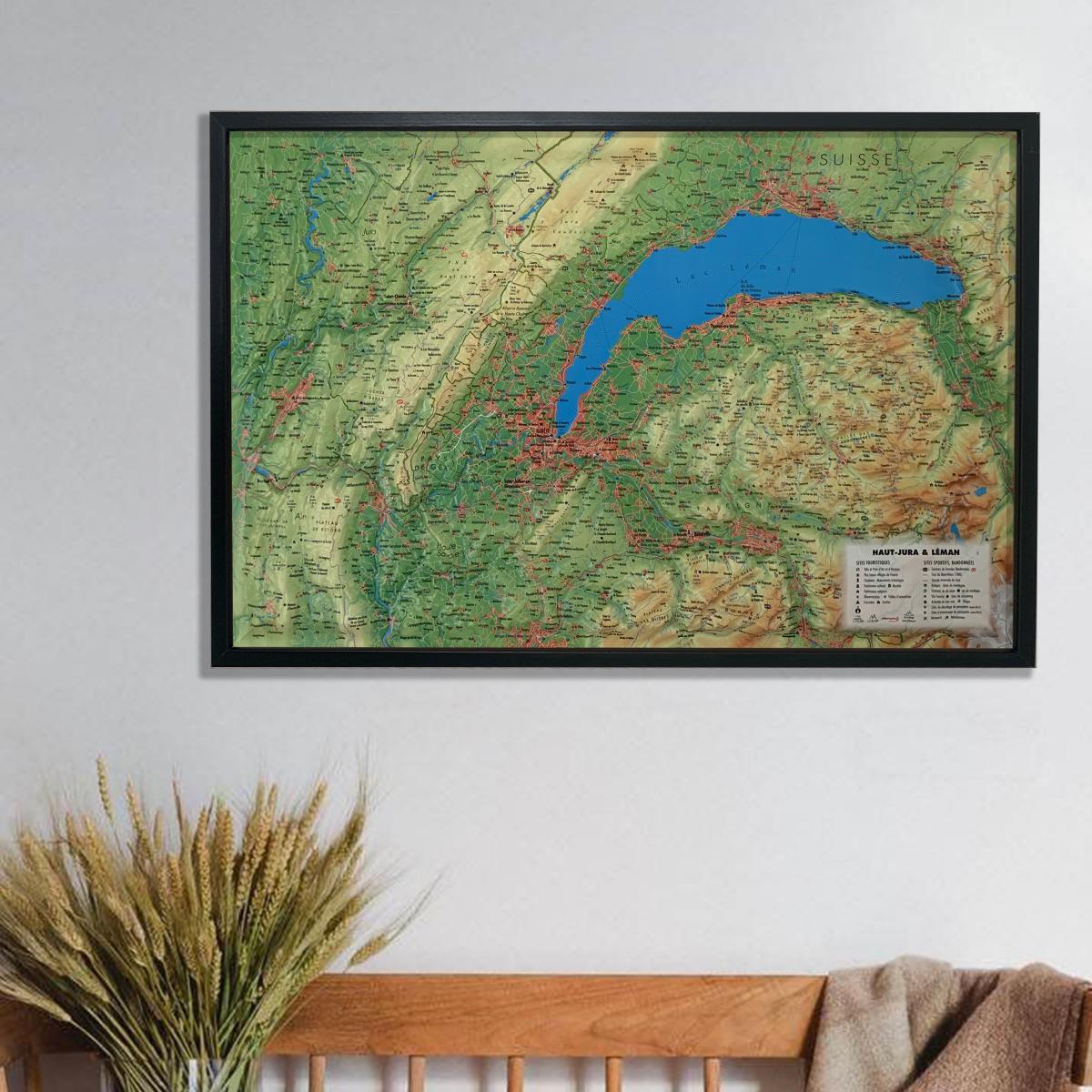
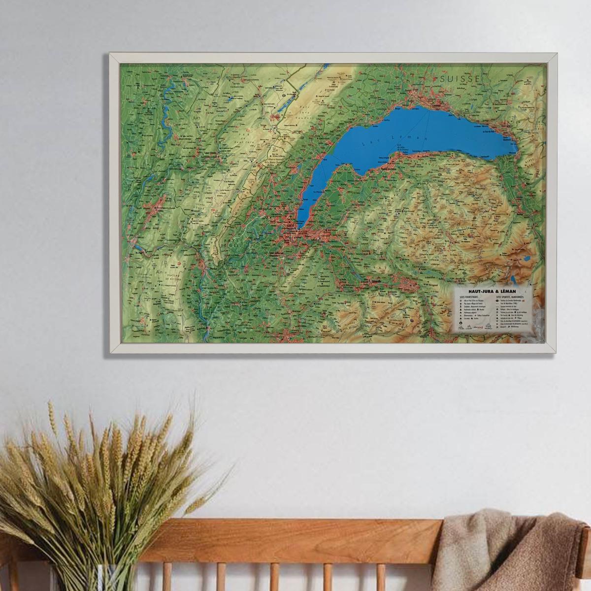
3D Raised relief map - Haut-Jura region & Lake Geneva (41 cm x 61 cm) | 3D Map (French)

Price
Regular price CHF 3800
Regular price Sale price CHF 3800
/
  • Ships within 24 business hours from our warehouse in France
  • Real-time inventory
  • Cartovia Guarantee – Delivery issue?
    We resend immediately upon receiving a simple photo.
  • Low stock - 2 items left
  • Backordered, shipping soon
Tax included.

Often purchased together:

Explore the landscapes of the Haut-Jura region and Lake Geneva with this detailed raised relief wall map, showcasing the characteristic ridges, valleys, Nordic ski areas and the scenic surroundings of Lake Geneva.

A finishing frame is available as an optional accessory; we strongly recommend it for easier hanging and an enhanced display.

General data shown on the map:

  • Hydrological, natural, hypsometric and administrative information

Touristic points of interest:

  • “Most Beautiful Villages of France”

  • Towns and Regions of Art and History

  • “Grands Sites Occitanie”

  • Cultural and religious heritage

  • Museums

  • Natural sites

  • Waterfalls

  • Prehistoric sites

  • Caves

  • Viewpoints and orientation tables

Sport and outdoor activity sites:

  • Long-distance hiking trails

  • Grande Traversée du Jura (GTJ)

  • Mountain huts and guesthouses

  • Alpine and Nordic ski resorts

  • Via ferrata routes

  • Thermal spas

  • Beaches

  • White-water activity areas

  • Paragliding sites (www.ffvl.fr)

    • Take-off and landing zones

  • Airports and aerodromes

Scale & dimensions:

  • Planimetric scale: 1:195,000

  • Altimetric scale: 1:120,000

  • Size: 61 × 41 cm

Perfect for hikers, Nordic sport enthusiasts, travellers or anyone wishing to decorate their home with a beautiful and informative map of the Haut-Jura and Lake Geneva.


ISBN / EAN : 9791097206277
Date de publication : 2020
Echelle : 1/195,000 (1 cm = 1.95 km)
Dimensions déplié(e) : 41cm x 61cm
Langue : French
Poids : 136 g