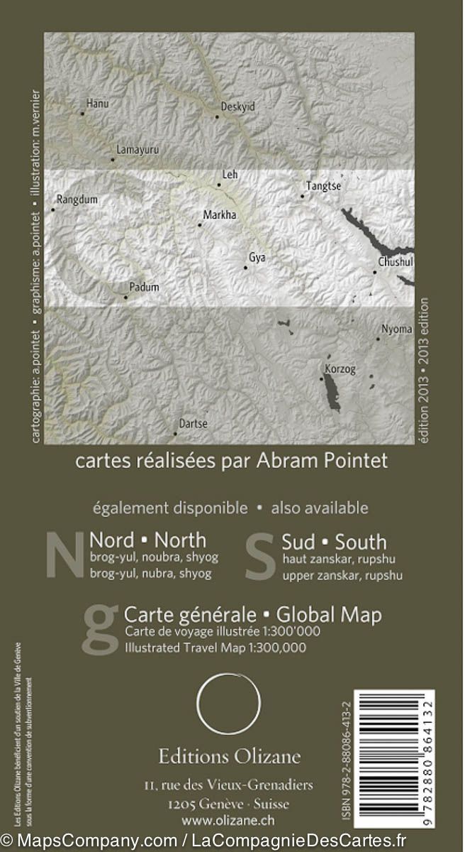
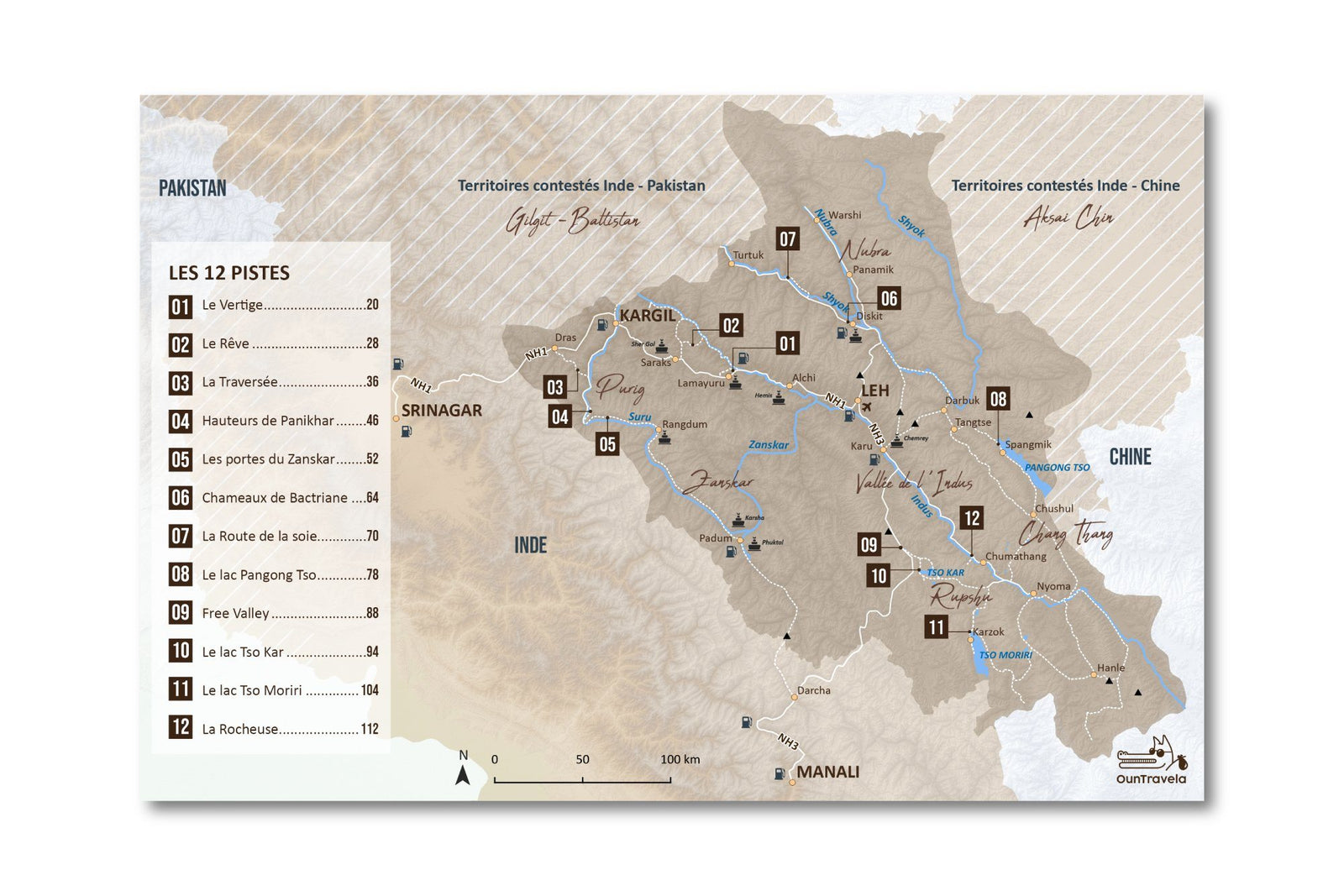
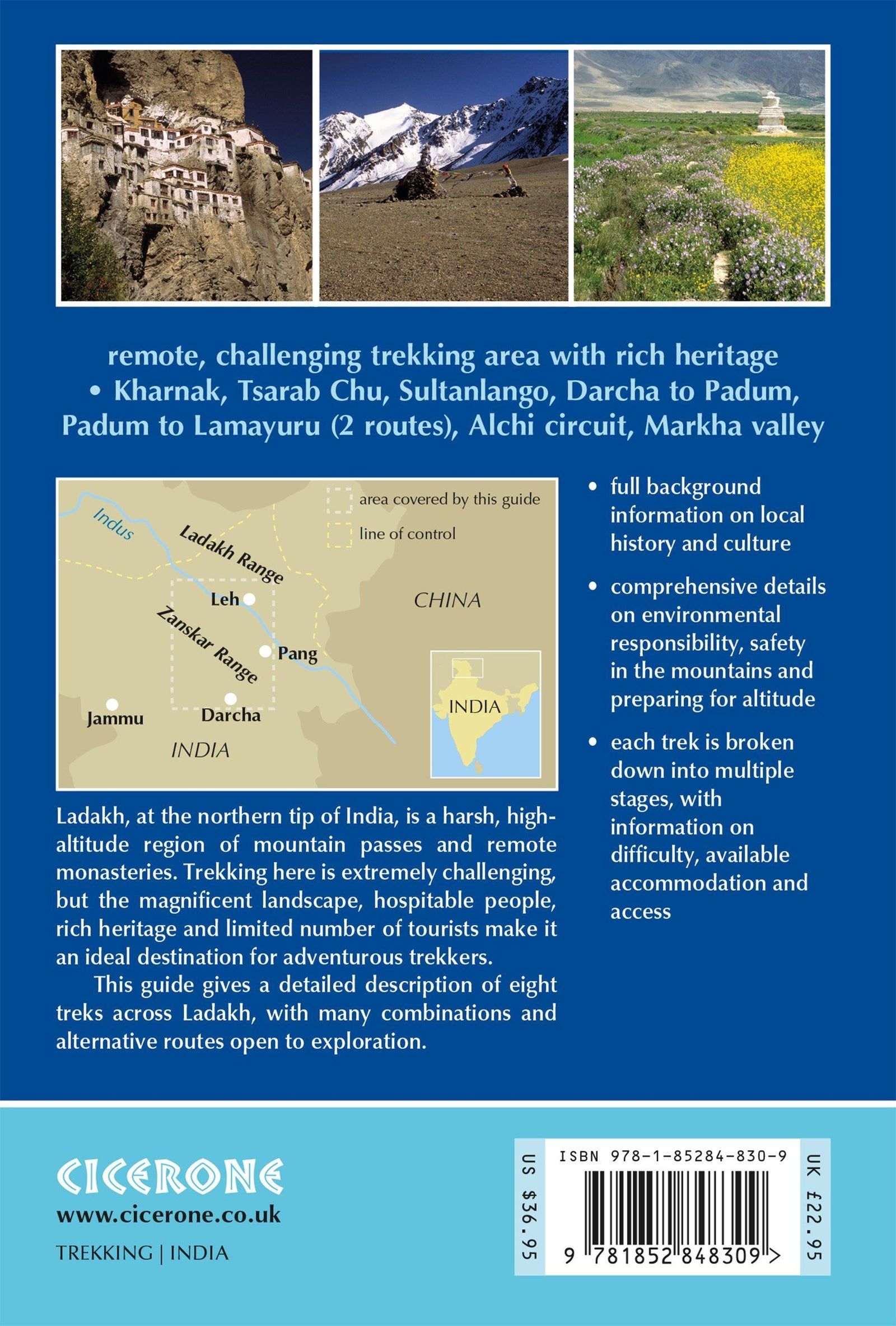
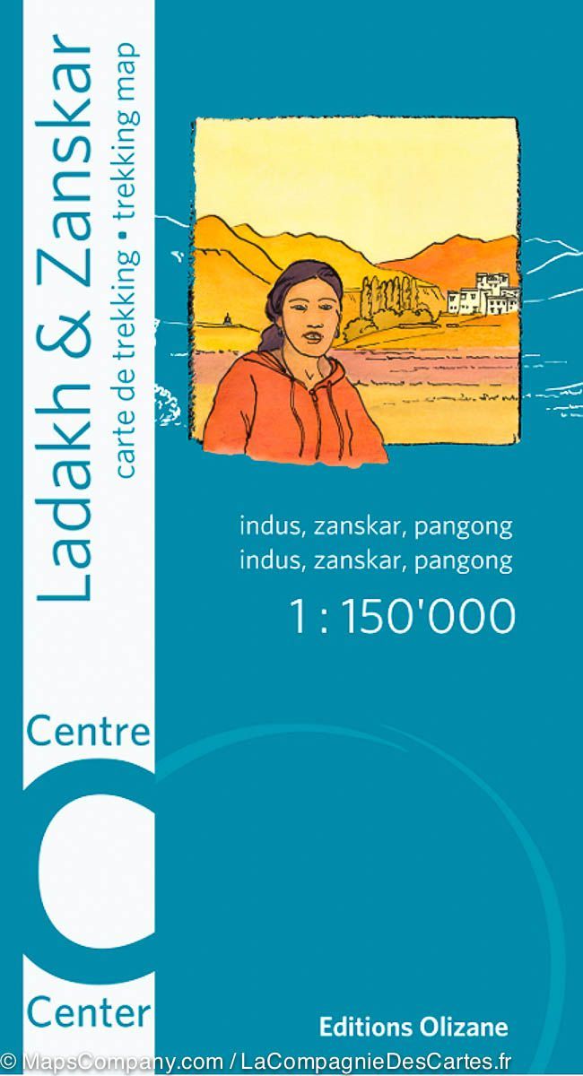
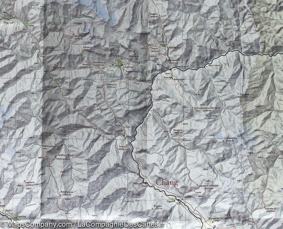
Hiking map - Center of Ladakh and Zanskar (India) | Olizane
- Shipping within 24 working hours from our warehouse in France
- Delivery costs calculated instantly in the basket
- Free returns (*)
- Real-time inventory
- In stock, ready to ship
Over 19,500 maps 🗺️ and travel guides, hiking maps, posters, globes, and decor in stock!
MapsCompany becomes Cartovia ✨ We tell you everything here 🗺️
Trusted by map lovers and explorers 🌏 in 80+ countries since 2010 ✅
ISBN/EAN : 9782880864132
Publication date: 2013
Scale: 1/150,000 (1cm=1.5km)
Printed sides: both sides
Folded dimensions: 22 x 12 x 0.5cm
Unfolded dimensions: 96 x 66cm
Language(s): French English
Weight:
59 g
La carte correspond tout à fait à l’attente.
There are a but a handful of Ladakh trekking maps. The Olizane series is the most detailed at 1;150,000 scale. There are N, Central and S maps in the series. They are essential resources given their detail. If they could reprint or reorganize this series, it would be most practical to center a map on the Leh/Indus R corridor. Similarly, organizing along a Zanskar or Nubra axis would be practical. Trips in Ladakh are along river valleys and the passes between them.....The Milestone Himalayan Series (1;175,000) has the Leh/Indus R focus but lack the topographic lines of the Olizane series. In conclusion, the 3 Olizane maps are very good because of their scale and topographic lines, but may require you to splice two maps to cover your trek or trip. For example if you travel from Leh to Alchi to Lamayaru you will need both the N and Central maps....so not perfect!
The exclusive newsletter for travel and discovery enthusiasts!