Carte sud des lignes télégraphiques militaires des Philippines de 1902 carte murale roulée (en tube) National Geographic Historic POD Default Title

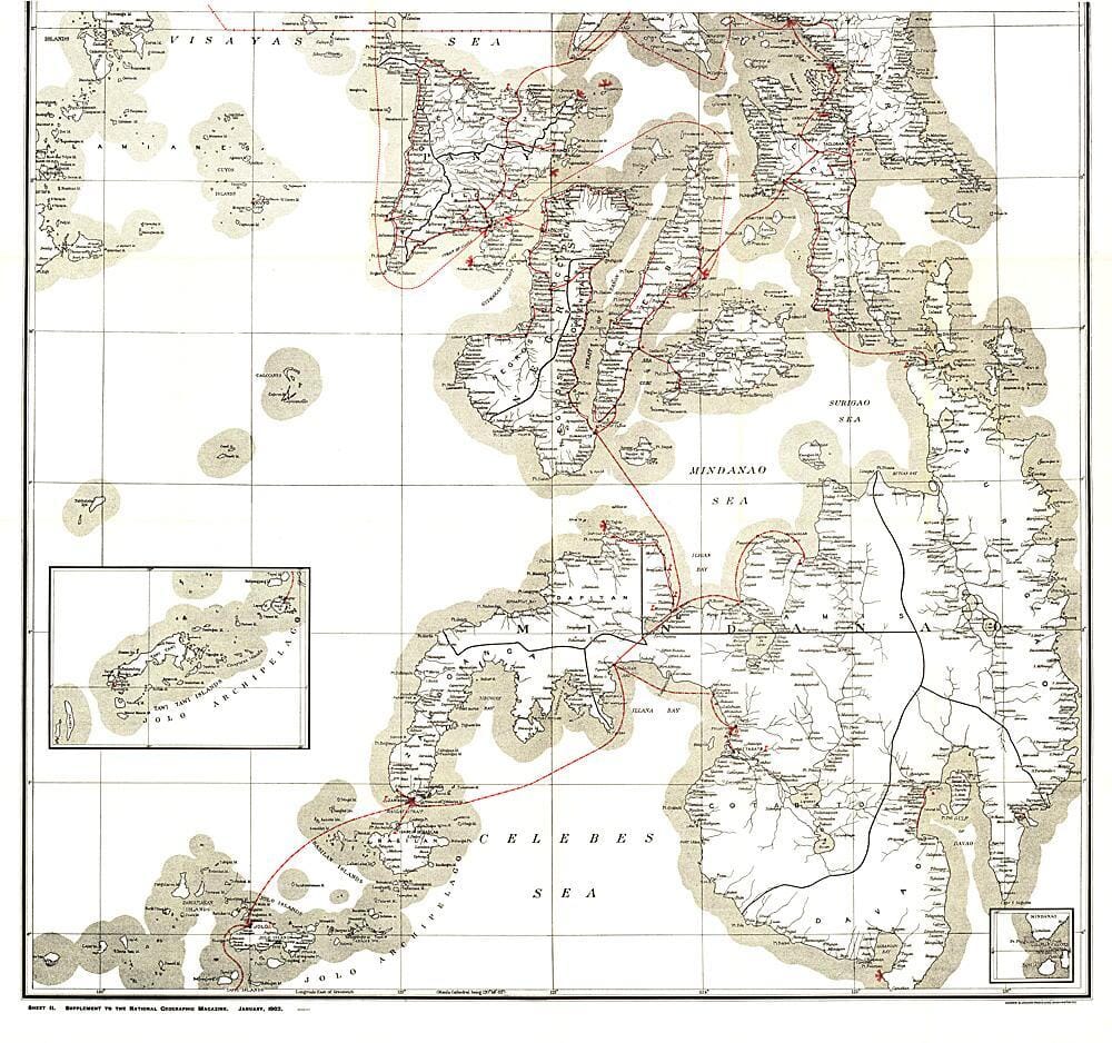
Southern map of the Philippine military telegraph lines from 1902

Price
Regular price 18300 zł
Regular price Sale price 18300 zł
Save -183 zł
/
  • Shipping within 48 business hours from our warehouse in the USA. For this product, customs fees may be requested by the carrier upon delivery.
  • Frais de livraison calculés instantanément dans le panier
  • Retours gratuits (*)
  • Stocks en temps réel
  • In stock, ready to ship
  • Backordered, shipping soon
Tax included.

Souvent achetés ensemble :

This map was produced in stunning detail as a supplement to the January 1902 National Geographic magazine, and accompanies the map of the northern Philippine Islands. Just four years earlier, the United States had purchased the rights to the territory from Spain for $20,000,000, and this magnificent map shows the entire island group, along with a detailed inset of the Manila Bay area. Anyone interested in history or the Far East will find this map an excellent addition to their map collection.


ISBN/EAN : 2321353M
Publication date: 1902
Unfolded dimensions: 36in / 33.75in
Language(s): English
Weight: 0 g

Customer Reviews

Be the first to write a review
0%
(0)
0%
(0)
0%
(0)
0%
(0)
0%
(0)