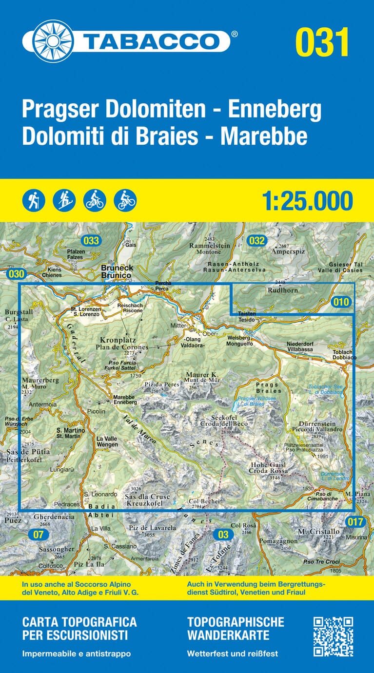
Hiking map No. 074 - South Tyrolean Wine Route (Italy) | Kompass
- Shipping within 24 working hours from our warehouse in France
- Delivery costs calculated instantly in the basket
- Free returns (*)
- Real-time inventory
Over 19,500 maps 🗺️ and travel guides, hiking maps, posters, globes, and decor in stock!
MapsCompany becomes Cartovia ✨ We tell you everything here 🗺️
Trusted by map lovers and explorers 🌏 in 80+ countries since 2010 ✅
Hiking map South Tyrolean Wine Route, Unterland / Strada del Vino, Bassa Atesina: The map for hiking, cycling and many other nature activities.
Kompass hiking maps are easy to read and yet contain all the information you need for a perfect hike, bike tour, or excursion. They depict nature at the appropriate scale. Countless additional information is constantly checked and expanded by the team of cartographers.
The precise mapping includes all official hiking trails with their names and numbers (like long-distance hiking trails), cycle paths (including trails), via ferrata, hostels and mountain huts, parking lots, buses and trains, ski tours and cross-country trails, springs, swimming spots, and much more. This makes the map ideal for discovering new destinations, planning hikes, and getting your bearings along the way.
The vegetation, the contour lines, the design of the rocks as well as the shading (cast shadow) of the mountains give an intuitive image of the landscape.
ISBN/EAN : 9783991219798
Publication date: 2025
Scale: 1/35,000 (1cm=350m)
Folded dimensions: 11 x 19cm
Language(s): English, Italian, German
Weight:
150 g
The exclusive newsletter for travel and discovery enthusiasts!