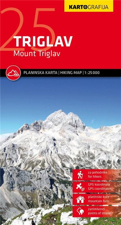
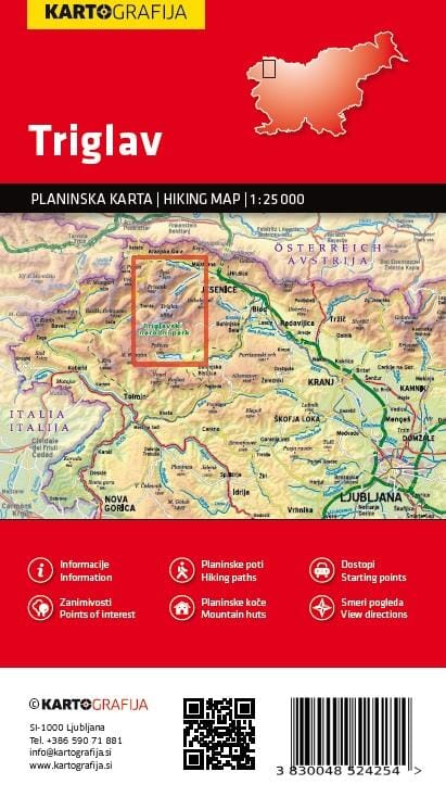
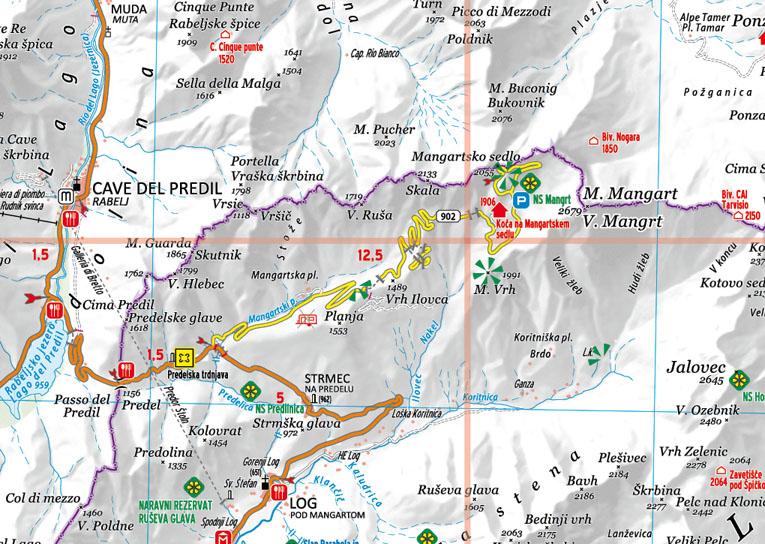
Hiking map - Mount Triglav (Slovenia) | Kartografija

Price
Regular price 1290 €
Regular price Sale price 1290 €
Save -12,90 €
/
  • Shipping within 24 working hours from our warehouse in France
  • Delivery costs calculated instantly in the basket
  • Free returns (*)
  • Real-time inventory
  • In stock, ready to ship
  • Backordered, shipping soon
Tax included.

Often purchased together:

The central part of Triglav National Park on a lightweight, waterproof and tear-resistant, contoured and GPS-compatible 1:25,000 map from Kartografija, with details of local mountain shelters with photos and QR codes.

The map is centered on the summit of Triglav and extends north to Kranjska Gora, south to Lake Bohinj, west to Trenta, and east to Bohinjska Bistrica in the southeast corner of the map. Contours at 10m intervals with shading and graphic relief, as well as numerous spot heights and excellent presentation of the topography. An overlay highlights marked hiking trails, indicating difficult sections.

32 refuges are listed on the reverse, with more symbols highlighting the locations of other tourist accommodation, hostels, climbing sites, viewpoints, interesting natural or cultural sites, etc. The road network shows parking lots and service stations.

The map has latitude and longitude lines at 1' intervals plus UTM reticles at 1 km intervals. On the reverse side, an overview map highlights eight access routes to the summit of Triglav. 25 shelters are shown with photos, coordinates, GPS coordinates, and QR codes for further information; also listed are seven other huts highlighted on the map.


ISBN/EAN : 3830048524254
Publication date: 2024
Scale: 1/25,000 (1cm=250m)
Printed sides: both sides
Folded dimensions: 12.5 x 23cm
Unfolded dimensions: 99 x 68cm
Language(s): English, Slovenian
Weight: 75 g

Customer Reviews

Be the first to write a review
0%
(0)
0%
(0)
0%
(0)
0%
(0)
0%
(0)