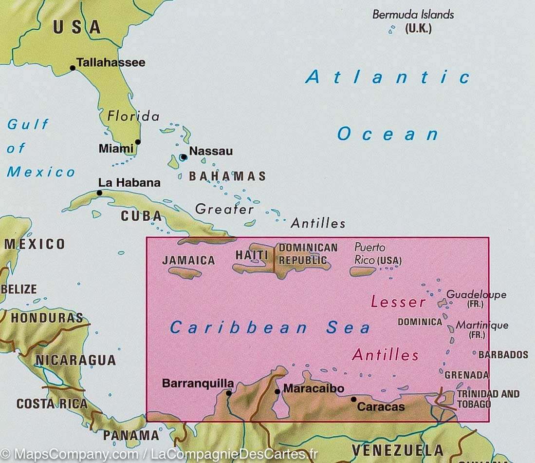
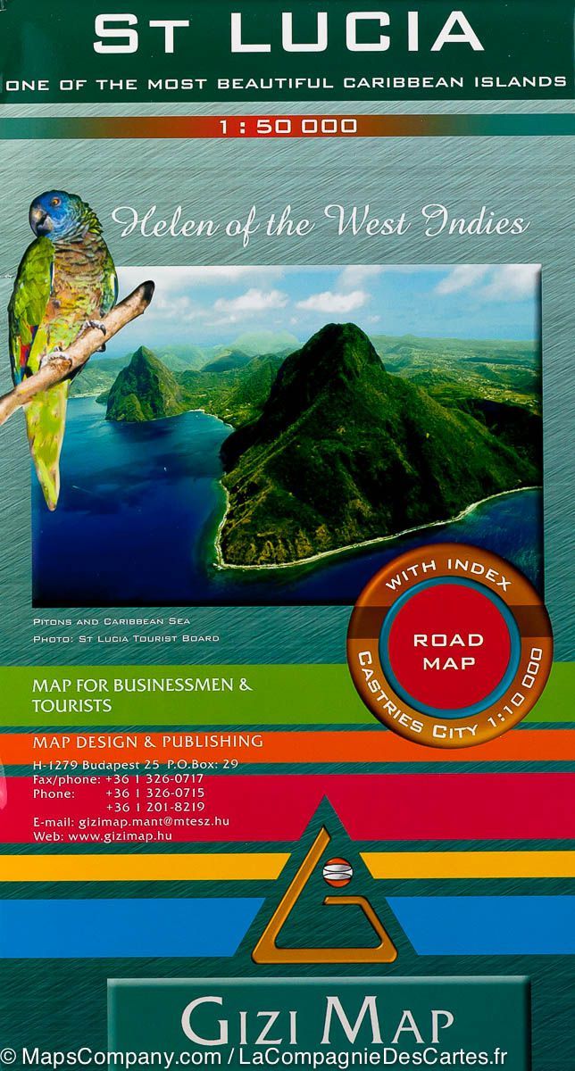
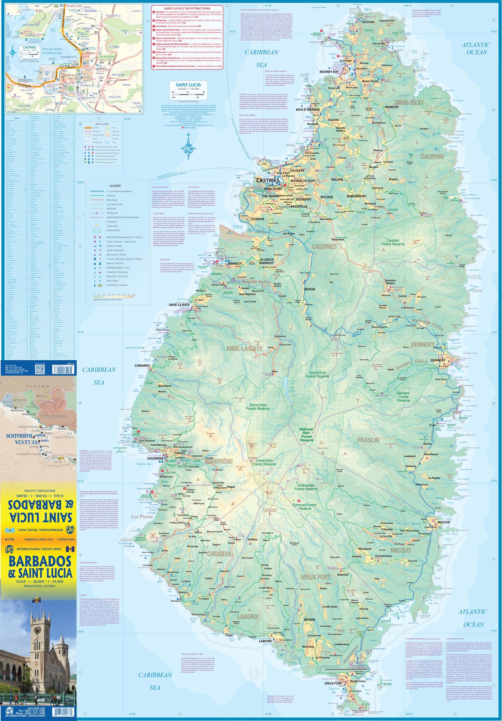
This complete road map comprising a geographical index of Saint Lucia (scale 1: 45,000) takes all the roads and streets known to the island with their names, locates hiking trails and dive sites. It provides inserts for the main urban areas: Castries Capital, Gros Islet, Soufriere and Old Fort.
The map is sold folded, measuring 13.5 cm x 19.5 cm and is designed for easy opening and folding. Its complete format unfolded is 67 cm x 98 cm.
The map has the following features:
- the complete road network detailed on the street
- a complete index of streets and roads
- Additional maps of main cities
- an attractive presentation, all in color
- very detailed topography
- Legend and ladder
- The depth lines, the probes in meters, the lines of longitude and latitude and other identifiers.
ISBN/EAN : 9791095793083
Publication date: 2013
Scale: 1/45000 (1cm=450m)
Folded dimensions: 22.5 x 12.5cm
Unfolded dimensions: 67 x 98cm
Language(s): English
Weight:
89 g